
Snowdonia
Beschreibung
Wanderwege Region
Links
Fakten
Berichte
Führer und Karten
Übernachtung
Organisationen
Reisebüros
GPS
Sonstiges
Bücher

The Book Depository
United Kingdom
2022
United Kingdom
2022
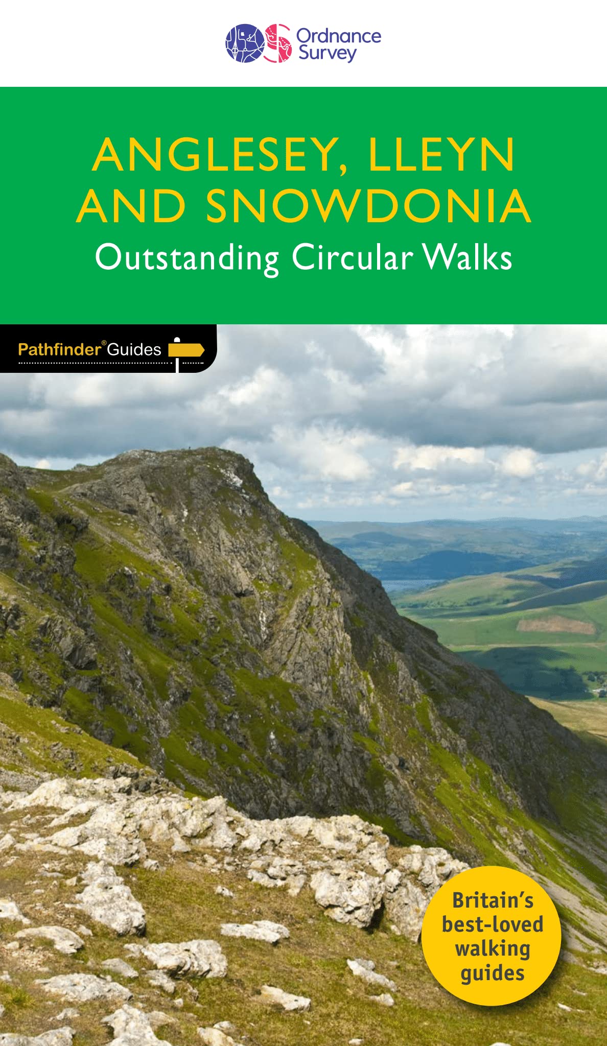
- ANGLESEY, LLEYN AND SNOWDONIA
- Pathfinder (R) Guide to Anglesey, Lleyn and Snowdonia, featuring 28 outstanding and mostly circular rambles across the Isle of Anglesey, western Conwy and Gwynedd: from Holyhead Mountain to Aran Benlynn and Aran Fawddwy, and from Aberdaron to Conwy. A new Pathfinder (R) title, now including 11 brand new walks for Anglesey, three new walks on... Read more
- Also available from:
- De Zwerver, Netherlands
- Stanfords, United Kingdom
De Zwerver
Netherlands
2022
Netherlands
2022
- Wandelgids 78 Pathfinder Guides Anglesey, Lleyn and Snowdonia | Ordnance Survey
- Pathfinder (R) Guide to Anglesey, Lleyn and Snowdonia, featuring 28 outstanding and mostly circular rambles across the Isle of Anglesey, western Conwy and Gwynedd: from Holyhead Mountain to Aran Benlynn and Aran Fawddwy, and from Aberdaron to Conwy. A new Pathfinder (R) title, now including 11 brand new walks for Anglesey, three new walks on... Read more

Stanfords
United Kingdom
2022
United Kingdom
2022
- Anglesey, Lleyn and Snowdonia - Outstanding Circular Walks
- Pathfinder (R) Guide to Anglesey, Lleyn and Snowdonia, featuring 28 outstanding and mostly circular rambles across the Isle of Anglesey, western Conwy and Gwynedd: from Holyhead Mountain to Aran Benlynn and Aran Fawddwy, and from Aberdaron to Conwy. A new Pathfinder (R) title, now including 11 brand new walks for Anglesey, three new walks on... Read more


The Book Depository
United Kingdom
2019
United Kingdom
2019
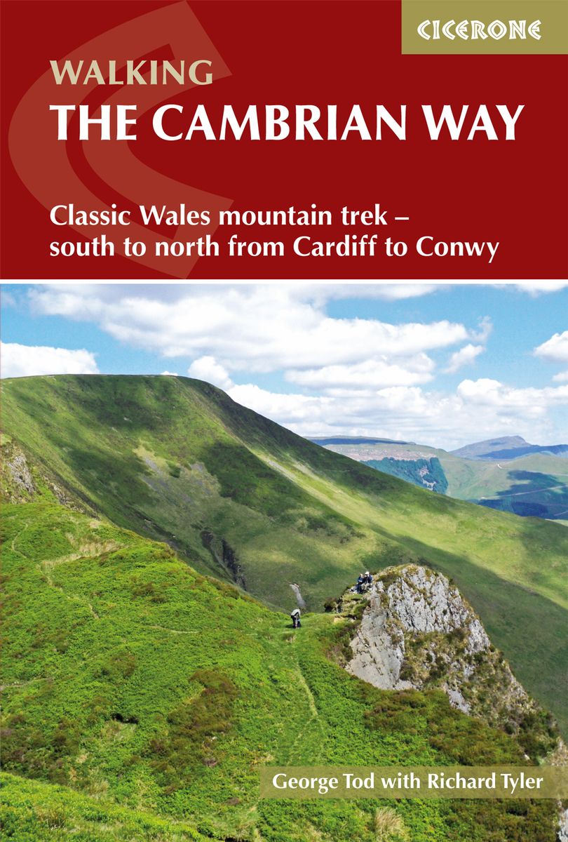
- The Cambrian Way
- Classic Wales mountain trek - south to north from Cardiff to Conwy Read more
- Also available from:
- De Zwerver, Netherlands
- Stanfords, United Kingdom
De Zwerver
Netherlands
2019
Netherlands
2019
- Wandelgids The Cambrian Way | Cicerone
- Guidebook to the Cambrian Way, a challenging three-week mountain trek through Wales from Cardiff to Conwy. The 470km unwaymarked route is presented from south to north. Often sticking to long, beautiful ridgelines, it crosses wild and rugged terrain and visits many of Wales's highest mountains, including Snowdon. Read more

Stanfords
United Kingdom
2019
United Kingdom
2019
- The Cambrian Way: Classic Wales mountain trek - south to north from Cardiff to Conwy
- Dubbed `the mountain connoisseurs` walk`, the Cambrian Way stretches 479km between the mighty castles of Cardiff in the south and Conwy on the north coast. Traversing the heartland of Wales, the challenging route crosses the Brecon Beacons, the Cambrian Mountains and Snowdonia, passing through two national parks and visiting many of the... Read more


The Book Depository
United Kingdom
2020
United Kingdom
2020
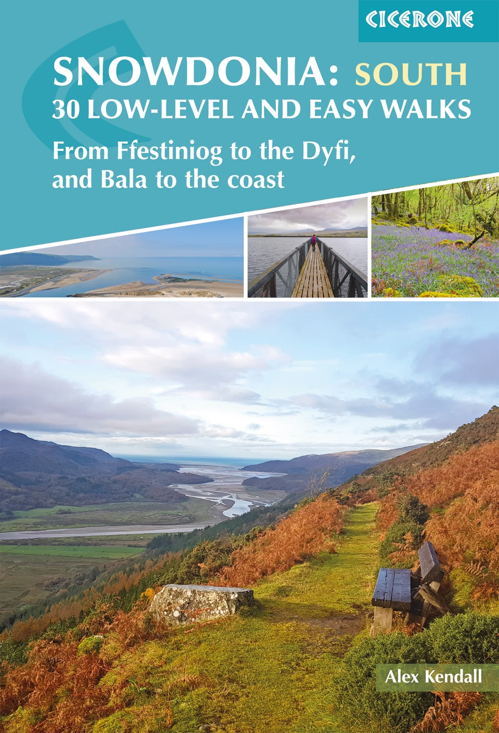
- Snowdonia: 30 Low-level and Easy Walks - South
- From Ffestiniog to the Dyfi, and Bala to the coast Read more
- Also available from:
- De Zwerver, Netherlands
- Stanfords, United Kingdom
De Zwerver
Netherlands
2020
Netherlands
2020
- Wandelgids Snowdonia: South - Low-level and easy walks | Cicerone
- Through 30 day walks ranging from 3km to 18km, this guide offers opportunities for walkers of all abilities to explore the lowlands, moorland and estuaries of Snowdonia National Park. The second of two volumes to low-level and easy walking in Snowdonia, this guide covers the southern region between Llan Ffestiniog and Machynlleth. Other centres... Read more

Stanfords
United Kingdom
2020
United Kingdom
2020
- Snowdonia: 30 Low-level and easy walks - South: From Ffestiniog to the Dyfi, and Bala to the coast
- Through 30 day walks ranging from 3km to 18km, this guide offers opportunities for walkers of all abilities to explore the lowlands, moorland and estuaries of Snowdonia National Park. The second of two volumes to low-level and easy walking in Snowdonia, this guide covers the southern region between Llan Ffestiniog and Machynlleth. Other centres... Read more

The Book Depository
United Kingdom
2018
United Kingdom
2018
- Fastpacking
- Multi-day running adventures: tips, stories and route ideas Read more

The Book Depository
United Kingdom
United Kingdom
- Local Walks Around Harlech: In the Snowdonia National Park
- In the Snowdonia National Park Read more
- Also available from:
- Stanfords, United Kingdom


The Book Depository
United Kingdom
United Kingdom
- Snowdonia/Eryri
- Circular Walks in the Snowdonia National Park Read more
- Also available from:
- Stanfords, United Kingdom

Stanfords
United Kingdom
United Kingdom
- Snowdonia/Eryri: Circular Walks in the Snowdonia National Park
- These attractive and cleverly structured guides will give walkers ten of the best themed short circular walks in Britain`s 14 National Parks.With clear information, an overview and introduction for each walk, expertly written numbered directions, large scale Ordnance Survey maps, superb eye-grabbing panoramic photographs, and interpretation of... Read more

- Also available from:
- De Zwerver, Netherlands
- Stanfords, United Kingdom

Stanfords
United Kingdom
2021
United Kingdom
2021
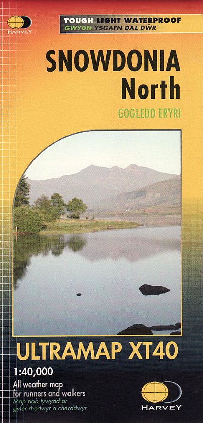
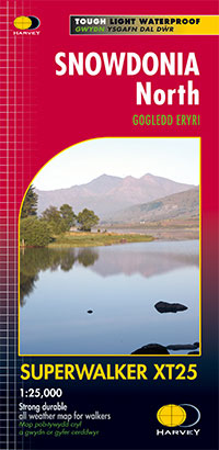
- Snowdonia North Harvey Ultramap XT40
- The northern part of Snowdonia with Snowdon and the Glyders and Carnedds peaks at 1:40,000 on a waterproof and tear-resistant, pocket-size Ultramap from Harvey Map Services with the same cartography as their Superwalker map of this area. The map is double-sided with an overlap between the sides; coverage extends from west of Llanberis eastwards... Read more

The Book Depository
United Kingdom
United Kingdom

The Book Depository
United Kingdom
2019
United Kingdom
2019
- The Big Rounds
- Running and walking the Bob Graham, Paddy Buckley and Charlie Ramsay Rounds Read more
Karten

The Book Depository
United Kingdom
United Kingdom
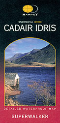
- Snowdonia Cadair Idris
- The Cadair Idris area of southern Snowdonia at 1:25,000 on a waterproof and tear-resistant map from Harvey Map Services in their Superwalker series. Coverage extends from Dolgellau in the north to just short of Machynlleth. Map legend and additional notes are also in Welsh.Snowdonia is covered on five Superwalker maps Read more
- Also available from:
- Stanfords, United Kingdom
Stanfords
United Kingdom
United Kingdom
- Cadair Idris - Snowdonia / Eryri Harvey Superwalker
- The Cadair Idris area of southern Snowdonia at 1:25,000 on a waterproof and tear-resistant map from Harvey Map Services in their Superwalker series. Coverage extends from Dolgellau in the north to just short of Machynlleth. Map legend and additional notes are also in Welsh. Current edition of this title was published in 2011.Maps in Harvey’s... Read more

The Book Depository
United Kingdom
United Kingdom
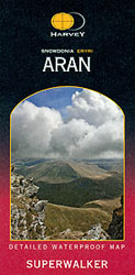
- Snowdonia Aran
- The Aran area of southern Snowdonia at 1:25,000 on a waterproof and tear-resistant map from Harvey Map Services in their Superwalker series. Coverage extends from the southern shore of Llyn Celyn and the A4212 southwards to Dolgellau in the south-western corner of the map. Map legend and additional notes are also in Welsh.Snowdonia is covered... Read more
- Also available from:
- Stanfords, United Kingdom
Stanfords
United Kingdom
United Kingdom
- Aran - Snowdonia / Eryri Harvey Superwalker
- The Aran area of southern Snowdonia at 1:25,000 on a waterproof and tear-resistant map from Harvey Map Services in their Superwalker series. Coverage extends from the southern shore of Llyn Celyn and the A4212 southwards to Dolgellau in the south-western corner of the map. Map legend and additional notes are also in Welsh. Current edition of... Read more

The Book Depository
United Kingdom
2010
United Kingdom
2010
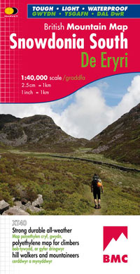
- Snowdonia South
- Waterproof mountain map of Snowdonia South from Harvey at 1:40,000, with a geological map of the region on the reverse, as well as an extension to the main map covering Aberdovey and advice on navigating the region safely. MAIN MAP: Topography is shown through clear altitude shading, spot heights, contours at 15m intervals, and index contours... Read more
- Also available from:
- De Zwerver, Netherlands
- Stanfords, United Kingdom
De Zwerver
Netherlands
2010
Netherlands
2010
- Wandelkaart Snowdonia Zuid | Harvey Maps
- Waterproof mountain map of Snowdonia South from Harvey at 1:40,000, with a geological map of the region on the reverse, as well as an extension to the main map covering Aberdovey and advice on navigating the region safely. MAIN MAP: Topography is shown through clear altitude shading, spot heights, contours at 15m intervals, and index contours... Read more

Stanfords
United Kingdom
2010
United Kingdom
2010
- Snowdonia South Harvey British Mountain Map XT40
- Waterproof mountain map of Snowdonia South from Harvey at 1:40,000, with a geological map of the region on the reverse, as well as an extension to the main map covering Aberdovey and advice on navigating the region safely. *MAIN MAP:* Topography is shown through clear altitude shading, spot heights, contours at 15m intervals, and index contours... Read more

The Book Depository
United Kingdom
United Kingdom
- Paddy Buckley Round
- Paddy Buckley Round, a route combining the 47 mountain peaks in Snowdonia and the toughest of the three great classics for mountain runners, presented on a waterproof and tear-resistant, contoured and GPS compatible map at 1:40,000 from Harvey Map Services. The map provides a vivid presentation of the topography, with contours at 15m intervals... Read more
- Also available from:
- Stanfords, United Kingdom

Stanfords
United Kingdom
United Kingdom
- Paddy Buckley Round in Snowdonia
- Paddy Buckley Round, a route combining the 47 mountain peaks in Snowdonia and the toughest of the three great classics for mountain runners, presented on a waterproof and tear-resistant, contoured and GPS compatible map at 1:40,000 from Harvey Map Services. The map provides a vivid presentation of the topography, with contours at 15m intervals... Read more
De Zwerver
Netherlands
2021
Netherlands
2021
- Wandelkaart Snowdonia Noord /Snowdon,Glyders,Carnedds | Harvey Maps
- The northern part of Snowdonia with Snowdon and the Glyders and Carnedds peaks at 1:25,000 on a waterproof and tear-resistant map from Harvey Map Services in their Superwalker series. The map is double-sided with an overlap between the sides; coverage extends from west of Llanberis eastwards to Betws-y-Coed. Map legend and additional notes are... Read more
- Also available from:
- Stanfords, United Kingdom

Stanfords
United Kingdom
2021
United Kingdom
2021
- Snowdonia North Harvey Superwalker XT25
- The northern part of Snowdonia with Snowdon and the Glyders and Carnedds peaks at 1:25,000 on a light, waterproof and tear-resistant map from Harvey Map Services. The map is double-sided with an overlap between the sides; coverage extends from west of Llanberis eastwards to Betws-y-Coed. Map legend and additional notes are also in Welsh.PLEASE... Read more
De Zwerver
Netherlands
2021
Netherlands
2021
- Wandelkaart Snowdonia Noord | Harvey Maps
- Waterproof mountain map of Snowdonia from Harvey at 1:40,000, with a geological map of the region on the reverse, enlargements of Snowdon and Tryfan, and advice on navigating the region safely.MAIN MAP: Topography is shown through clear altitude shading, spot heights, contours at 15m intervals, and index contours at 75m intervals. A variety of... Read more
- Also available from:
- Stanfords, United Kingdom

Stanfords
United Kingdom
2021
United Kingdom
2021
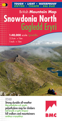
- Snowdonia North / Gogledd Eryri Harvey British Mountain Map XT40
- Waterproof mountain map of Snowdonia North from Harvey at 1:40,000, with a geological map of the region on the reverse, enlargements of Snowdon and Tryfan, and advice on navigating the region safely.*MAIN MAP:* Topography is shown through clear altitude shading, spot heights, contours at 15m intervals, and index contours at 75m intervals. A... Read more

Stanfords
United Kingdom
United Kingdom
- Snowdon / Yr Wyddfa 1840-1841
- Map No. 115, Snowdon / Yr Wyddfa 1840-1841, in the Cassini Historical Series of old Ordnance Survey mapping of England and Wales at 1:50,000 in a format designed to offer a convenient comparison with the present day coverage from the OS, and most locations in three different editions. Old historical maps have been combined so that the sheet... Read more
Stanfords
United Kingdom
United Kingdom
- Bala and Lake Vyrnwy / Y Bala a Llyn Efyrnwy 1902-1903
- Map No. 125, Bala and Lake Vyrnwy / Y Bala a Llyn Efyrnwy 1902-1903, in the Cassini Historical Series of old Ordnance Survey mapping of England and Wales at 1:50,000 in a format designed to offer a convenient comparison with the present day coverage from the OS, and most locations in three different editions. Old historical maps have been... Read more
Stanfords
United Kingdom
United Kingdom
- Aberystwyth and Machynlleth 1901-1903
- Map No. 135, Aberystwyth and Machynlleth 1901-1903, in the Cassini Historical Series of old Ordnance Survey mapping of England and Wales at 1:50,000 in a format designed to offer a convenient comparison with the present day coverage from the OS, and most locations in three different editions. Old historical maps have been combined so that the... Read more
Stanfords
United Kingdom
United Kingdom
- Porthmadog and Dolgellau 1836-1841
- Map No. 124, Porthmadog and Dolgellau 1836-1841, in the Cassini Historical Series of old Ordnance Survey mapping of England and Wales at 1:50,000 in a format designed to offer a convenient comparison with the present day coverage from the OS, and most locations in three different editions. Old historical maps have been combined so that the... Read more
Stanfords
United Kingdom
United Kingdom
- Snowdon / Yr Wyddfa 1840-1922 (3-map set)
- Map No. 115, Snowdon / Yr Wyddfa 1840-1922 (3-map set), in the Cassini Historical Series of old Ordnance Survey mapping of England and Wales at 1:50,000 in a format designed to offer a convenient comparison with the present day coverage from the OS, and most locations in three different editions. Old historical maps have been combined so that... Read more
Stanfords
United Kingdom
United Kingdom
- Denbigh and Colwyn Bay / Dinbych a Bae Colwyn 1838-1924 (3-map set)
- Map No. 116, Denbigh and Colwyn Bay / Dinbych a Bae Colwyn 1838-1924 (3-map set), in the Cassini Historical Series of old Ordnance Survey mapping of England and Wales at 1:50,000 in a format designed to offer a convenient comparison with the present day coverage from the OS, and most locations in three different editions. Old historical maps... Read more
Stanfords
United Kingdom
United Kingdom
- Bala and Lake Vyrnwy / Y Bala a Llyn Efyrnwy 1836-1840
- Map No. 125, Bala and Lake Vyrnwy / Y Bala a Llyn Efyrnwy 1836-1840, in the Cassini Historical Series of old Ordnance Survey mapping of England and Wales at 1:50,000 in a format designed to offer a convenient comparison with the present day coverage from the OS, and most locations in three different editions. Old historical maps have been... Read more
Stanfords
United Kingdom
United Kingdom
- Porthmadog and Dolgellau 1836-1922 (3-map set)
- Map No. 124, Porthmadog and Dolgellau 1836-1922 (3-map set), in the Cassini Historical Series of old Ordnance Survey mapping of England and Wales at 1:50,000 in a format designed to offer a convenient comparison with the present day coverage from the OS, and most locations in three different editions. Old historical maps have been combined so... Read more
Stanfords
United Kingdom
United Kingdom
- Aberystwyth and Machynlleth 1833-1923 (3-map set)
- Map No. 135, Aberystwyth and Machynlleth 1833-1923 (3-map set), in the Cassini Historical Series of old Ordnance Survey mapping of England and Wales at 1:50,000 in a format designed to offer a convenient comparison with the present day coverage from the OS, and most locations in three different editions. Old historical maps have been combined... Read more