The Book Depository
United Kingdom
» Click to open
Stanfords
United Kingdom
  • Aran - Snowdonia / Eryri Harvey Superwalker
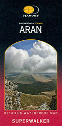
  • The Aran area of southern Snowdonia at 1:25,000 on a waterproof and tear-resistant map from Harvey Map Services in their Superwalker series. Coverage extends from the southern shore of Llyn Celyn and the A4212 southwards to Dolgellau in the south-western corner of the map. Map legend and additional notes are also in Welsh. Current edition of... Read more
» Click to close
The Book Depository
United Kingdom
2010
» Click to open
De Zwerver
Netherlands
2010
  • Wandelkaart Snowdonia Zuid | Harvey Maps
  • Waterproof mountain map of Snowdonia South from Harvey at 1:40,000, with a geological map of the region on the reverse, as well as an extension to the main map covering Aberdovey and advice on navigating the region safely. MAIN MAP: Topography is shown through clear altitude shading, spot heights, contours at 15m intervals, and index contours... Read more
Stanfords
United Kingdom
2010
  • Snowdonia South Harvey British Mountain Map XT40
  • Waterproof mountain map of Snowdonia South from Harvey at 1:40,000, with a geological map of the region on the reverse, as well as an extension to the main map covering Aberdovey and advice on navigating the region safely. *MAIN MAP:* Topography is shown through clear altitude shading, spot heights, contours at 15m intervals, and index contours... Read more
» Click to close
The Book Depository
United Kingdom
» Click to open
Stanfords
United Kingdom
  • Paddy Buckley Round in Snowdonia
  • Paddy Buckley Round, a route combining the 47 mountain peaks in Snowdonia and the toughest of the three great classics for mountain runners, presented on a waterproof and tear-resistant, contoured and GPS compatible map at 1:40,000 from Harvey Map Services. The map provides a vivid presentation of the topography, with contours at 15m intervals... Read more
» Click to close
The Book Depository
United Kingdom
» Click to open
Stanfords
United Kingdom
  • Cadair Idris - Snowdonia / Eryri Harvey Superwalker
  • The Cadair Idris area of southern Snowdonia at 1:25,000 on a waterproof and tear-resistant map from Harvey Map Services in their Superwalker series. Coverage extends from Dolgellau in the north to just short of Machynlleth. Map legend and additional notes are also in Welsh. Current edition of this title was published in 2011.Maps in Harvey’s... Read more
» Click to close
De Zwerver
Netherlands
2021
» Click to open
Stanfords
United Kingdom
2021
  • Snowdonia North Harvey Superwalker XT25
  • The northern part of Snowdonia with Snowdon and the Glyders and Carnedds peaks at 1:25,000 on a light, waterproof and tear-resistant map from Harvey Map Services. The map is double-sided with an overlap between the sides; coverage extends from west of Llanberis eastwards to Betws-y-Coed. Map legend and additional notes are also in Welsh.PLEASE... Read more
» Click to close
De Zwerver
Netherlands
2021
» Click to open
Stanfords
United Kingdom
2021
  • Snowdonia North / Gogledd Eryri Harvey British Mountain Map XT40
  • Waterproof mountain map of Snowdonia North from Harvey at 1:40,000, with a geological map of the region on the reverse, enlargements of Snowdon and Tryfan, and advice on navigating the region safely.*MAIN MAP:* Topography is shown through clear altitude shading, spot heights, contours at 15m intervals, and index contours at 75m intervals. A... Read more
» Click to close
Stanfords
United Kingdom
Stanfords
United Kingdom
Stanfords
United Kingdom
Stanfords
United Kingdom
Stanfords
United Kingdom
Stanfords
United Kingdom
Stanfords
United Kingdom
Stanfords
United Kingdom
Stanfords
United Kingdom