
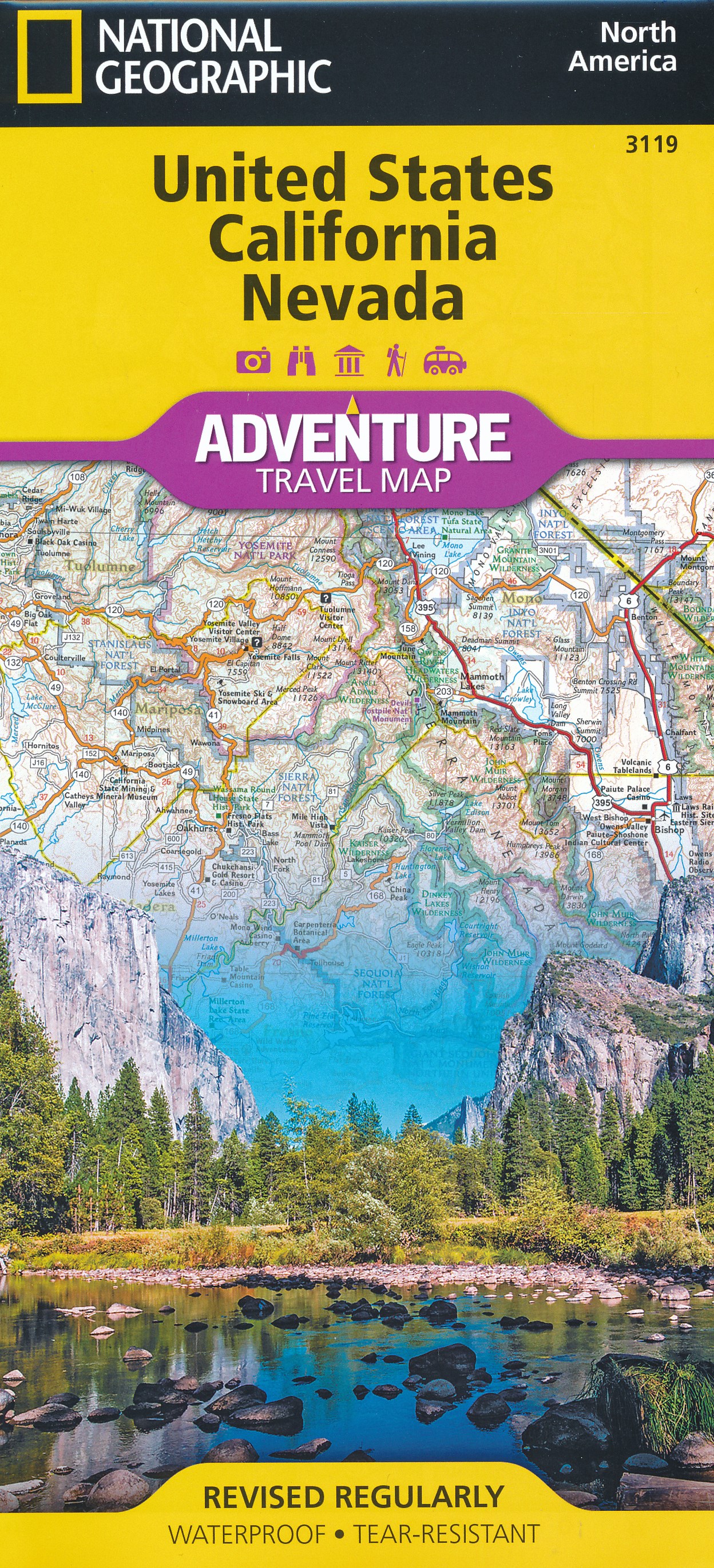
Nevada
Beschreibung
Nevada is a sparsely populated state in the West of the country.
The Tahoe Rim Trail, 165 miles, is shared with California in the West. The American Discovery Trail crosses Nevada.
The wilderness and emptiness of Nevada – high mountain ranges, desert brushlands, canyons - is best enjoyed on the thousands of miles of trails in the Toyabe National Forest, Humboldt National Forest and Great Basin National Park.
Karte

Wanderwege Landesteil
Links
Fakten
Berichte
Führer und Karten
Übernachtung
Organisationen
Reisebüros
GPS
Sonstiges
Bücher

The Book Depository
United Kingdom
United Kingdom

The Book Depository
United Kingdom
United Kingdom
- Five-Star Trails: Lake Tahoe
- 40 Unforgettable Hikes in the Central Sierra Nevada Read more


The Book Depository
United Kingdom
United Kingdom
- Hiking the Sierra Nevada
- A Guide to the Area's Greatest Hiking Adventures Read more


The Book Depository
United Kingdom
United Kingdom
- Backpacking Nevada
- From Slickrock Canyons to Granite Summits Read more

The Book Depository
United Kingdom
United Kingdom
- Tahoe Rim Trail
- The Official Guide for Hikers, Mountain Bikers, and Equestrians Read more

- Also available from:
- De Zwerver, Netherlands


The Book Depository
United Kingdom
United Kingdom
- Sierra North
- Backcountry Trips in California's Sierra Nevada Read more

The Book Depository
United Kingdom
United Kingdom
- Afoot & Afield: Las Vegas & Southern Nevada
- A Comprehensive Hiking Guide Read more


The Book Depository
United Kingdom
United Kingdom
- Sierra South
- Backcountry Trips in California's Sierra Nevada Read more
De Zwerver
Netherlands
2012
Netherlands
2012
- Reisgids Kunstreiseführer Andalusien | Dumont
- Andalusien, Spaniens südlichste und zweitgrößte Region, beeindruckt durch die Spuren ihrer wechselseitigen Geschichte. Die andalusische Kunst ist durch den großen Einfluss der islamischen Kultur geprägt. Im Laufe ihrer rund 800 Jahre langen Herrschaft verleihen die Mauren in der Architektur ihrer Überlegenheit im christlichen Europa einen... Read more
Karten

The Book Depository
United Kingdom
United Kingdom
- Also available from:
- De Zwerver, Netherlands
- Stanfords, United Kingdom

Stanfords
United Kingdom
United Kingdom
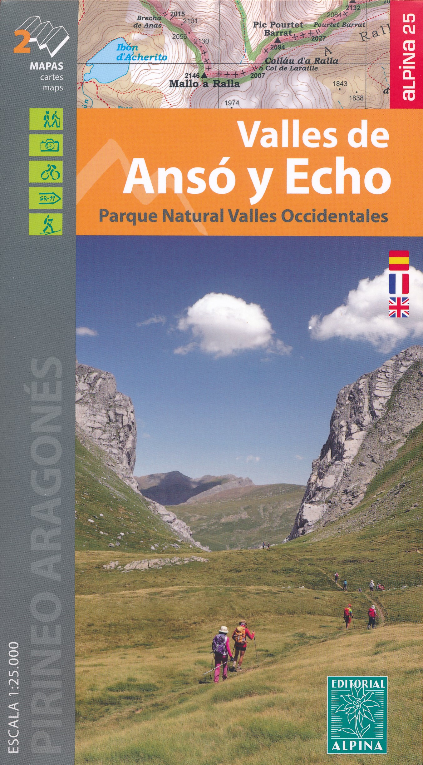
- Valles de Ansó & Echo Editorial Alpina
- Valles de Ansó & Echo in an extensive and very popular series of walking maps from Editorial Alpina covering the Pyrenees, Catalonia and other selected hiking areas in Spain, including Picos de Europa, Sierra Nevada and parts of Andalucía, Majorca, etc. Scales vary from 1:50,000 to 1:10,000, with the majority of the titles at 1:25,000. The maps... Read more

The Book Depository
United Kingdom
United Kingdom
- Also available from:
- De Zwerver, Netherlands
- Stanfords, United Kingdom

Stanfords
United Kingdom
United Kingdom
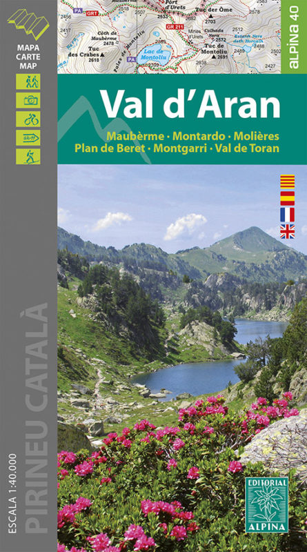
- Val d`Aran - Mauberme - Montardo - Molieres Editorial Alpina
- Val d`Aran in an extensive and very popular series of walking maps from Editorial Alpina covering the Pyrenees, Catalonia and other selected hiking areas in Spain, including Picos de Europa, Sierra Nevada and parts of Andalucía, Majorca, etc. Scales vary from 1:50,000 to 1:10,000, with the majority of the titles at 1:25,000. The maps have... Read more

- Also available from:
- De Zwerver, Netherlands
- Stanfords, United Kingdom

Stanfords
United Kingdom
United Kingdom
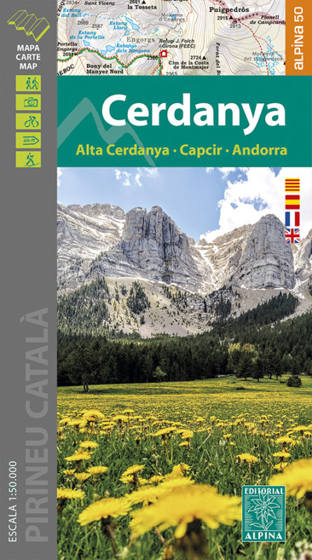
- Cerdanya - Alta Cerdanya - Capcir - Andorra Editorial Alpina
- Cerdanya: Alta Cerdanya - Capcir - Andorra at 1;50,000 in an extensive and very popular series of walking maps from Editorial Alpina covering the Pyrenees, Catalonia and other selected hiking areas in Spain, including Picos de Europa, Sierra Nevada and parts of Andalucía, Majorca, etc. Scales vary from 1:50,000 to 1:10,000, with the majority of... Read more

The Book Depository
United Kingdom
United Kingdom
- Garraf - La Morella - Eramprunya - Parc Natural del Garraf
- Zeer gedetailleerde wandelkaart van dit mooie natuurgebied in Noord Oost Spanje. Met ingetekende wandelroutes en andere informatie. Spaans en deel in het engels, maar uitstekende kaart. Met symbolen voor campings, hutten. Read more
- Also available from:
- De Zwerver, Netherlands
- Stanfords, United Kingdom

De Zwerver
Netherlands
Netherlands
- Wandelkaart 62 Parc Naturel del Garraf | Editorial Alpina
- Zeer gedetailleerde wandelkaart van dit mooie natuurgebied in Noord Oost Spanje. Met ingetekende wandelroutes en andere informatie. Spaans en deel in het engels, maar uitstekende kaart. Met symbolen voor campings, hutten. Read more
Stanfords
United Kingdom
United Kingdom
- Garraf - la Morella - Eramprunya Editorial Alpina
- Massíf de Garraf in an extensive and very popular series of walking maps from Editorial Alpina covering the Pyrenees, Catalonia and other selected hiking areas in Spain, including Picos de Europa, Sierra Nevada and parts of Andalucía, Majorca, etc. Scales vary from 1:50,000 to 1:10,000, with the majority of the titles at 1:25,000. The maps have... Read more

- Also available from:
- De Zwerver, Netherlands
- Stanfords, United Kingdom

Stanfords
United Kingdom
United Kingdom
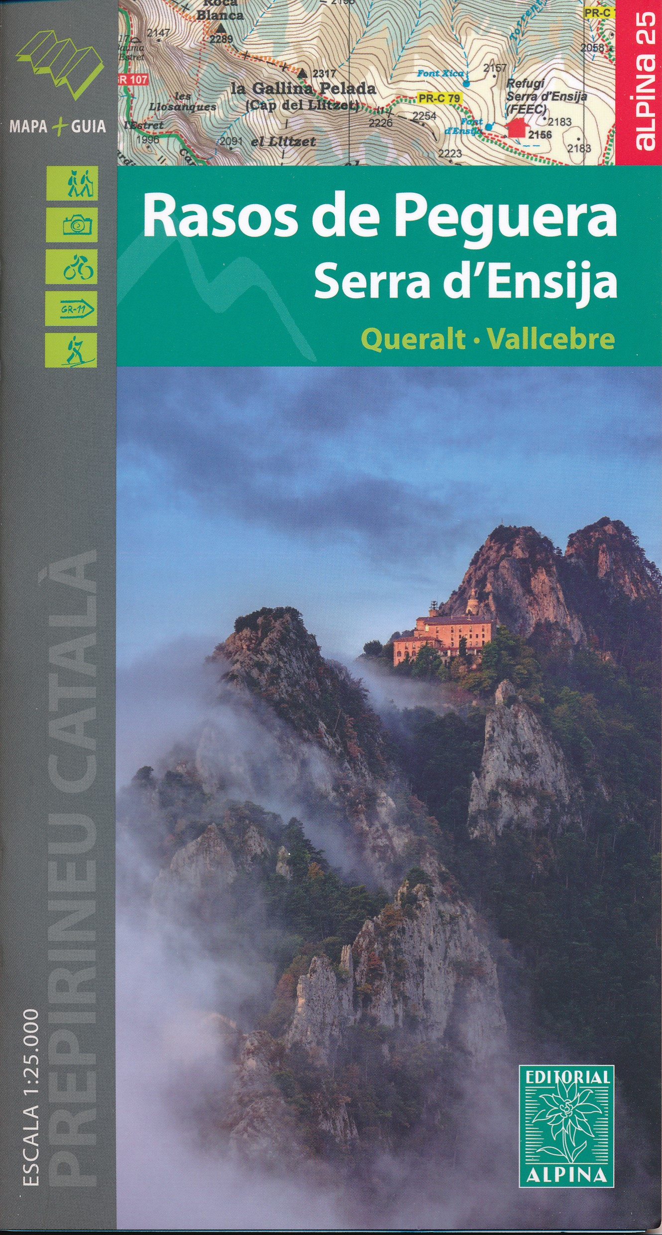
- Rasos de Peguera - Serra d`Ensija Editorial Alpina
- Rasos de Peguera - Serra d`Ensija in an extensive and very popular series of walking maps from Editorial Alpina covering the Pyrenees, Catalonia and other selected hiking areas in Spain, including Picos de Europa, Sierra Nevada and parts of Andalucía, Majorca, etc. Scales vary from 1:50,000 to 1:10,000, with the majority of the titles at... Read more

- Also available from:
- De Zwerver, Netherlands
- Stanfords, United Kingdom

Stanfords
United Kingdom
United Kingdom
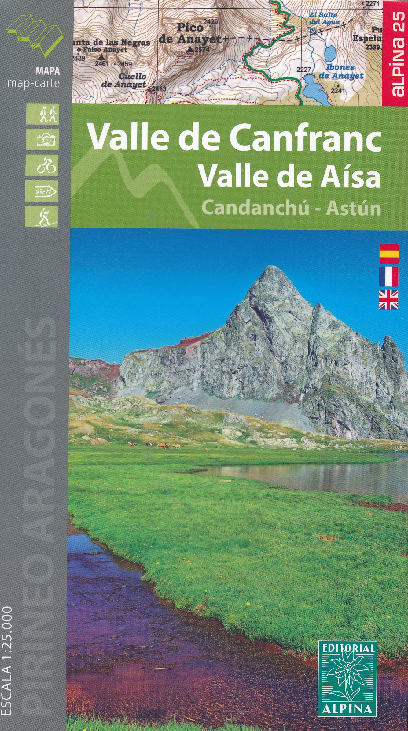
- Valle de Canfranc - Valle de Aisa - Candanchu - Astun Editorial Alpina
- Valle de Canfranc - Valle de Aisa in an extensive and very popular series of walking maps from Editorial Alpina covering the Pyrenees, Catalonia and other selected hiking areas in Spain, including Picos de Europa, Sierra Nevada and parts of Andalucía, Majorca, etc. Scales vary from 1:50,000 to 1:10,000, with the majority of the titles at... Read more

The Book Depository
United Kingdom
United Kingdom
- Delta de l'Ebre PN - Serra de Montsia
- The Delta of the Ebro – Serra de Montsià in an extensive and very popular series of walking maps from Editorial Alpina covering the Pyrenees, Catalonia and other selected hiking areas in Spain, including Picos de Europa, Sierra Nevada and parts of Andalucía, Majorca, etc. Scales vary from 1:50,000 to 1:10,000, with the majority of the titles... Read more
- Also available from:
- Stanfords, United Kingdom

Stanfords
United Kingdom
United Kingdom
- Delta of the Ebro – Serra de Montsià Editorial Alpina
- The Delta of the Ebro – Serra de Montsià in an extensive and very popular series of walking maps from Editorial Alpina covering the Pyrenees, Catalonia and other selected hiking areas in Spain, including Picos de Europa, Sierra Nevada and parts of Andalucía, Majorca, etc. Scales vary from 1:50,000 to 1:10,000, with the majority of the titles... Read more

The Book Depository
United Kingdom
United Kingdom
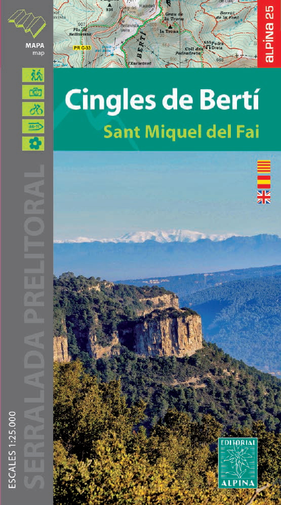
- Cingles del Berti - Sant Miquel des Fai
- Cingles de Berti area at 1:25,000 in an extensive and very popular series of walking maps from Editorial Alpina. Contours are at 10m intervals, enhanced by relief shading and vegetation colouring. The map has UTM grid and 1’ margin ticks. In addition to footpaths, the overprint shows various types of accommodation (hotels, campsites, etc.),... Read more
- Also available from:
- De Zwerver, Netherlands
- Stanfords, United Kingdom
De Zwerver
Netherlands
Netherlands
- Wandelkaart 54 Cingles de Berti | Editorial Alpina
- Cingles de Berti area at 1:25,000 in an extensive and very popular series of walking maps from Editorial Alpina. Contours are at 10m intervals, enhanced by relief shading and vegetation colouring. The map has UTM grid and 1’ margin ticks. In addition to footpaths, the overprint shows various types of accommodation (hotels, campsites, etc.),... Read more
Stanfords
United Kingdom
United Kingdom
- Cingles de Berti - Sant Miquel des Fai Editorial Alpina
- Cingles de Berti area at 1:25,000 in an extensive and very popular series of walking maps from Editorial Alpina. Contours are at 10m intervals, enhanced by relief shading and vegetation colouring. The map has UTM grid and 1’ margin ticks. In addition to footpaths, the overprint shows various types of accommodation (hotels, campsites, etc.),... Read more

The Book Depository
United Kingdom
United Kingdom
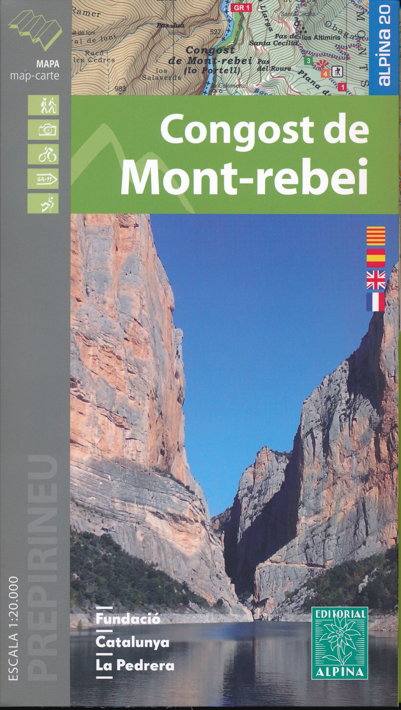
- Mont-rebei congost de
- Congost de Mont-rebei in an extensive and very popular series of walking maps from Editorial Alpina covering the Pyrenees, Catalonia and other selected hiking areas in Spain, including Picos de Europa, Sierra Nevada and parts of Andalucía, Majorca, etc. Scales vary from 1:50,000 to 1:10,000, with the majority of the titles at 1:25,000. The... Read more
- Also available from:
- De Zwerver, Netherlands
- Stanfords, United Kingdom
De Zwerver
Netherlands
Netherlands
- Wandelkaart 33 Congost de Mont-rebei | Editorial Alpina
- Congost de Mont-rebei in an extensive and very popular series of walking maps from Editorial Alpina covering the Pyrenees, Catalonia and other selected hiking areas in Spain, including Picos de Europa, Sierra Nevada and parts of Andalucía, Majorca, etc. Scales vary from 1:50,000 to 1:10,000, with the majority of the titles at 1:25,000. The... Read more

Stanfords
United Kingdom
United Kingdom
- Congost de Mont-rebei Editorial Alpina
- Congost de Mont-rebei in an extensive and very popular series of walking maps from Editorial Alpina covering the Pyrenees, Catalonia and other selected hiking areas in Spain, including Picos de Europa, Sierra Nevada and parts of Andalucía, Majorca, etc. Scales vary from 1:50,000 to 1:10,000, with the majority of the titles at 1:25,000. The... Read more

- Also available from:
- Stanfords, United Kingdom

Stanfords
United Kingdom
United Kingdom
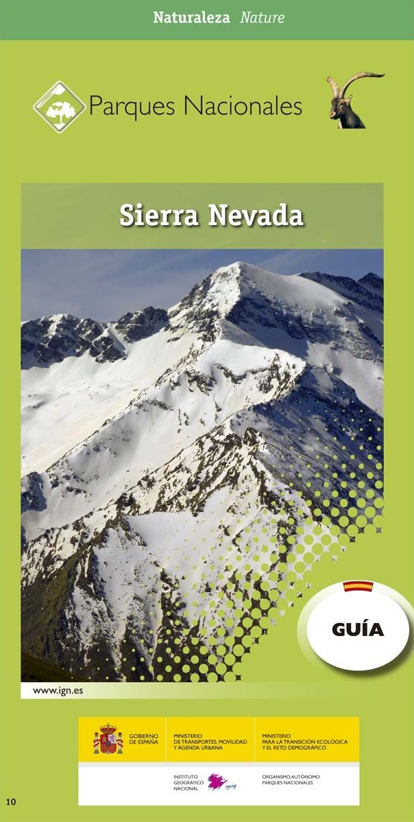
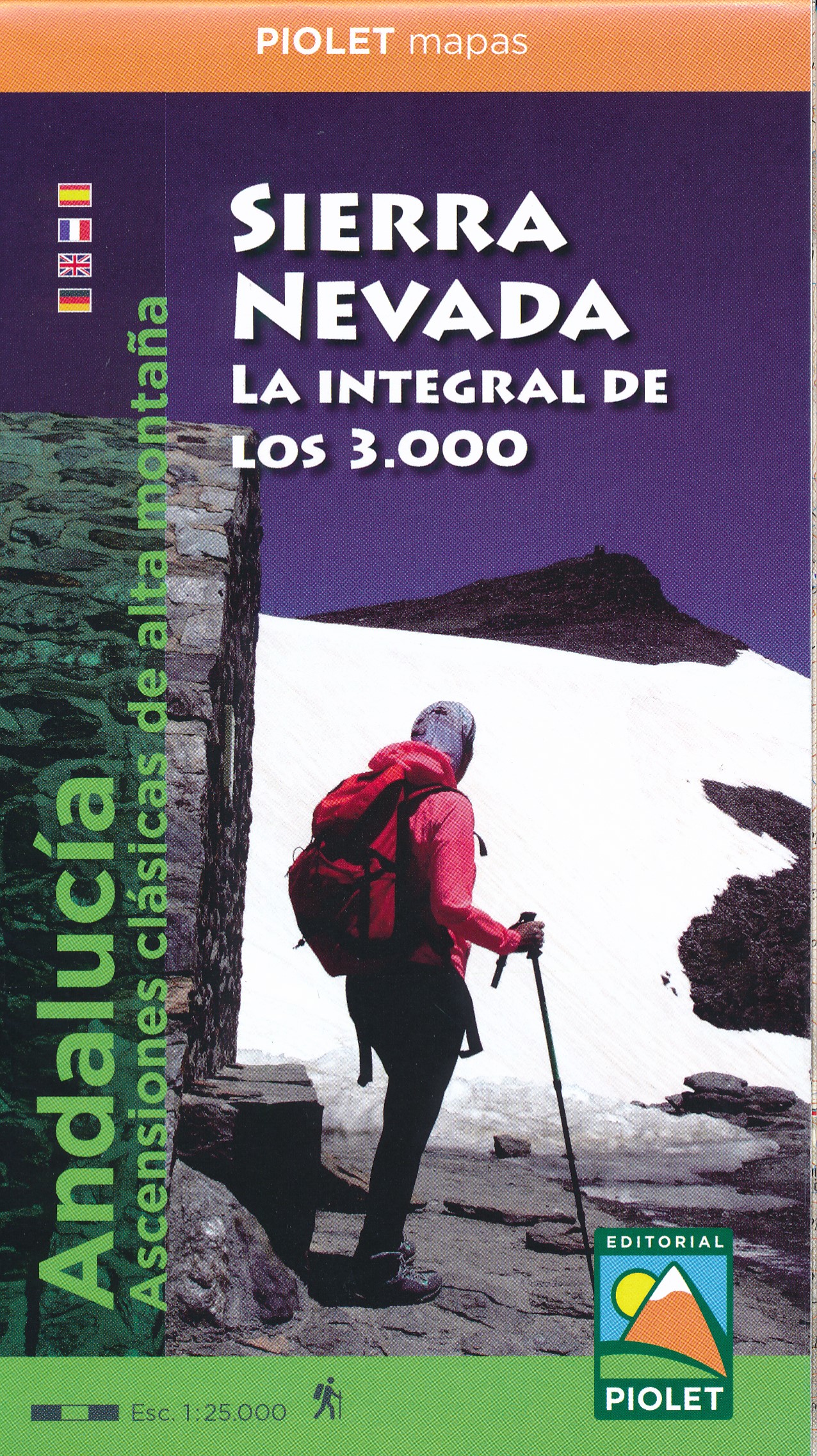
- Sierra Nevada - La Alpujarra Editorial Alpina
- Spain’s Sierra Nevada on a contoured and GPS-compatible map at 1:40,000 from Editorial Alpina highlighting local and long-distance hiking routes, mountain refuges and other accommodation, etc. Accompanying bilingual booklet provides English language descriptions of several recommended walking trails and ascents, etc, plus an extensive list of... Read more
De Zwerver
Netherlands
Netherlands
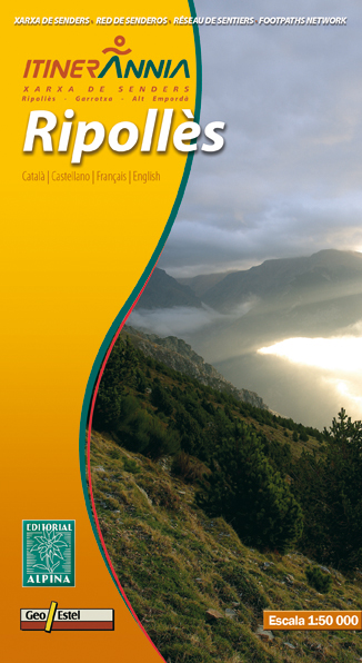
- Wandelkaart Ripolles | Editorial Alpina
- Zeer gedetailleerde wandelkaart van een klein deel van de Spaanse Pyreneeen. Met ingetekende wandelroutes en andere informatie. Uitstekende kaart. Met symbolen voor campings, hutten. Op de topografische wandelkaart worden o.a. berghutten, campings aangeduid en hoogtelijnen, ingetekende wandelroutes en de GR paden (doorgaande... Read more
- Also available from:
- Stanfords, United Kingdom

Stanfords
United Kingdom
United Kingdom
- Ripollès Editorial Alpina
- Ripollès in an extensive and very popular series of walking maps from Editorial Alpina covering the Pyrenees, Catalonia and other selected hiking areas in Spain, including Picos de Europa, Sierra Nevada and parts of Andalucía, Majorca, etc. Scales vary from 1:50,000 to 1:10,000, with the majority of the titles at 1:25,000. The maps have... Read more
De Zwerver
Netherlands
Netherlands
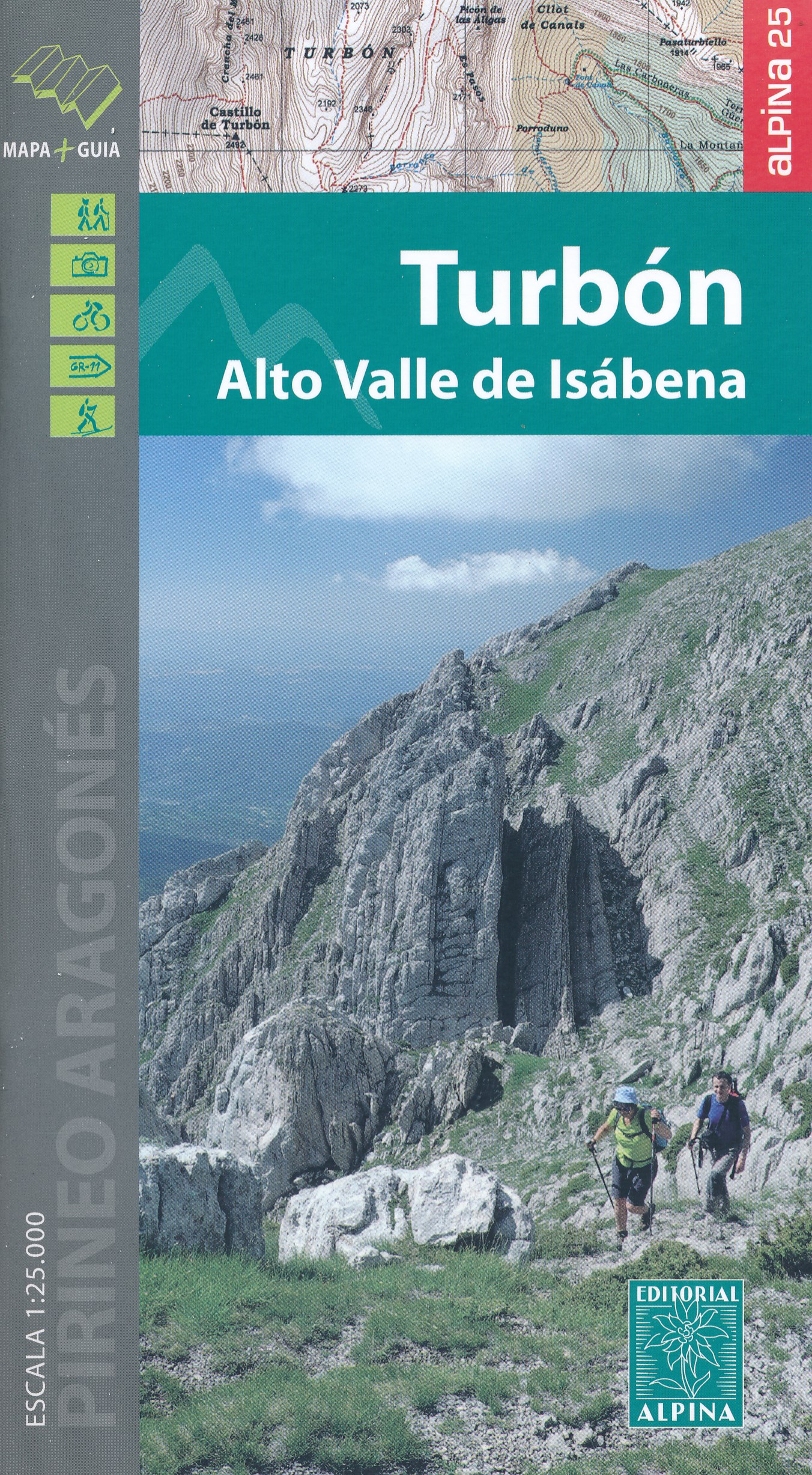
- Wandelkaart 17 Turbón, Alto Valle de Isábena | Editorial Alpina
- El Turbón - Alto Valle de Isábena in an extensive and very popular series of walking maps from Editorial Alpina covering the Pyrenees, Catalonia and other selected hiking areas in Spain, including Picos de Europa, Sierra Nevada and parts of Andalucía, Majorca, etc. Scales vary from 1:50,000 to 1:10,000, with the majority of the titles at... Read more
- Also available from:
- Stanfords, United Kingdom

Stanfords
United Kingdom
United Kingdom
- El Turbón – Alto Valle de Isábena Editorial Alpina
- El Turbón - Alto Valle de Isábena in an extensive and very popular series of walking maps from Editorial Alpina covering the Pyrenees, Catalonia and other selected hiking areas in Spain, including Picos de Europa, Sierra Nevada and parts of Andalucía, Majorca, etc. Scales vary from 1:50,000 to 1:10,000, with the majority of the titles at... Read more
De Zwerver
Netherlands
2021
Netherlands
2021
De Zwerver
Netherlands
2017
Netherlands
2017
De Zwerver
Netherlands
Netherlands