
Great Eastern Trail
Beschreibung
- Name Great Eastern Trail (GET)
- Länge von Wanderweg 2,575 km, 1,600 Meilen
- Länge in Tagen 170 Tage
- Traildino Schwierigkeit SW, Anspruchsvolle Wanderung, Bergwanderung
- Schwierigkeitsgrad Berg- und Alpinwanderung T2, Bergwandern
 GET, 1600 miles (2575 km)
Hiking trail from Alabama to New York, in the eastern States, along the Appalachian Mountains. The proposed length is 1600 miles (2575 km) or even 2000 miles. The GET should get the pressure off the AT. Currently, many local organisations are working together to get a deffinite route proposal. Under construction.
Karte


Links
Fakten
Berichte
Führer und Karten
Übernachtung
Organisationen
Reisebüros
GPS
Sonstiges
Bücher

The Book Depository
United Kingdom
United Kingdom
- London's Secret Walks
- 25 Walks Around London's Most Historic Districts Read more


- Also available from:
- De Zwerver, Netherlands
De Zwerver
Netherlands
2020
Netherlands
2020
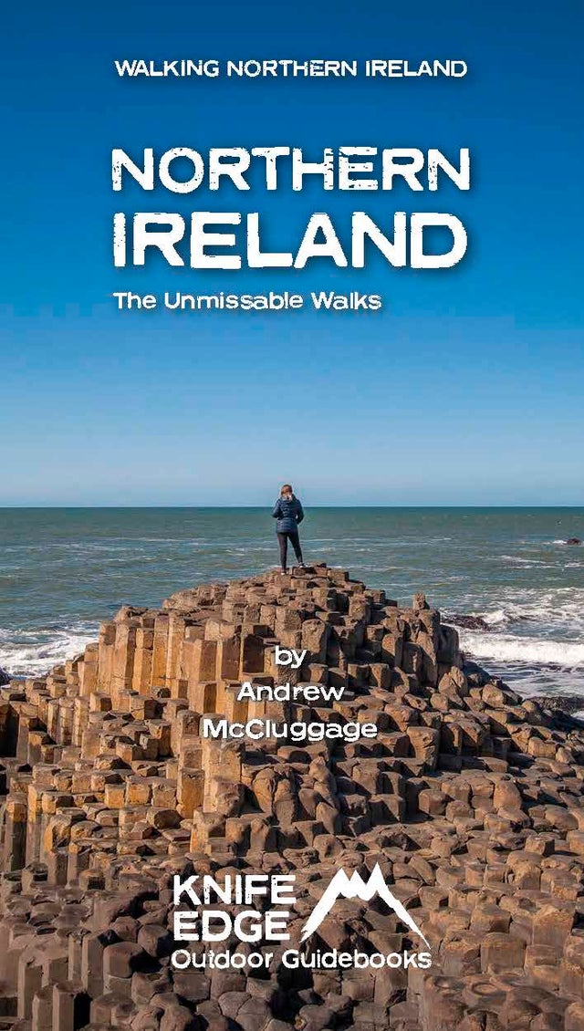
- Wandelgids Northern Ireland : The Unmissable Hikes | Knife Edge Outdoor
- Discover Northern Ireland`s wild mountains, epic cliffs, spectacular beaches and stunning moorland in this, the definitive guidebook for walking in Northern Ireland, It contains 35 epic walks, hand-picked by a Country Down local, including the Causeway Coast, the Glens of Antrim, the Mourne Mountains, the Sperrin Mountains and much more.* The... Read more

- Also available from:
- De Zwerver, Netherlands
De Zwerver
Netherlands
2021
Netherlands
2021

The Book Depository
United Kingdom
2019
United Kingdom
2019
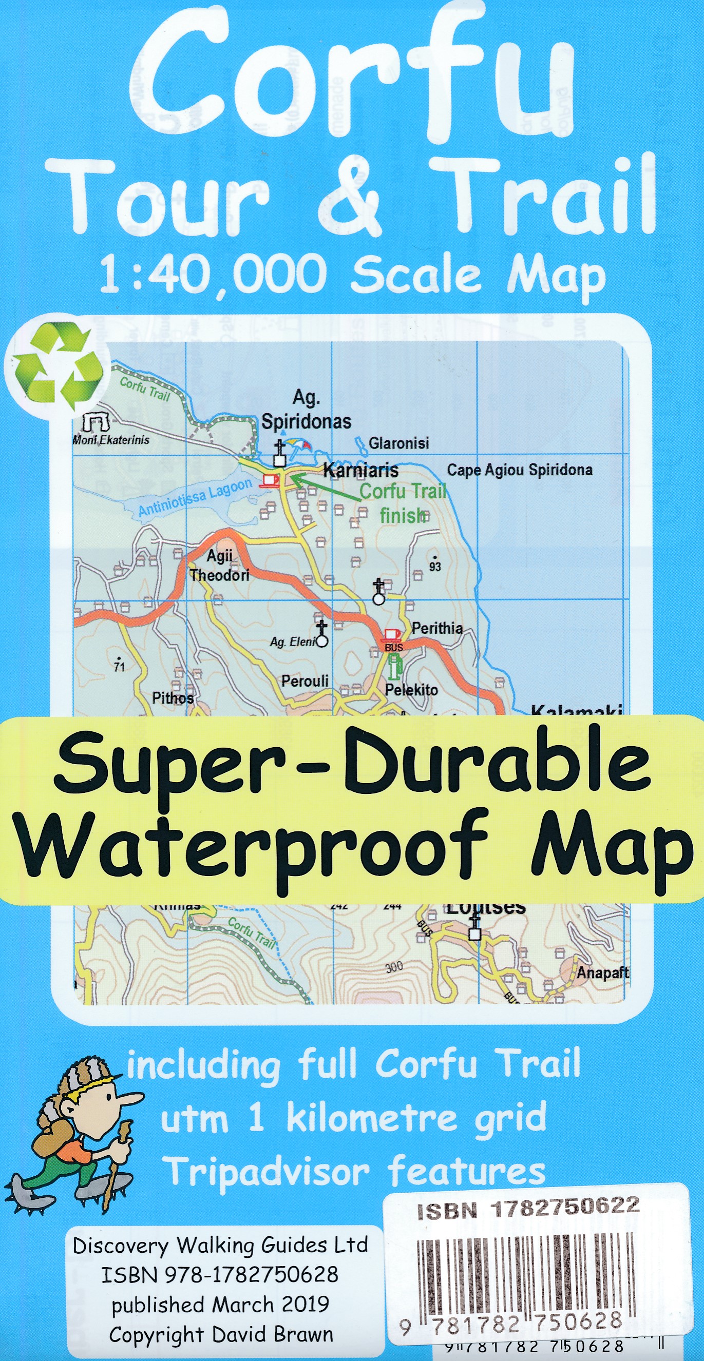
- Corfu Tour & Trail Super-Durable Map
- For better adventures, use the best map. Corfu Tour & Trail Super-Durable Map is the most detailed, accurate, toughest, large scale map of the island that you can buy. Our large 1:40,000 scale produces a double sided map sheet of 840mm by 680mm; big enough to show masses of detail but compact enough to use in the car or on the trail. Corfu... Read more
- Also available from:
- De Zwerver, Netherlands
De Zwerver
Netherlands
2019
Netherlands
2019
- Wandelkaart Tour & Trail Corfu - Korfoe | Discovery Walking Guides
- For better adventures, use the best map. Corfu Tour & Trail Super-Durable Map is the most detailed, accurate, toughest, large scale map of the island that you can buy. Our large 1:40,000 scale produces a double sided map sheet of 840mm by 680mm; big enough to show masses of detail but compact enough to use in the car or on the trail. Corfu... Read more

The Book Depository
United Kingdom
United Kingdom
- Walking The Invisible
- See through the eyes of the Brontes as you immerse yourself in their lives and landscapes, wandering the very same paths they each would have walked in search of the inspiration behind their novels and poetry. An `imaginative and elegant trek through the landscape of the Brontes` Grazia In his journey to get closer... Read more

- Also available from:
- De Zwerver, Netherlands
De Zwerver
Netherlands
2011
Netherlands
2011
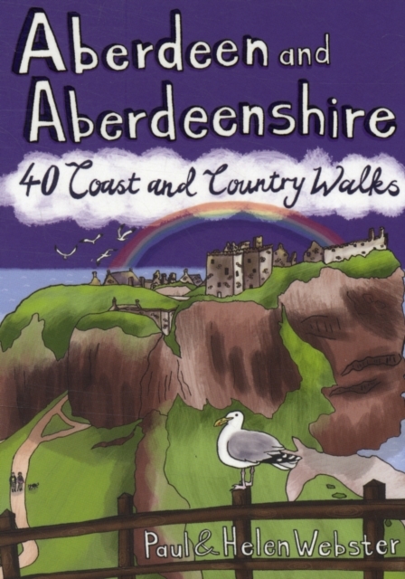
- Wandelgids Weekend Walks Aberdeen and Aberdeenshire | Pocket Mountains
- Aberdeenshire has a stunning coastline with vast, spectacular sandy beaches and picturesque fishing villages. Inland is fertile, peaceful farmland rising to the moors and finally the foothills of the Cairngorms. Its beating heart is the thriving city of Aberdeen. We help you find the best walking routes in all parts of Aberdeenshire, from the... Read more


The Book Depository
United Kingdom
2021
United Kingdom
2021
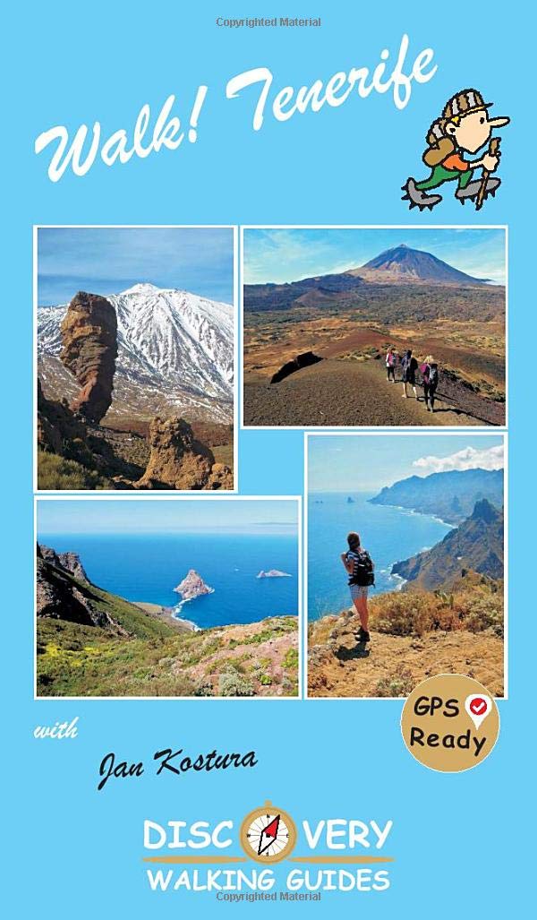
- Walk Tenerife
- TENERIFE - A WALKER`S ISLAND Tenerife is a big island - 2034 square kilometres big. It offers walkers a wide variety of exciting landscapes to choose from; everything from coastal strolls, high altitude summits, pine forests and laurel forests, challenging and strenuous routes to easy country walks. Walk! Tenerife is a comprehensive walking... Read more
- Also available from:
- De Zwerver, Netherlands
De Zwerver
Netherlands
2021
Netherlands
2021
- Wandelgids Walk! Tenerife | Discovery Walking Guides
- TENERIFE - A WALKER`S ISLAND Tenerife is a big island - 2034 square kilometres big. It offers walkers a wide variety of exciting landscapes to choose from; everything from coastal strolls, high altitude summits, pine forests and laurel forests, challenging and strenuous routes to easy country walks. Walk! Tenerife is a comprehensive walking... Read more

- Also available from:
- De Zwerver, Netherlands


The Book Depository
United Kingdom
United Kingdom
- Peak District Year Round Walks
- There just isn`t a bad time to walk in the Peak District, each season offers something new. The twenty circular walks in this book vary in length from 2 to 8 miles and are enjoyable all year round. The author has divided the routes into seasons to show each at its very best. In spring, the fields around Monyash are golden with cowslips and the... Read more

- Also available from:
- De Zwerver, Netherlands


The Book Depository
United Kingdom
2019
United Kingdom
2019
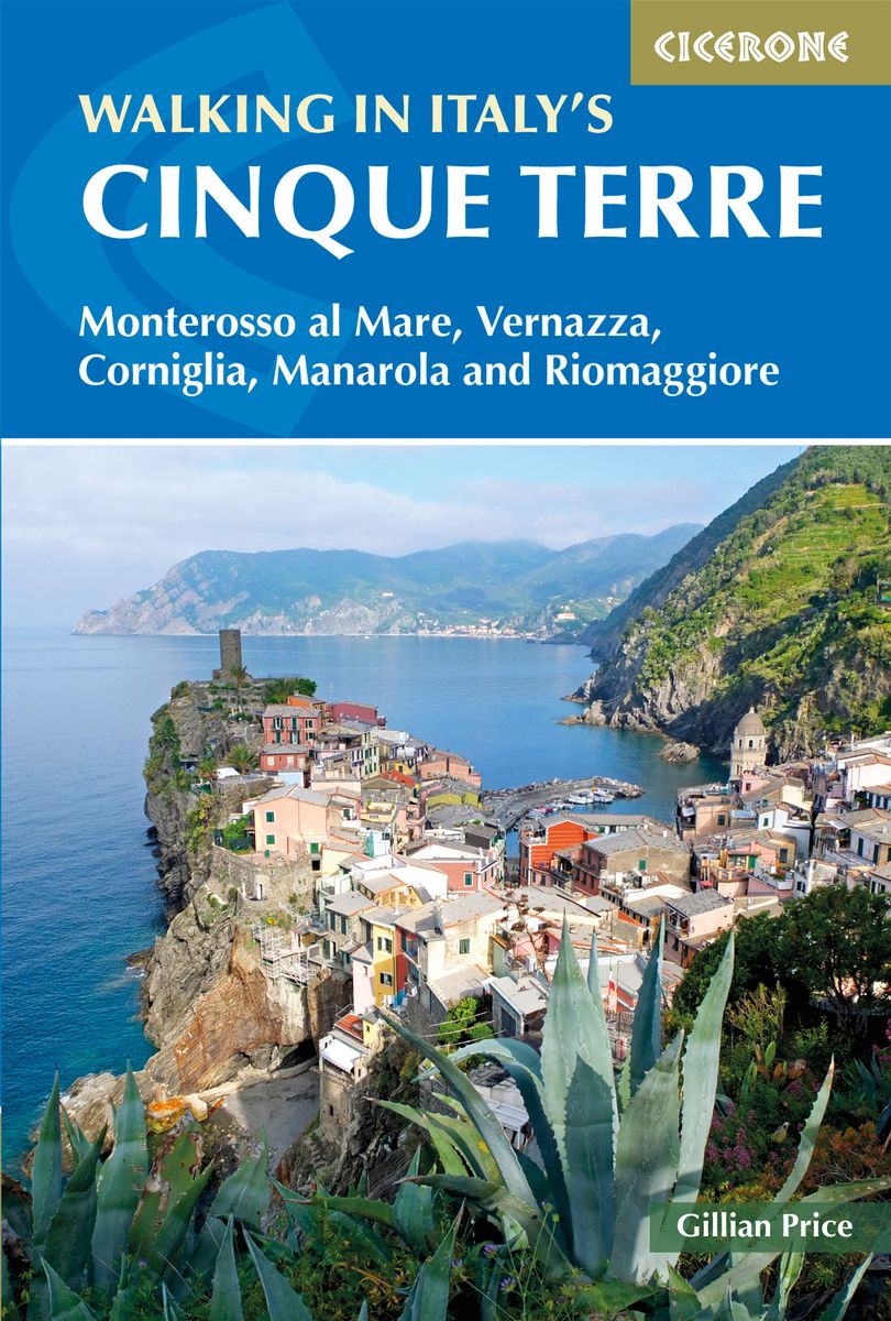
- Walking in Italy's Cinque Terre
- Monterosso al Mare, Vernazza, Corniglia, Manarola and Riomaggiore Read more
- Also available from:
- De Zwerver, Netherlands
De Zwerver
Netherlands
2019
Netherlands
2019
- Wandelgids Walking in Italy's Cinque Terre | Cicerone
- Guidebook to walking Italy's stunning Cinque Terre. Describes 16 routes in and around the five famous fishing villages of Monterosso, Vernazza, Corniglia, Manarola and Riomaggiore. Breathtakingly beautiful, this UNESCO World Heritage coastline is a walker's (and foodie's) dream destination. Read more
Weitere Bücher…

Karten

The Book Depository
United Kingdom
2018
United Kingdom
2018
- Ben Nevis and Glen Coe
- Waterproof mountain map of Ben Nevis & Glen Coe from Harvey at 1:40,000, with a geological map of the region on the reverse, an enlargement of Ben Nevis' summit, and advice on navigating the region safely.MAIN MAP: Topography is shown through clear altitude shading, spot heights, contours at 15m intervals, and index contours at 75m intervals. A... Read more
- Also available from:
- De Zwerver, Netherlands
- Stanfords, United Kingdom

De Zwerver
Netherlands
2018
Netherlands
2018
- Wandelkaart Ben Nevis & Glen Coe | Harvey Maps
- Waterproof mountain map of Ben Nevis & Glen Coe from Harvey at 1:40,000, with a geological map of the region on the reverse, an enlargement of Ben Nevis' summit, and advice on navigating the region safely.MAIN MAP: Topography is shown through clear altitude shading, spot heights, contours at 15m intervals, and index contours at 75m intervals. A... Read more

Stanfords
United Kingdom
2018
United Kingdom
2018
- Ben Nevis & Glen Coe Harvey British Mountain Map XT40
- Waterproof mountain map of Ben Nevis & Glen Coe from Harvey at 1:40,000, with a geological map of the region on the reverse, an enlargement of Ben Nevis` summit, and advice on navigating the region safely.*MAIN MAP:* Topography is shown through clear altitude shading, spot heights, contours at 15m intervals, and index contours at 75m intervals.... Read more

- Also available from:
- De Zwerver, Netherlands
- Stanfords, United Kingdom


Stanfords
United Kingdom
United Kingdom
- Glocknergruppe - Matrei - Kals - Heiligenblut Tabacco 076
- This Tabacco topographic map at 1:25,000 (1cm = 250m) covers the Alta Via routes, as well as the Via Ferrata where you get further than the ordinary walker with the help of steel ladders. Additional information includes: symbols to indicate 6 different types of accommodation from mountain hut, hotel to camping site. As well as information on... Read more

De Zwerver
Netherlands
2019
Netherlands
2019
- Reisgids Iceland Road Guide | Vegahandbokin
- Iceland Road Guide from Vegahandbókin, an exceptionally comprehensive, 605-page guide with region-by-region descriptions of sites accompanied by road maps and street plans, plus a separate road atlas section covering the whole country at 1:500,000 and information on a wide variety of tourism relating topics to help the user get the best of... Read more
- Also available from:
- Stanfords, United Kingdom

Stanfords
United Kingdom
2019
United Kingdom
2019
- Iceland Road Guide
- Iceland Road Guide from Vegahandbókin, an exceptionally comprehensive, 605-page guide with region-by-region descriptions of sites accompanied by road maps and street plans, plus a separate road atlas section covering the whole country at 1:500,000 and information on a wide variety of tourism relating topics to help the user get the best of... Read more

Stanfords
United Kingdom
United Kingdom
- Muktinath
- Koban, sheet no. 2883-07, in the topographic survey of Nepal at 1:50,000 published by the Nepali Government in the late 1990s and early 2000s and produced from remote sensing data by Finnish cartographers as part of that country’s international aid program. The maps cover 15’ x 15’ quadrangles.IMPORTANT – PLEASE NOTE BEFORE ORDERING:... Read more
Stanfords
United Kingdom
United Kingdom
- Ghandruk
- Ghandruk, sheet no. 2883-12, in the topographic survey of Nepal at 1:50,000 published by the Nepali Government in the late 1990s and early 2000s and produced from remote sensing data by Finnish cartographers as part of that country’s international aid program. The maps cover 15’ x 15’ quadrangles.IMPORTANT – PLEASE NOTE BEFORE ORDERING:... Read more
Stanfords
United Kingdom
United Kingdom
- Apsuwa Khoka - Bala
- Apsuwa Khoka – Bala, sheet no. 2787-05, in the topographic survey of Nepal at 1:50,000 published by the Nepali Government in the late 1990s and early 2000s and produced from remote sensing data by Finnish cartographers as part of that country’s international aid program. The maps cover 15’ x 15’ quadrangles.IMPORTANT – PLEASE NOTE BEFORE... Read more
Stanfords
United Kingdom
United Kingdom
- Dho
- Dho, sheet no. 2983-13, in the topographic survey of Nepal at 1:50,000 published by the Nepali Government in the late 1990s and early 2000s and produced from remote sensing data by Finnish cartographers as part of that country’s international aid program. The maps cover 15’ x 15’ quadrangles.IMPORTANT – PLEASE NOTE BEFORE ORDERING:... Read more
Stanfords
United Kingdom
United Kingdom
- Lamabagar
- Lamabagar, sheet no. 2786-01, in the topographic survey of Nepal at 1:50,000 published by the Nepali Government in the late 1990s and early 2000s and produced from remote sensing data by Finnish cartographers as part of that country’s international aid program. The maps cover 15’ x 15’ quadrangles.IMPORTANT – PLEASE NOTE BEFORE ORDERING:... Read more
Stanfords
United Kingdom
United Kingdom
- Gamgadhi
- Gamgadji, sheet no. 2982-05, in the topographic survey of Nepal at 1:50,000 published by the Nepali Government in the late 1990s and early 2000s and produced from remote sensing data by Finnish cartographers as part of that country’s international aid program. The maps cover 15’ x 15’ quadrangles.IMPORTANT – PLEASE NOTE BEFORE ORDERING:... Read more
Stanfords
United Kingdom
United Kingdom
- Langtang Lirung
- Langtang Lirung, sheet no. 2885-11, in the topographic survey of Nepal at 1:50,000 published by the Nepali Government in the late 1990s and early 2000s and produced from remote sensing data by Finnish cartographers as part of that country’s international aid program. The maps cover 15’ x 15’ quadrangles.IMPORTANT – PLEASE NOTE BEFORE ORDERING:... Read more
Stanfords
United Kingdom
United Kingdom
- Khadachakra
- Khadachakra, sheet no. 2981-15, in the topographic survey of Nepal at 1:50,000 published by the Nepali Government in the late 1990s and early 2000s and produced from remote sensing data by Finnish cartographers as part of that country’s international aid program. The maps cover 15’ x 15’ quadrangles.IMPORTANT – PLEASE NOTE BEFORE ORDERING:... Read more
Stanfords
United Kingdom
United Kingdom
- Mt. Pumori
- Mt Pumori, sheet no. 2886-16, in the topographic survey of Nepal at 1:50,000 published by the Nepali Government in the late 1990s and early 2000s and produced from remote sensing data by Finnish cartographers as part of that country’s international aid program. The maps cover 15’ x 15’ quadrangles.IMPORTANT – PLEASE NOTE BEFORE ORDERING:... Read more
Stanfords
United Kingdom
United Kingdom
- Phugau Ghomion
- Phugau Ghomion, sheet no. 2884-02, in the topographic survey of Nepal at 1:50,000 published by the Nepali Government in the late 1990s and early 2000s and produced from remote sensing data by Finnish cartographers as part of that country’s international aid program. The maps cover 15’ x 15’ quadrangles.IMPORTANT – PLEASE NOTE BEFORE ORDERING:... Read more

Stanfords
United Kingdom
United Kingdom
- Cycling the Canal de la Garonne: From Bordeaux to Toulouse
- This guidebook presents a cycle ride along the Canal de la Garonne in the south of France. The 290km route is covered in 7 stages from bustling Bordeaux to the splendid rose city of Toulouse, with a 135km excursion from to Lacanau on the Atlantic coast. Optional side trips explore the countryside and historical towns and villages, including... Read more
Stanfords
United Kingdom
United Kingdom
- Olanchungola
- Olanchungola, sheet no. 2787-08, in the topographic survey of Nepal at 1:50,000 published by the Nepali Government in the late 1990s and early 2000s and produced from remote sensing data by Finnish cartographers as part of that country’s international aid program. The maps cover 15’ x 15’ quadrangles.IMPORTANT – PLEASE NOTE BEFORE ORDERING:... Read more