Mont Blanc
Beschreibung

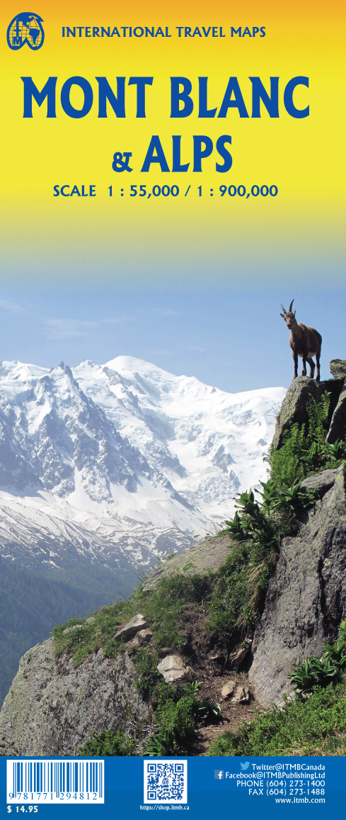
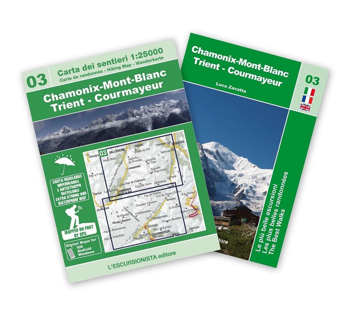
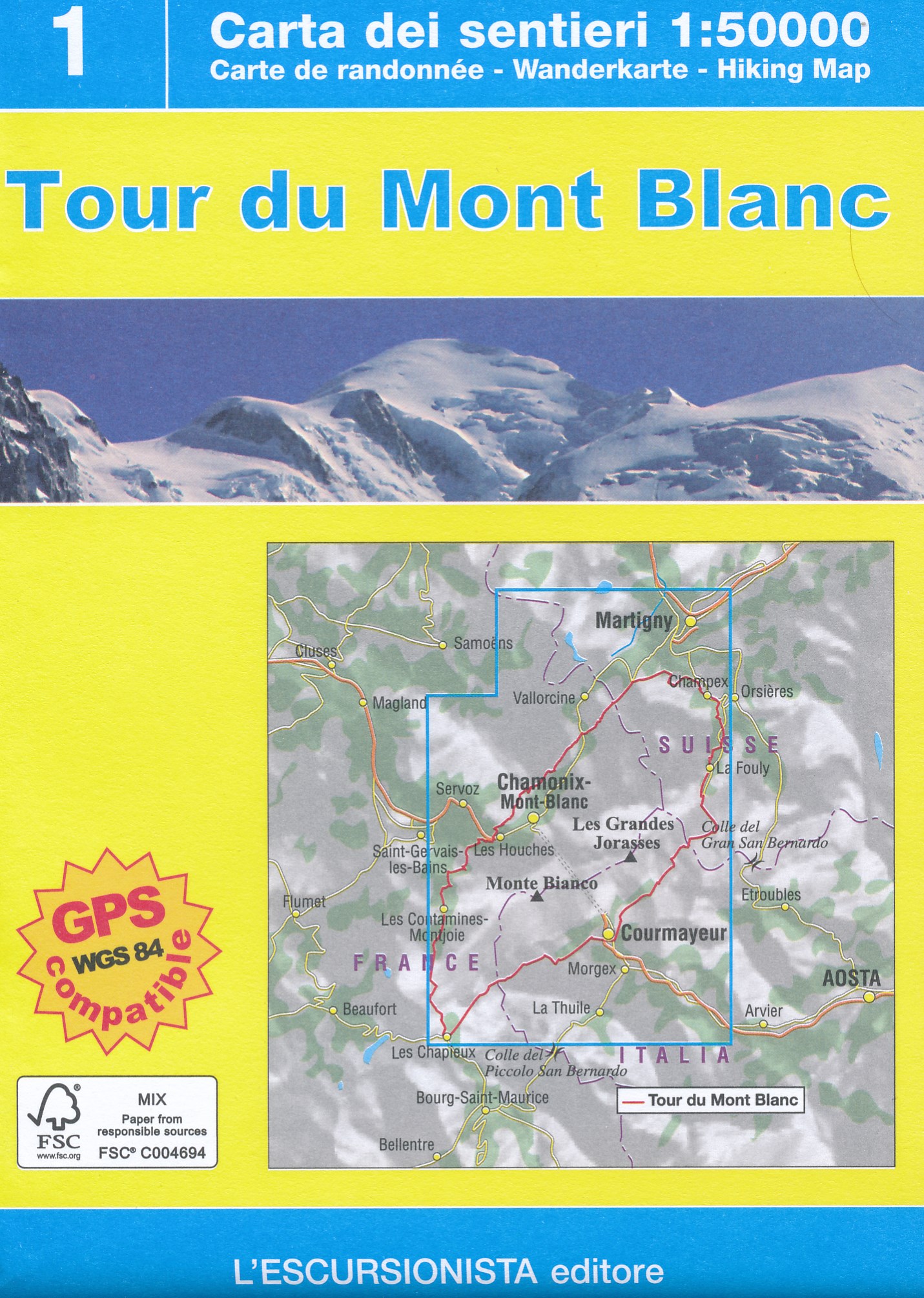
The Mont Blanc Massif is divided between the countries France, Italy and Switzerland. France gets the major part, including the summit of the Mont Blanc itself (4.810 m). The Tour du Mont Blanc is one of the most popular hikes in the Alps, attracting thousands of visitors worldwide every year.
Karte


Wanderwege Region


Links
Fakten
Berichte
Führer und Karten
Übernachtung
Organisationen
Reisebüros
GPS
Sonstiges
Bücher


- Also available from:
- De Zwerver, Netherlands
- Stanfords, United Kingdom
De Zwerver
Netherlands
2016
Netherlands
2016

Stanfords
United Kingdom
2016
United Kingdom
2016
- Thames Estuary, Rochester & Southend-on-Sea OS Landranger Map 178 (paper)
- Thames Estuary with Rochester and Southend-on-Sea, including a section of the North Downs Way / E2 European Long-Distance Path, on a paper version of map No. 178 from the Ordnance Survey’s Landranger series at 1:50,000, with contoured and GPS compatible topographic mapping plus tourist information.MOBILE DOWNLOADS: As well as the physical... Read more

- Also available from:
- De Zwerver, Netherlands
- Stanfords, United Kingdom

De Zwerver
Netherlands
2021
Netherlands
2021

Stanfords
United Kingdom
2021
United Kingdom
2021
- Worcester, The Malverns, Evesham & Tewkesbury OS Landranger Map 150 (paper)
- The area around Worcester, Great Malvern, Evesham and Tewkesbury, including the Malvern Hills and part of the Cotswold Way / E2 European Long-distance Path, on a paper version of map No. 150 from the Ordnance Survey’s Landranger series at 1:50,000, with contoured and GPS compatible topographic mapping plus tourist information.MOBILE DOWNLOADS:... Read more

The Book Depository
United Kingdom
2020
United Kingdom
2020
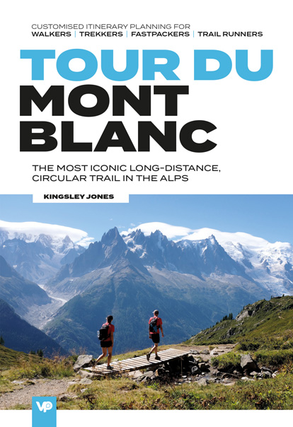
- Tour du Mont Blanc
- The most iconic long-distance, circular trail in the Alps with customised itinerary planning for walkers, trekkers, fastpackers and trail runners Read more
- Also available from:
- De Zwerver, Netherlands
- Stanfords, United Kingdom
De Zwerver
Netherlands
2020
Netherlands
2020
- Wandelgids Tour du Mont Blanc | Vertebrate Publishing
- The most iconic long-distance, circular trail in the Alps with customised itinerary planning for walkers, trekkers, fastpackers and trail runners Read more

Stanfords
United Kingdom
2020
United Kingdom
2020
- Tour du Mont Blanc: The most iconic long-distance, circular trail in the Alps with customised itinerary planning for walkers, trekkers, fastpackers and trail runners
- Tour du Mont Blanc is the definitive guidebook for one of the most famous long-distance treks in the world. This trek circles the entire Mont Blanc massif, passing through spectacular scenery in France, Italy and Switzerland. You`ll traverse high mountain passes, see stunning glaciers, pass azure lakes, wander through tranquil green valleys and... Read more

The Book Depository
United Kingdom
United Kingdom

The Book Depository
United Kingdom
2018
United Kingdom
2018
- The GR5 Trail - Benelux and Lorraine
- The North Sea to Schirmeck in the Vosges mountains Read more
- Also available from:
- De Zwerver, Netherlands

De Zwerver
Netherlands
2018
Netherlands
2018
- Wandelgids The GR5 Trail Benelux and Lorraine | Cicerone
- Guidebook to walking the northern section of the GR5 - 1000km starting in Hoek van Holland and passing through the Netherlands, Belgium, Luxembourg and Lorraine to Schirmeck in France. A long-distance route covering a variety of cultures and landscapes. The full GR5 from the North Sea to the Mediterranean is one of the world's greatest trails. Read more

- Also available from:
- De Zwerver, Netherlands
- Stanfords, United Kingdom

De Zwerver
Netherlands
2016
Netherlands
2016

Stanfords
United Kingdom
2016
United Kingdom
2016
- Dorking, Reigate, Crawley & Horsham OS Landranger Map 187 (paper)
- Dorking and Reigate area, including a section of the North Downs Way / E2 European Long-distance Path, on a paper version of map No. 187 from the Ordnance Survey’s Landranger series at 1:50,000, with contoured and GPS compatible topographic mapping plus tourist information.MOBILE DOWNLOADS: As well as the physical edition of the map, each... Read more

- Also available from:
- Stanfords, United Kingdom

Stanfords
United Kingdom
United Kingdom
- Aldershot, Guildford, Camberley & Haslemere OS Landranger Active Map 186 (waterproof)
- Aldershot and Guildford area, including the northern part of the South Downs National Park and a section of the North Downs Way / E2 European Long-distance Path, on a waterproof and tear-resistant OS Active version of map No. 186 from the Ordnance Survey’s Landranger series at 1:50,000, with contoured and GPS compatible topographic mapping plus... Read more

- Also available from:
- Stanfords, United Kingdom

Stanfords
United Kingdom
United Kingdom
- Reading, Windsor, Henley-on-Thames & Bracknell OS Landranger Active Map 175 (waterproof)
- Reading – Windsor area, including a section of the Thames Path / E2 European Long-distance Path, on a waterproof and tear-resistant OS Active version of map No. 175 from the Ordnance Survey’s Landranger series at 1:50,000, with contoured and GPS compatible topographic mapping plus tourist information.MOBILE DOWNLOADS: As well as the physical... Read more

- Also available from:
- De Zwerver, Netherlands
- Stanfords, United Kingdom
De Zwerver
Netherlands
2016
Netherlands
2016

Stanfords
United Kingdom
2016
United Kingdom
2016
- Stratford-upon-Avon, Warwick & Banbury OS Landranger Map 151 (paper)
- The area between Stratford-upon-Avon, Warwick and Banbury, including the northern part of the Cotswold Hills and part of the Cotswold Way / E2 European Long-distance Path, on a paper version of map No. 151 from the Ordnance Survey’s Landranger series at 1:50,000, with contoured and GPS compatible topographic mapping plus tourist... Read more


The Book Depository
United Kingdom
United Kingdom

The Book Depository
United Kingdom
2018
United Kingdom
2018
- Fastpacking
- Multi-day running adventures: tips, stories and route ideas Read more

- Also available from:
- De Zwerver, Netherlands
- Stanfords, United Kingdom
De Zwerver
Netherlands
2019
Netherlands
2019

Stanfords
United Kingdom
2019
United Kingdom
2019
- Maidstone, Royal Tunbridge Wells, Sevenoaks & Tonbridge OS Landranger Map 188 (paper)
- Maidstone, Tunbridge Wells and the High Weald area, including a section of the North Downs Way / E2 European Long-distance Path, on a paper version of map No. 188 from the Ordnance Survey’s Landranger series at 1:50,000, with contoured and GPS compatible topographic mapping plus tourist information.MOBILE DOWNLOADS: As well as the physical... Read more

- Also available from:
- De Zwerver, Netherlands
- Stanfords, United Kingdom
De Zwerver
Netherlands
2016
Netherlands
2016

Stanfords
United Kingdom
2016
United Kingdom
2016
- Ipswich, The Naze & Clacton-on-Sea OS Landranger Map 169 (paper)
- Ipswich with Harwich and The Naze area, including part of the E2 European Long-distance Path, on a paper version of map No. 169 from the Ordnance Survey’s Landranger series at 1:50,000, with contoured and GPS compatible topographic mapping plus tourist information.MOBILE DOWNLOADS: As well as the physical edition of the map, each Landranger... Read more
Karten

- Also available from:
- De Zwerver, Netherlands


The Book Depository
United Kingdom
2020
United Kingdom
2020
- Trekking the Tour of Mont Blanc
- Complete two-way hiking guidebook and map booklet Read more
- Also available from:
- Stanfords, United Kingdom

Stanfords
United Kingdom
2020
United Kingdom
2020
- Trekking the Tour of Mont Blanc: Complete two-way hiking guidebook and map booklet
- The Tour of Mont Blanc is one of the world`s classic treks. This guidebook to hiking the 170km TMB contains in-depth route description and mapping for both the classic 11 day anti-clockwise circuit and an alternative 10 day clockwise circuit. This well-signed but demanding route, starting from Les Houches or Champex, is suitable for fit... Read more

The Book Depository
United Kingdom
United Kingdom
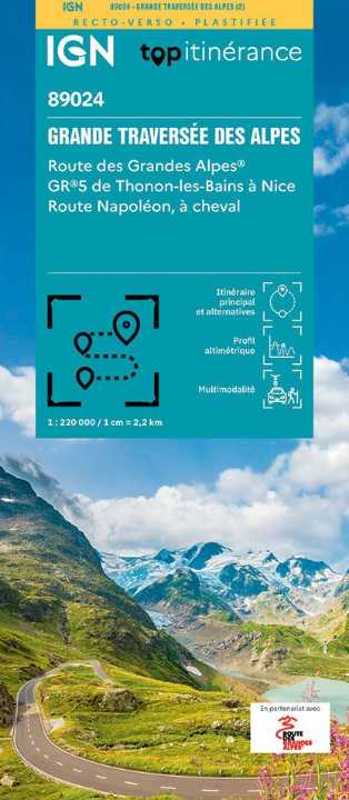
- Leman et Mont Blanc entre - Chablais Faucigny
- Selected tourist regions of the France on GPS compatible, contoured TOP 75 maps at 1:75,000 from the IGN, highlighting local and long-distance hiking paths, cycling routes and sites for other recreational activities. Each title includes five large panels with mapping at 1:25,000 to cover its most popular areas in greater detail. Cartography of... Read more
- Also available from:
- De Zwerver, Netherlands
- Stanfords, United Kingdom

De Zwerver
Netherlands
Netherlands
- Fietskaart - Wandelkaart 07 Entre Léman et Mont Blanc | IGN - Institut Géographique National
- Selected tourist regions of the France on GPS compatible, contoured TOP 75 maps at 1:75,000 from the IGN, highlighting local and long-distance hiking paths, cycling routes and sites for other recreational activities. Each title includes five large panels with mapping at 1:25,000 to cover its most popular areas in greater detail. Cartography of... Read more

Stanfords
United Kingdom
United Kingdom
- Lake Geneva and Mont Blanc IGN 75007
- Selected tourist regions of the France on GPS compatible, contoured TOP 75 maps at 1:75,000 from the IGN, highlighting local and long-distance hiking paths, cycling routes and sites for other recreational activities. Each title includes five large panels with mapping at 1:25,000 to cover its most popular areas in greater detail. Cartography of... Read more

- Also available from:
- De Zwerver, Netherlands
- Stanfords, United Kingdom
De Zwerver
Netherlands
Netherlands

Stanfords
United Kingdom
United Kingdom
- Annecy - Albertville - Chamonix-Mont-Blanc - Massif du Mont Blanc IGN TOP100 144
- Discover the new double-sided laminated edition of TOP100 road maps of France from the Institut Géographique National (IGN); exceptionally detailed, contoured road maps which include the cycle paths and greenways of the AF3V (French Association for the Development of Cycle Paths and Greenways), ideal for exploring the French countryside by car,... Read more
De Zwerver
Netherlands
Netherlands
- Also available from:
- Stanfords, United Kingdom

Stanfords
United Kingdom
United Kingdom
- Nice - Menton - PN du Mercantour IGN TOP100 165
- Discover the new double-sided laminated edition of TOP100 road maps of France from the Institut Géographique National (IGN); exceptionally detailed, contoured road maps which include the cycle paths and greenways of the AF3V (French Association for the Development of Cycle Paths and Greenways), ideal for exploring the French countryside by car,... Read more
De Zwerver
Netherlands
2020
Netherlands
2020
De Zwerver
Netherlands
Netherlands
- Wandelkaart - Topografische kaart 5003 Mont Blanc Grand Combin | Swisstopo
- Mont Blanc - Grand Combin area, map No. 5003, in the standard topographic survey of Switzerland at 1:50,000 from Swisstopo, i.e. without the special overprint highlighting walking trails, local bus stops, etc, presented in Swisstopo Read more
- Also available from:
- Stanfords, United Kingdom

Stanfords
United Kingdom
United Kingdom
- Mont Blanc - Grand Combin Swisstopo 5003
- Mont Blanc - Grand Combin area, map No. 5003, in the standard topographic survey of Switzerland at 1:50,000 from Swisstopo, i.e. without the special overprint highlighting walking trails, local bus stops, etc, presented in Swisstopo’s hiking editions of the 50K survey. Coverage extends from Chamonix and the Mont Blanc massif eastwards to Arolla... Read more

De Zwerver
Netherlands
2014
Netherlands
2014
- Wandelkaart 07 Mercantour & Alpi-Maritieme | Didier Richard
- Mercantour National Park and the Maritime Alps on a large, double-sided, contoured and GPS compatible map from Editions Didier Richard highlighting local walking trails and long-distance hiking routes including the GR5. Coverage extends from well north of Col de Larch to Sospel, Levens and Roquestéron in the mountains north of the French... Read more
- Also available from:
- Stanfords, United Kingdom

Stanfords
United Kingdom
2014
United Kingdom
2014
- Mercantour & Alpi-Marittime Didier Richard 07
- Mercantour National Park and the Maritime Alps on a large, double-sided, contoured and GPS compatible map from Editions Didier Richard highlighting local walking trails and long-distance hiking routes including the GR5. Coverage extends from well north of Col de Larch to Sospel, Levens and Roquestéron in the mountains north of the French... Read more


De Zwerver
Netherlands
2013
Netherlands
2013
- Wandelkaart 04 Massiccio del Monte Bianco | IGC - Istituto Geografico Centrale
- The Mont Blanc Massif in a series contoured hiking maps at 1:50,000 with local trails, long-distance footpaths, mountain accommodation, etc, from the Turin based Istituto Geografico Centrale. This new edition published in late 2013 highlights, among other routes, the Alta Via 1 and the northern section of the Alta Via 2, both of which join up... Read more
- Also available from:
- Stanfords, United Kingdom

Stanfords
United Kingdom
2013
United Kingdom
2013
- Mont Blanc Massif IGC 4
- The Mont Blanc Massif in a series contoured hiking maps at 1:50,000 with local trails, long-distance footpaths, mountain accommodation, etc, from the Turin based Istituto Geografico Centrale. The map highlights, among other routes, the Alta Via 1 and the northern section of the Alta Via 2, both of which join up with TMB, as well as the local... Read more
Weitere …