
Finsteraarhorn
Beschreibung
- Höhe 4274.00 m
Links
Fakten
Berichte
Führer und Karten
Übernachtung
Organisationen
Reisebüros
GPS
Sonstiges
Karten
De Zwerver
Netherlands
Netherlands
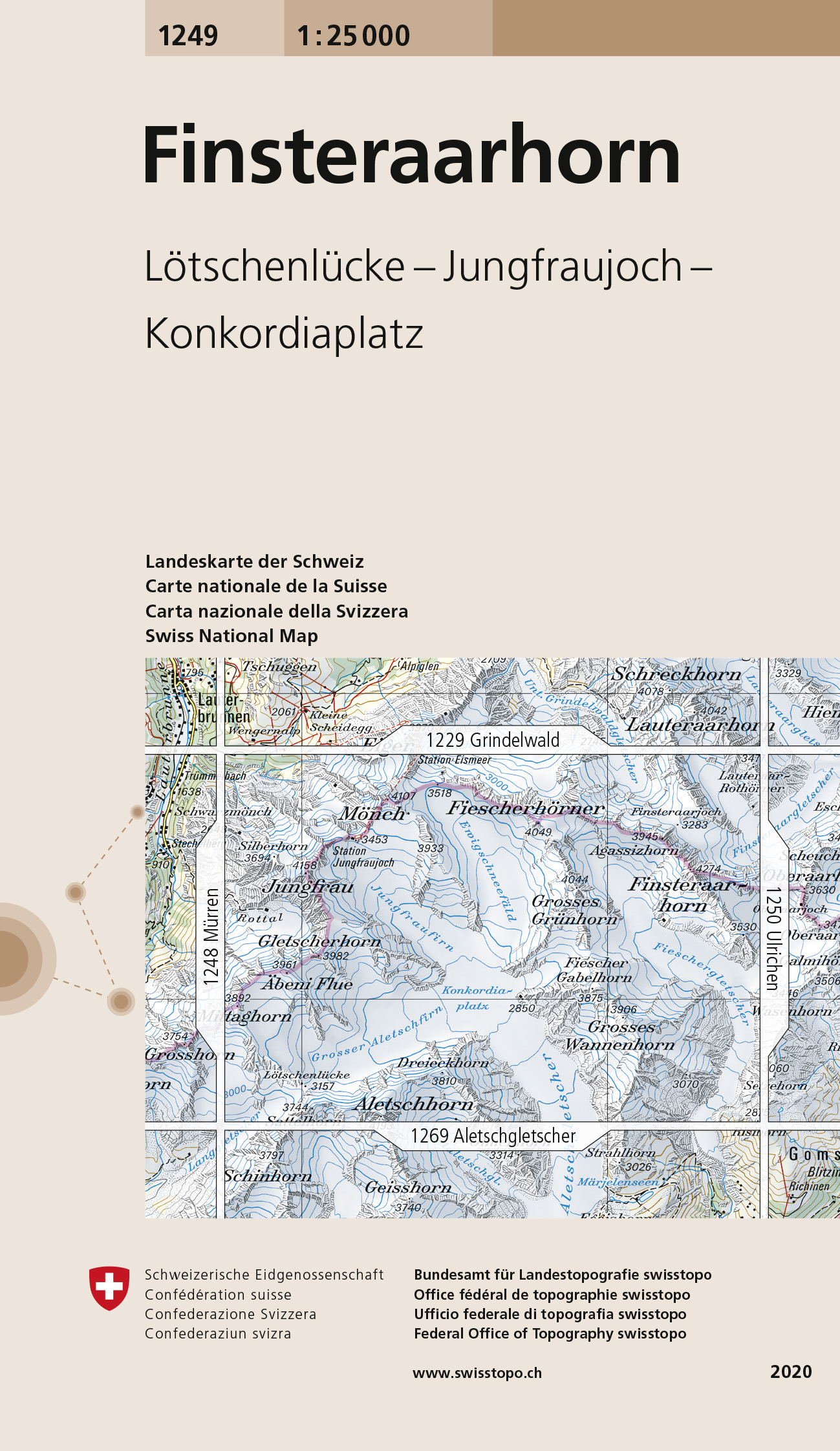
- Wandelkaart - Topografische kaart 1249 Finsteraarhorn | Swisstopo
- Map No. 1249, Finsteraarhorn, in the topographic survey of Switzerland at 1:25,000 from Swisstopo. Centered on the Konkordiaplatz, the map covers the upper part of the Aletsch Glacier with the peak of Aletschhorn right on its southern edge, and extends north to include the peaks of Jungfrau, M Read more
- Also available from:
- Stanfords, United Kingdom

Stanfords
United Kingdom
United Kingdom
- Finsteraarhorn Swisstopo 1249
- Map No. 1249, Finsteraarhorn, in the topographic survey of Switzerland at 1:25,000 from Swisstopo. Centered on the Konkordiaplatz, the map covers the upper part of the Aletsch Glacier with the peak of Aletschhorn right on its southern edge, and extends north to include the peaks of Jungfrau, Mönch and Chlyne Eiger (i.e not the Eiger itself).... Read more
De Zwerver
Netherlands
Netherlands
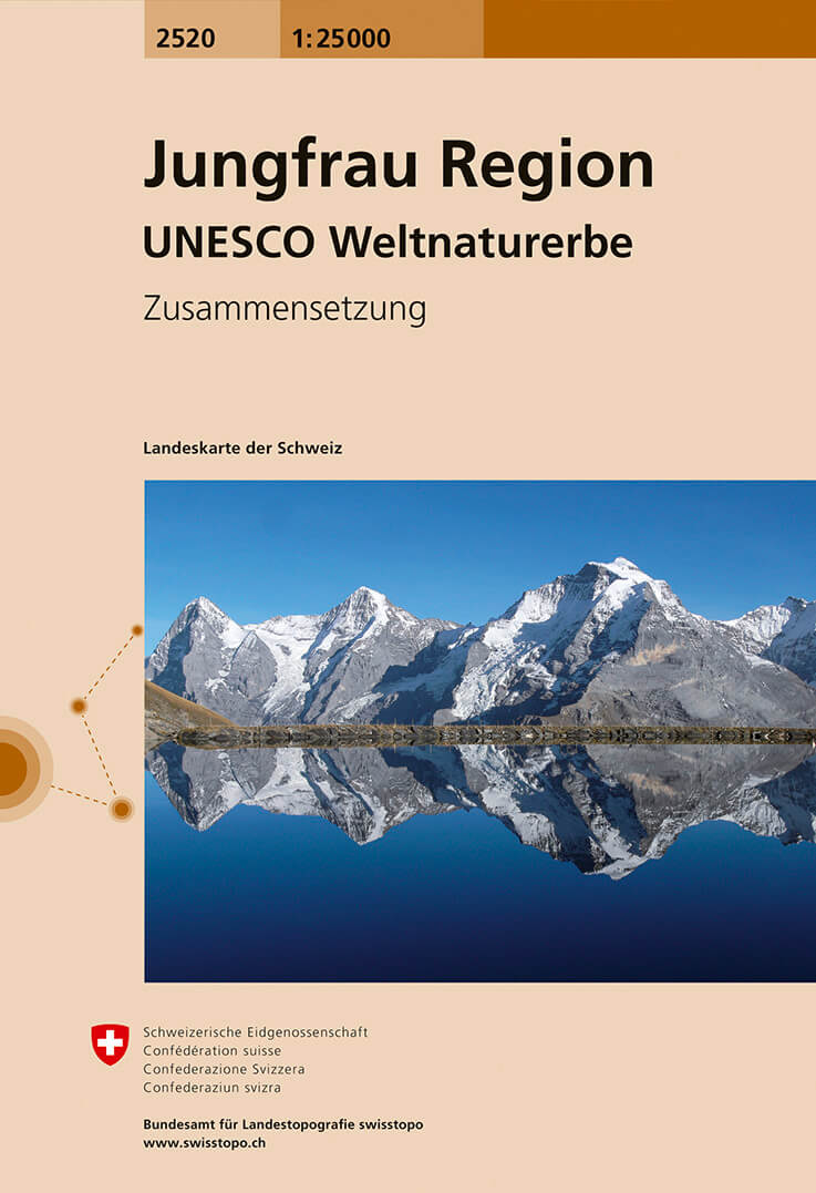
- Wandelkaart - Topografische kaart 2520 Jungfrau region | Swisstopo
- Map No. 2520, Jungfrau Region - STANDARD EDITION, in the topographic survey of Switzerland at 1:25,000 from Swisstopo, covering all the popular destinations of the eastern part of the Bernese Oberland, extending from Interlaken to the peaks of Eiger, M Read more
- Also available from:
- Stanfords, United Kingdom

Stanfords
United Kingdom
United Kingdom
- Jungfrau Region - UNESCO World Heritage Site Swisstopo 2520
- Map No. 2520, Jungfrau Region - STANDARD EDITION, in the topographic survey of Switzerland at 1:25,000 from Swisstopo, covering all the popular destinations of the eastern part of the Bernese Oberland, extending from Interlaken to the peaks of Eiger, Möch and Jungfrau, including Grindelwald, Lauterbrunnen, Wengen, Müren and Gimmelwald, Kleine... Read more
De Zwerver
Netherlands
Netherlands
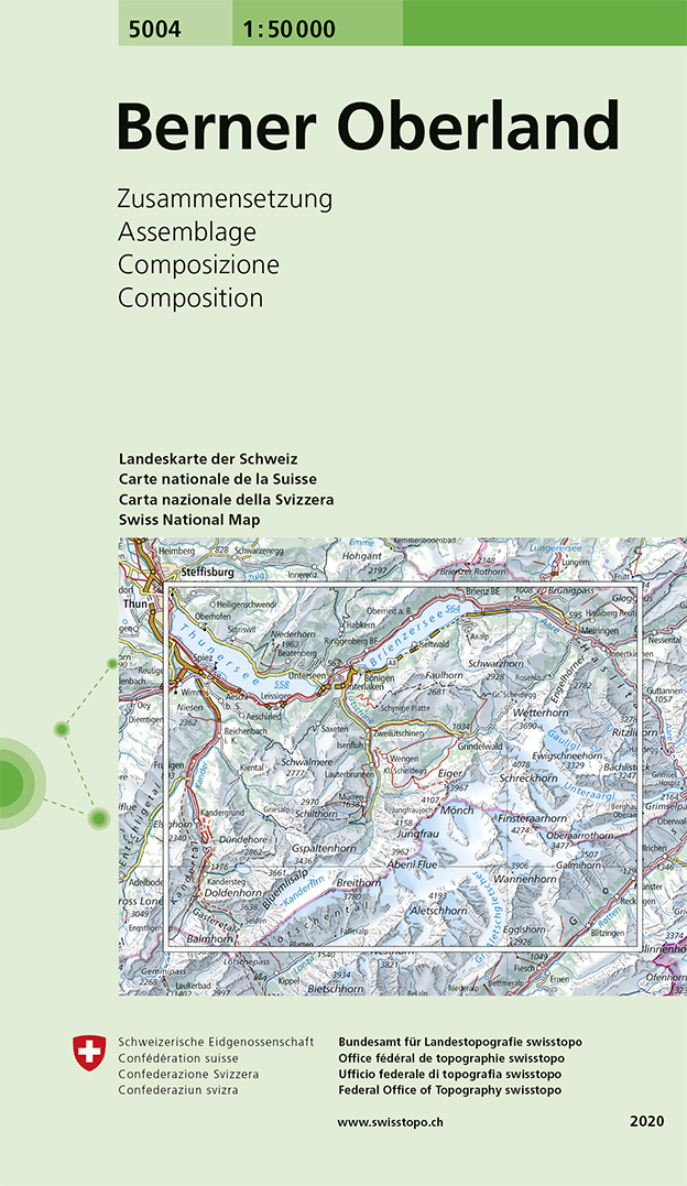
- Wandelkaart - Topografische kaart 5004 Berner Oberland | Swisstopo
- Bernese Oberland, map No. 5004, in the standard topographic survey of Switzerland at 1:50,000 from Swisstopo, i.e. without the special overprint highlighting walking trails, local bus stops, etc, presented in Swisstopo Read more
- Also available from:
- Stanfords, United Kingdom
Stanfords
United Kingdom
United Kingdom
- Bernese Oberland Swisstopo 5004
- Bernese Oberland, map No. 5004, in the standard topographic survey of Switzerland at 1:50,000 from Swisstopo, i.e. without the special overprint highlighting walking trails, local bus stops, etc, presented in Swisstopo’s hiking editions of the 50K survey. Coverage extends from Thun and Brienz with their lakes, across the peaks of Jungfrau,... Read more