De Zwerver
Netherlands
» Click to open
Stanfords
United Kingdom
  • Mont Blanc - Grand Combin Swisstopo 5003
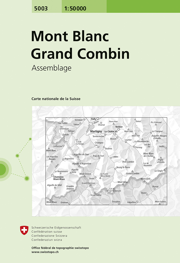
  • Mont Blanc - Grand Combin area, map No. 5003, in the standard topographic survey of Switzerland at 1:50,000 from Swisstopo, i.e. without the special overprint highlighting walking trails, local bus stops, etc, presented in Swisstopo’s hiking editions of the 50K survey. Coverage extends from Chamonix and the Mont Blanc massif eastwards to Arolla... Read more
» Click to close
De Zwerver
Netherlands
» Click to open
Stanfords
United Kingdom
  • Chanrion Swisstopo 1346
  • Map No. 1346, Chanrion, in the topographic survey of Switzerland at 1:25,000 from Bundesamt für Landestopographie (swisstopo), covering the whole country on 247 small format sheets, with special larger maps published for popular regions including some titles now available in hiking versions.Highly regarded for their superb use of graphic relief... Read more
» Click to close
De Zwerver
Netherlands
» Click to open
Stanfords
United Kingdom
  • Arolla Swisstopo 283
  • Arolla, map No. 283, in the standard topographic survey of Switzerland at 1:50,000 from Swisstopo, i.e. without the special overprint highlighting walking trails, local bus stops, etc, presented in Swisstopo’s hiking editions of the 50K survey. The map covers the peaks from the Matterhorn to Grand Combin, and the southern part of Val d’Herens... Read more
» Click to close
De Zwerver
Netherlands
» Click to open
Stanfords
United Kingdom
  • Arolla Swisstopo Hiking 283T
  • Arolla area, map No. 283T, at 1:50,000 in a special hiking edition of the country’s topographic survey, published by Swisstopo in cooperation with the Swiss Hiking Federation. The map covers the peaks from the Matterhorn to Grand Combin, and the southern part of Val d’Herens with Evolène and La Forclaz.Cartography, identical to the standard... Read more
» Click to close
De Zwerver
Netherlands
» Click to open
Stanfords
United Kingdom
  • Tour of Saint-Bernard L`Escursionista Editore Map-Guide
  • Tour of Saint-Bernard long-distance hiking route presented on a waterproof and tear-resistant, contoured and GPS compatible map at 1:25,000 published jointly by L’Escursionista Editore and Editrek, plus a separate multilingual guide booklet with stage by stage descriptions and other tourist information.Contour interval is 25m and the map has... Read more
» Click to close
De Zwerver
Netherlands
2023
Stanfords
United Kingdom