De Zwerver
Netherlands
2010
Netherlands
2010
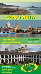
- Wegenkaart - landkaart Colombia | Mapas Naturismo
- Colombia at 1:1, 500,000 on an indexed double-sided map from Mapas NaTurismo with very clear presentation of the country’s topography, an overview map of Bogotá, plus a street plan of central Cartagena. The map divides the country between its more populated western part with the Andes and the lowlands east of the Andes, with Bogotá and Medellin... Read more