The Book Depository
United Kingdom
» Click to open
Stanfords
United Kingdom
  • Cerdanya - Alta Cerdanya - Capcir - Andorra Editorial Alpina
  • Cerdanya: Alta Cerdanya - Capcir - Andorra at 1;50,000 in an extensive and very popular series of walking maps from Editorial Alpina covering the Pyrenees, Catalonia and other selected hiking areas in Spain, including Picos de Europa, Sierra Nevada and parts of Andalucía, Majorca, etc. Scales vary from 1:50,000 to 1:10,000, with the majority of... Read more
» Click to close
The Book Depository
United Kingdom
» Click to open
Stanfords
United Kingdom
  • Valles de Ansó & Echo Editorial Alpina
  • Valles de Ansó & Echo in an extensive and very popular series of walking maps from Editorial Alpina covering the Pyrenees, Catalonia and other selected hiking areas in Spain, including Picos de Europa, Sierra Nevada and parts of Andalucía, Majorca, etc. Scales vary from 1:50,000 to 1:10,000, with the majority of the titles at 1:25,000. The maps... Read more
» Click to close
The Book Depository
United Kingdom
» Click to open
Stanfords
United Kingdom
  • Garraf - la Morella - Eramprunya Editorial Alpina
  • Massíf de Garraf in an extensive and very popular series of walking maps from Editorial Alpina covering the Pyrenees, Catalonia and other selected hiking areas in Spain, including Picos de Europa, Sierra Nevada and parts of Andalucía, Majorca, etc. Scales vary from 1:50,000 to 1:10,000, with the majority of the titles at 1:25,000. The maps have... Read more
» Click to close
The Book Depository
United Kingdom
» Click to open
Stanfords
United Kingdom
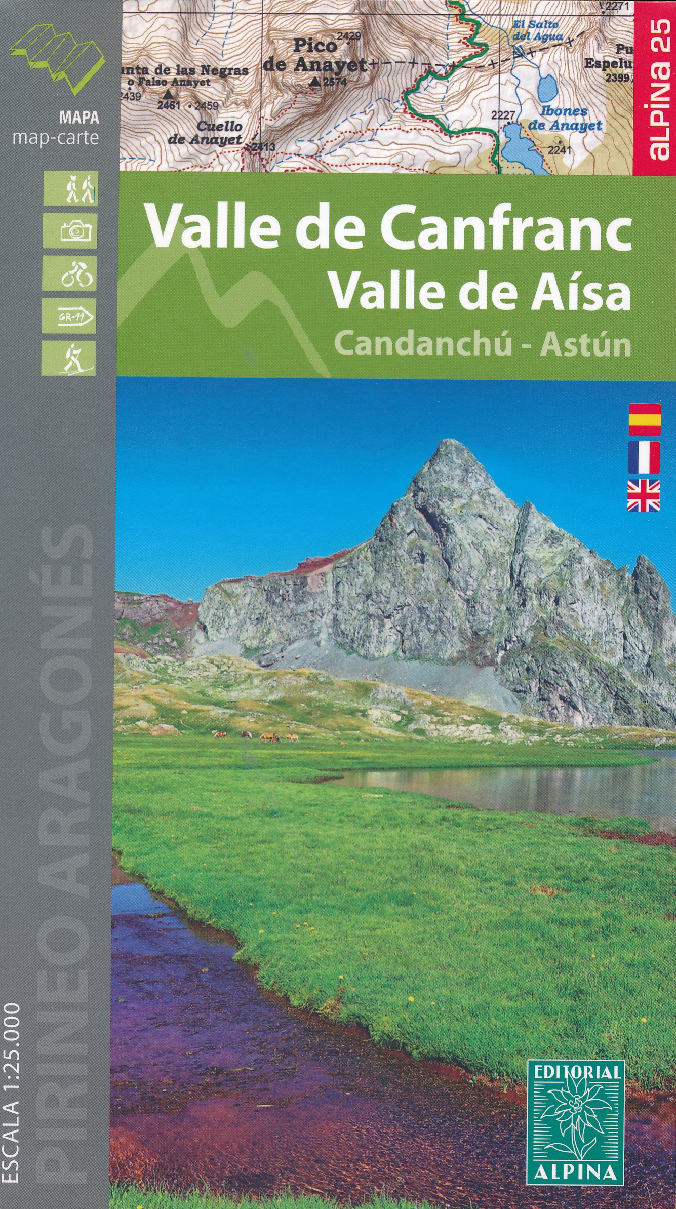
  • Valle de Canfranc - Valle de Aisa - Candanchu - Astun Editorial Alpina
  • Valle de Canfranc - Valle de Aisa in an extensive and very popular series of walking maps from Editorial Alpina covering the Pyrenees, Catalonia and other selected hiking areas in Spain, including Picos de Europa, Sierra Nevada and parts of Andalucía, Majorca, etc. Scales vary from 1:50,000 to 1:10,000, with the majority of the titles at... Read more
» Click to close
The Book Depository
United Kingdom
» Click to open
De Zwerver
Netherlands
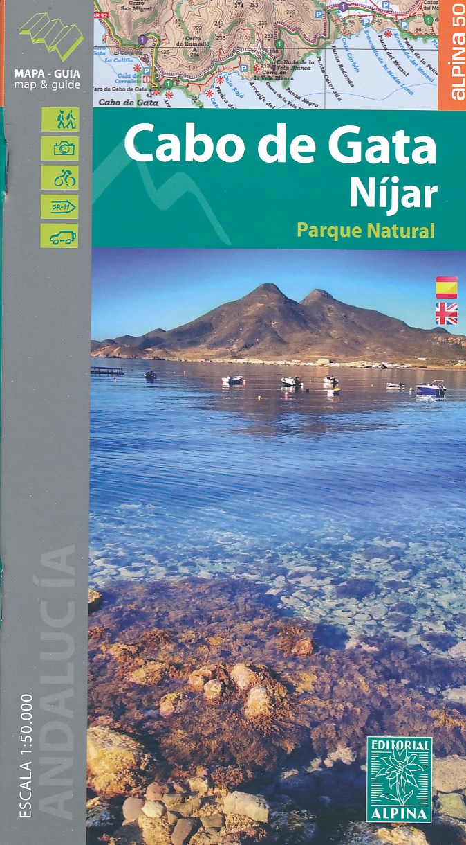
  • Wandelkaart Cabo de Gata - Nijar | Editorial Alpina
  • Gedetailleerde wandelkaart van een interessant wandelgebied. Uitstekend leesbaar, inhoudelijk een goede kaart met allerhande informatie op topografische basis waarbij wandelroutes, campings en hutten. Bij een aantal Alpina kaarten is een boekje bijgevoegd met routes. Door de toevoeging van gradengrid is deze kaart bruikbaar voor GPS. Cabo da... Read more
Stanfords
United Kingdom
  • Cabo de Gata-Níjar Natural Park Editorial Alpina
  • Cabo da Gata area on the south-eastern tip of Andalucía on a contoured and GPS compatible map at 1:50,000 from Editorial Alpina highlighting hiking and cycling trails, plus a booklet with English language descriptions of recommended routes, accommodation lists, etc.Topography is shown by contours at 20m intervals, with relief shading and... Read more
» Click to close
The Book Depository
United Kingdom
» Click to open
Stanfords
United Kingdom
  • Rasos de Peguera - Serra d`Ensija Editorial Alpina
  • Rasos de Peguera - Serra d`Ensija in an extensive and very popular series of walking maps from Editorial Alpina covering the Pyrenees, Catalonia and other selected hiking areas in Spain, including Picos de Europa, Sierra Nevada and parts of Andalucía, Majorca, etc. Scales vary from 1:50,000 to 1:10,000, with the majority of the titles at... Read more
» Click to close
The Book Depository
United Kingdom
» Click to open
Stanfords
United Kingdom
  • Delta of the Ebro – Serra de Montsià Editorial Alpina
  • The Delta of the Ebro – Serra de Montsià in an extensive and very popular series of walking maps from Editorial Alpina covering the Pyrenees, Catalonia and other selected hiking areas in Spain, including Picos de Europa, Sierra Nevada and parts of Andalucía, Majorca, etc. Scales vary from 1:50,000 to 1:10,000, with the majority of the titles... Read more
» Click to close
The Book Depository
United Kingdom
» Click to open
Stanfords
United Kingdom
  • Cingles de Berti - Sant Miquel des Fai Editorial Alpina
  • Cingles de Berti area at 1:25,000 in an extensive and very popular series of walking maps from Editorial Alpina. Contours are at 10m intervals, enhanced by relief shading and vegetation colouring. The map has UTM grid and 1’ margin ticks. In addition to footpaths, the overprint shows various types of accommodation (hotels, campsites, etc.),... Read more
» Click to close
The Book Depository
United Kingdom
» Click to open
Stanfords
United Kingdom
  • Congost de Mont-rebei Editorial Alpina
  • Congost de Mont-rebei in an extensive and very popular series of walking maps from Editorial Alpina covering the Pyrenees, Catalonia and other selected hiking areas in Spain, including Picos de Europa, Sierra Nevada and parts of Andalucía, Majorca, etc. Scales vary from 1:50,000 to 1:10,000, with the majority of the titles at 1:25,000. The... Read more
» Click to close
The Book Depository
United Kingdom
» Click to open
Stanfords
United Kingdom
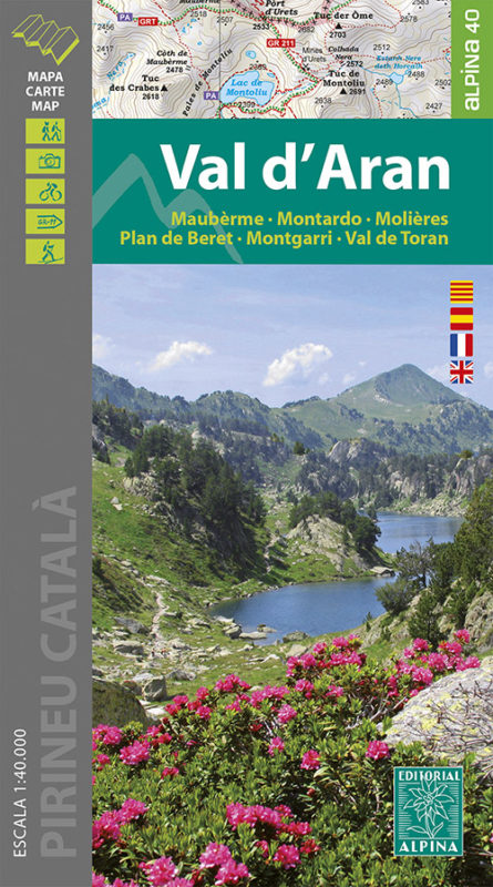
  • Val d`Aran - Mauberme - Montardo - Molieres Editorial Alpina
  • Val d`Aran in an extensive and very popular series of walking maps from Editorial Alpina covering the Pyrenees, Catalonia and other selected hiking areas in Spain, including Picos de Europa, Sierra Nevada and parts of Andalucía, Majorca, etc. Scales vary from 1:50,000 to 1:10,000, with the majority of the titles at 1:25,000. The maps have... Read more
» Click to close
Stanfords
United Kingdom
Stanfords
United Kingdom
» Click to open
Stanfords
United Kingdom
  • Mora
  • Topographic survey of Portugal at 1:50,000 from the Instituto Geográfico do Exército, the country’s military survey organisation. The maps have contours at 20m intervals and in addition to the standard features shown on topographic mapping at this scale also indicate various types of terrain or vegetation (sand, terraces, rocks, woodlands,... Read more
» Click to close
Stanfords
United Kingdom
De Zwerver
Netherlands
» Click to open
Stanfords
United Kingdom
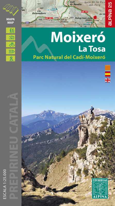
  • Moixeró - La Tosa - Cadí-Moixeró Natural Park Editorial Alpina
  • Moixeró - La Tosa in an extensive and very popular series of walking maps from Editorial Alpina covering the Pyrenees, Catalonia and other selected hiking areas in Spain, including Picos de Europa, Sierra Nevada and parts of Andalucía, Majorca, etc. Scales vary from 1:50,000 to 1:10,000, with the majority of the titles at 1:25,000. The maps... Read more
» Click to close
Stanfords
United Kingdom