Waldviertel North - Gmünd - Heidenreichstein - Waidhofen a.d.T. - Raabs a.d.T. – Trebon area of eastern Austria presented at 1:50,000 in a series of contoured and GPS compatible outdoor leisure map from Freytag & Berndt with hiking and cycling routes, mountain huts, campsites and youth hostels, local bus stops, plus other tourist information.To...Read more
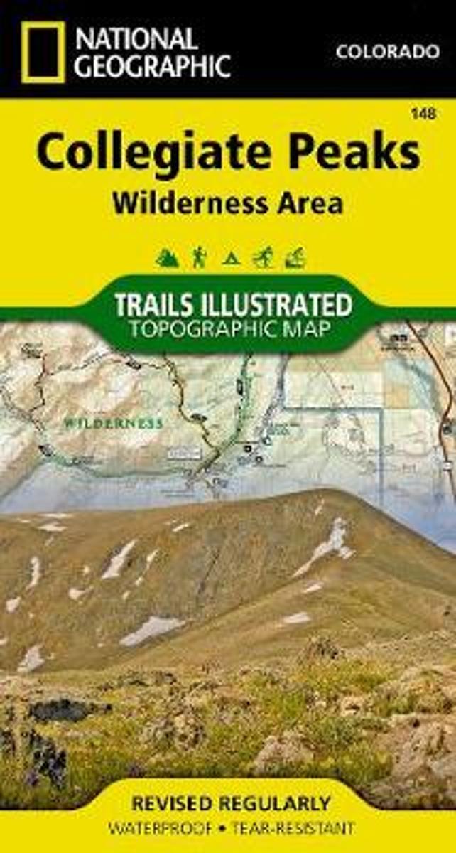
Map No. 148, Collegiate Peaks Wildernes, CO, in an extensive series of GPS compatible, contoured hiking maps of USA’s national and state parks or forests and other popular recreational areas. Cartography based on the national topographic survey, with additional tourist information.The maps, with most titles now printed on light, waterproof and...Read more
Waterproof Tear-Resistant Topographic MapNational Geographic's Trails Illustrated map of Collegiate Peaks Wilderness is a two-sided, waterproof map designed to meet the needs of outdoor enthusiasts with unmatched durability and detail. This map was created in conjunction with local land management agencies and is loaded with valuable...Read more
Waterproof Tear-Resistant Topographic MapNational Geographic's Trails Illustrated map of Collegiate Peaks Wilderness is a two-sided, waterproof map designed to meet the needs of outdoor enthusiasts with unmatched durability and detail. This map was created in conjunction with local land management agencies and is loaded with valuable...Read more
Book two in the Journey series, this volume is filled with stories and ultralight backpacking tips from Carol "Brawny" Wellman. Trail descriptions for the Pacific Crest Trail, Appalachian Trail, John Muir Trail, Continental Divide Trail, Colorado Trail, Vermont Trail, Bartram Trail, including trail guide, plus the Foothills Trail. Learn how to...Read more
Book two in the Journey series, this volume is filled with stories and ultralight backpacking tips from Carol "Brawny" Wellman. Trail descriptions for the Pacific Crest Trail, Appalachian Trail, John Muir Trail, Continental Divide Trail, Colorado Trail, Vermont Trail, Bartram Trail, including trail guide, plus the Foothills Trail. Learn how to...Read more
A hike for everyone! Enjoy parts or all of the 469-mile trail through 7 national forests, 6 wilderness areas, 5 major river systems, and 8 mountain ranges. It runs from outside of Denver to Durango in south-western Colorado.Read more
A hike for everyone! Enjoy parts or all of the 469-mile trail through 7 national forests, 6 wilderness areas, 5 major river systems, and 8 mountain ranges. It runs from outside of Denver to Durango in south-western Colorado.Read more
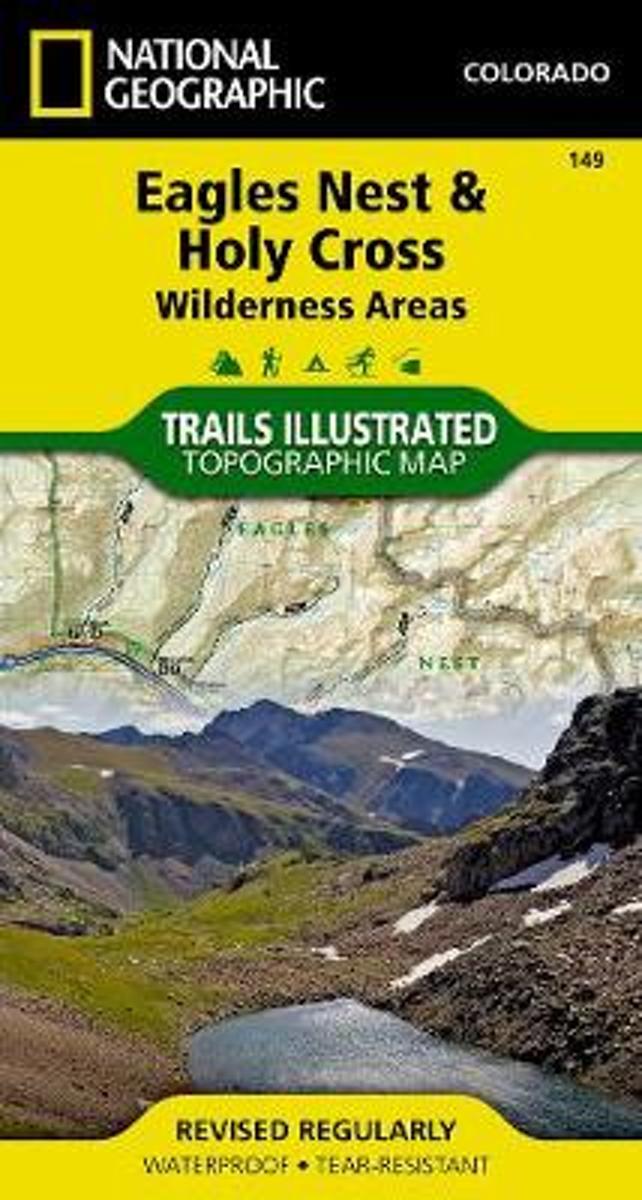
Map No. 149, Holy Cross - Eagles Nest Wilderness, CO, in an extensive series of GPS compatible, contoured hiking maps of USA’s national and state parks or forests and other popular recreational areas. Cartography based on the national topographic survey, with additional tourist information.The maps, with most titles now printed on light,...Read more
Waterproof Tear-Resistant Topographic MapNational Geographic's Trails Illustrated map of Holy Cross and Eagles Nest Wilderness is a two-sided, waterproof map designed to meet the needs of outdoor enthusiasts with unmatched durability and detail. This map was created in conjunction with local land management agencies and is loaded with...Read more
Waterproof Tear-Resistant Topographic MapNational Geographic's Trails Illustrated map of Holy Cross and Eagles Nest Wilderness is a two-sided, waterproof map designed to meet the needs of outdoor enthusiasts with unmatched durability and detail. This map was created in conjunction with local land management agencies and is loaded with...Read more
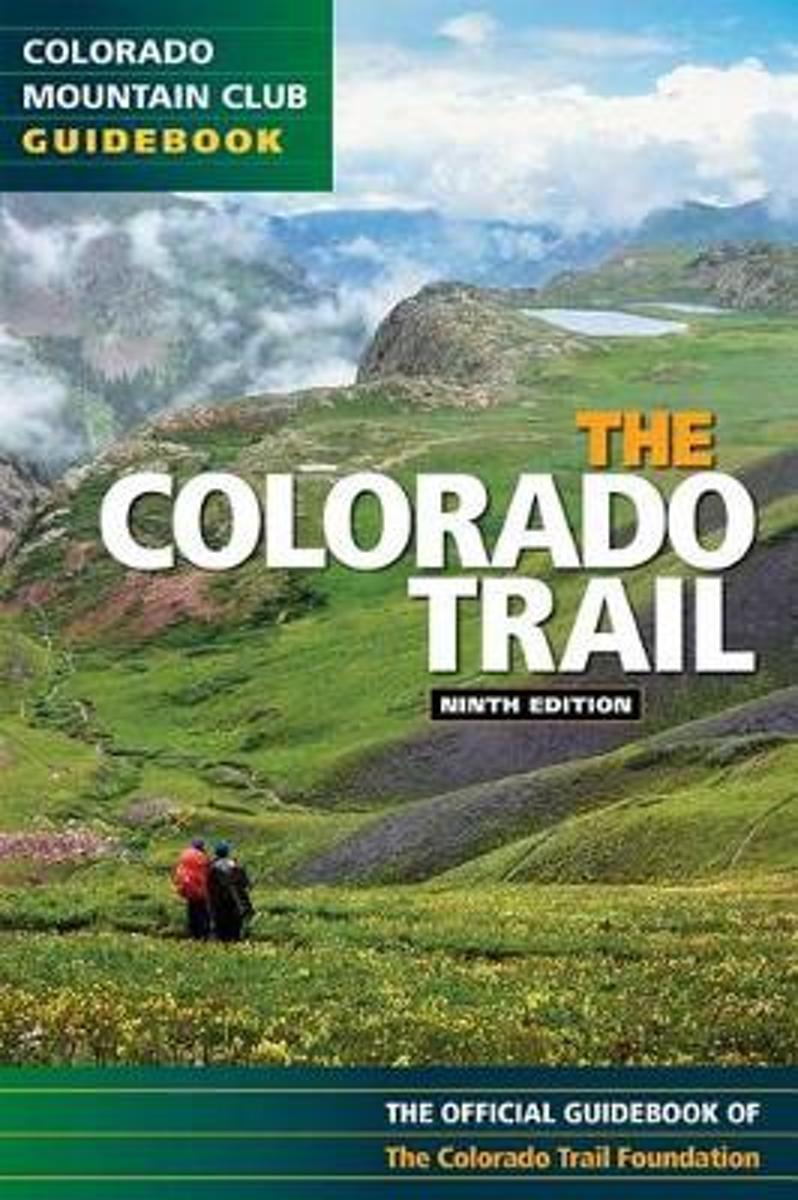
Exploring all 468 miles of the Colorado Trail, this official guidebook is updated with the latest information on dozens of side trips, nearby towns, natural history, and safety considerations. Includes handy trip logs and full-color maps with GPS coordinates for each of the 28 segments. 86 color photos.Read more
Exploring all 468 miles of the Colorado Trail, this official guidebook is updated with the latest information on dozens of side trips, nearby towns, natural history, and safety considerations. Includes handy trip logs and full-color maps with GPS coordinates for each of the 28 segments. 86 color photos.Read more
Head out for adventure on the unpaved back roads of America with Nick Legans complete guide to gravel grinders and bikepacking!Gravel cycling is a glorious return to the purest roots of two-wheeled adventure. From farm roads and miners paths to the high passes of the Rockies and the Alps, gravel cycling and bikepacking will set you free to...Read more
Head out for adventure on the unpaved back roads of America with Nick Legans complete guide to gravel grinders and bikepacking!Gravel cycling is a glorious return to the purest roots of two-wheeled adventure. From farm roads and miners paths to the high passes of the Rockies and the Alps, gravel cycling and bikepacking will set you free to...Read more