The Book Depository
United Kingdom
2019
» Click to open
De Zwerver
Netherlands
2019
  • Wandelgids 
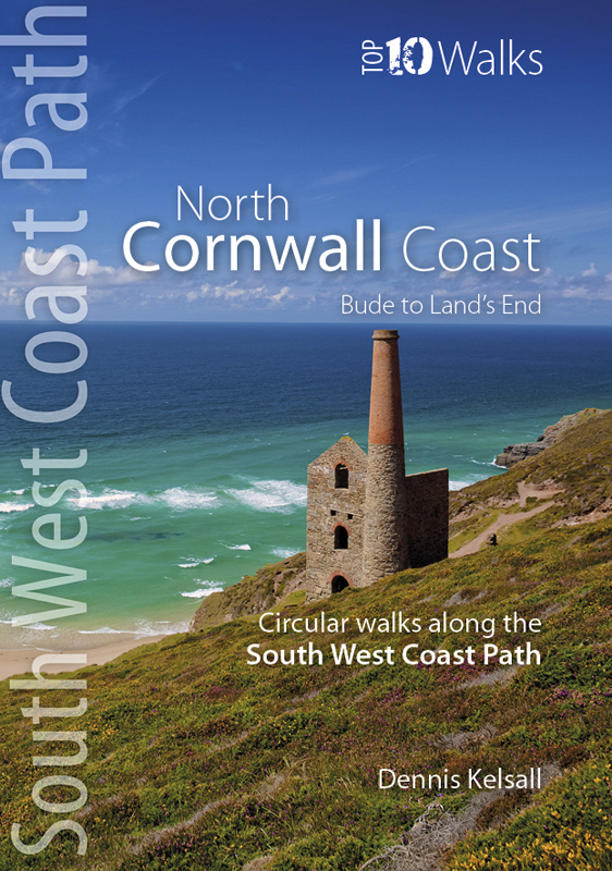
North Cornwall Coast | Northern Eye Books
  • These attractive and cleverly structured guides will give walkers ten of the best short circular walks along each of the five sections of the 630-mile long South West Coast Path in a popular pocket-size format.With clear information, an overview and introduction for each walk, expertly written numbered directions, large scale Ordnance Survey... Read more
Stanfords
United Kingdom
2019
» Click to close
The Book Depository
United Kingdom
2021
» Click to open
» Click to close
The Book Depository
United Kingdom
» Click to open
Stanfords
United Kingdom
  • Bude, Clovelly, Boscastle & Holsworthy OS Landranger Map 190 (paper)
  • Bude and Clovelly area, including a section of the South West Coast Path, on a paper version of map No. 190 from the Ordnance Survey’s Landranger series at 1:50,000, with contoured and GPS compatible topographic mapping plus tourist information.MOBILE DOWNLOADS: As well as the physical edition of the map, each Landranger title now includes a... Read more
» Click to close
The Book Depository
United Kingdom
» Click to open
Stanfords
United Kingdom
» Click to close
The Book Depository
United Kingdom
The Book Depository
United Kingdom
2013
» Click to open
De Zwerver
Netherlands
2013
» Click to close
The Book Depository
United Kingdom
The Book Depository
United Kingdom
2019
» Click to open
De Zwerver
Netherlands
2019
  • Wandelgids South West Coast Path: Somerset & North Devon | Northern Eye Books
  • These attractive and cleverly structured guides will give walkers ten of the best short circular walks along each of the five sections of the 630-mile long South West Coast Path in a popular pocket-size format.With clear information, an overview and introduction for each walk, expertly written numbered directions, large scale Ordnance Survey... Read more
Stanfords
United Kingdom
2019
» Click to close
The Book Depository
United Kingdom
2015
» Click to open
Stanfords
United Kingdom
2015
  • South Devon - Brixham to Newton Ferrers OS Explorer Map OL20 (paper)
  • The coast of South Devon on a detailed topographic and GPS compatible map OL20, paper version, from the Ordnance Survey’s 1:25,000 Explorer series. The map extends westwards beyond Newton Ferrers to Plymouth, eastwards beyond Brixham to Torquay, and inland to include part of the Dartmoor National Park. Coverage includes Paignton, Totness,... Read more
» Click to close
The Book Depository
United Kingdom
2021
» Click to open
De Zwerver
Netherlands
2021
» Click to close
The Book Depository
United Kingdom
» Click to open
Stanfords
United Kingdom
  • Taunton, Lyme Regis, Chard & Bridport OS Landranger Map 193 (paper)
  • Taunton and Lyme Regis area, including a section of the South West Coast Path / E9 European Long-distance Path, on a paper version of map No. 193 from the Ordnance Survey’s Landranger series at 1:50,000, with contoured and GPS compatible topographic mapping plus tourist information.MOBILE DOWNLOADS: As well as the physical edition of the map,... Read more
» Click to close
The Book Depository
United Kingdom
» Click to open
Stanfords
United Kingdom
» Click to close
The Book Depository
United Kingdom
The Book Depository
United Kingdom
2019
» Click to open
De Zwerver
Netherlands
2019
Stanfords
United Kingdom
2019
» Click to close
The Book Depository
United Kingdom
» Click to open
Stanfords
United Kingdom
  • North Devon Coastal Walks
  • Explore the North Devon coast with this laminated, waterproof, tear-resistant Devon walking map. With 10 circular, clearly-marked routes this easy-to-use map will help you discover this beautiful coast line via some of the finest pubs and tearooms. North Devon is arguably one of the most beautiful corners of England and is superb walking... Read more
» Click to close