The Book Depository
United Kingdom
2015
» Click to open
Stanfords
United Kingdom
2015
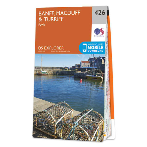
  • Banff, Macduff & Turriff - Fyvie OS Explorer Map 426 (paper)
  • Banff, Macduff, Turriff and Fyvie area on a detailed topographic and GPS compatible map No. 426, paper version, from the Ordnance Survey’s 1:25,000 Explorer series. MOBILE DOWNLOADS: this title and all the other OS Explorer maps include a code for downloading after purchase the digital version onto your smartphone or tablet for viewing on the... Read more
» Click to close
The Book Depository
United Kingdom
2022
» Click to open
De Zwerver
Netherlands
2022
» Click to close
The Book Depository
United Kingdom
» Click to open
Stanfords
United Kingdom
  • Banff, Macduff & Turriff - Fyvie OS Explorer Active Map 426 (waterproof)
  • Banff, Macduff, Turriff and Fyvie area on a detailed topographic and GPS compatible map No. 426, waterproof version, from the Ordnance Survey’s 1:25,000 Explorer series. MOBILE DOWNLOADS: this title and all the other OS Explorer maps include a code for downloading after purchase the digital version onto your smartphone or tablet for viewing on... Read more
» Click to close
The Book Depository
United Kingdom
» Click to open
Stanfords
United Kingdom
  • Banff, Huntly, Portsoy & Turriff OS Landranger Active Map 29 (waterproof)
  • Waterproof and tear-resistant OS Active version of map No. 29 from the Ordnance Survey’s Landranger series at 1:50,000, with contoured and GPS compatible topographic mapping plus tourist information.MOBILE DOWNLOADS: As well as the physical edition of the map, each Landranger title now includes a code for downloading after purchase its digital... Read more
» Click to close
The Book Depository
United Kingdom
2021
The Book Depository
United Kingdom
De Zwerver
Netherlands
2024
De Zwerver
Netherlands
2024
De Zwerver
Netherlands
De Zwerver
Netherlands
2019
De Zwerver
Netherlands
2022
De Zwerver
Netherlands
» Click to open
Stanfords
United Kingdom
  • Banff, Huntly, Portsoy & Turriff OS Landranger Map 29 (paper)
  • Paper version of map No. 29 from the Ordnance Survey’s Landranger series at 1:50,000, with contoured and GPS compatible topographic mapping plus tourist information.MOBILE DOWNLOADS: As well as the physical edition of the map, each Landranger title now includes a code for downloading after purchase its digital version onto your smartphone or... Read more
» Click to close
Stanfords
United Kingdom
Stanfords
United Kingdom
Stanfords
United Kingdom
2008