
Kings Canyon National Park
Beschreibung
Wanderwege Region
Links
Fakten
Berichte
Führer und Karten
Übernachtung
Organisationen
Reisebüros
GPS
Sonstiges
Bücher
De Zwerver
Netherlands
2024
Netherlands
2024
Bol.com
Netherlands
Netherlands
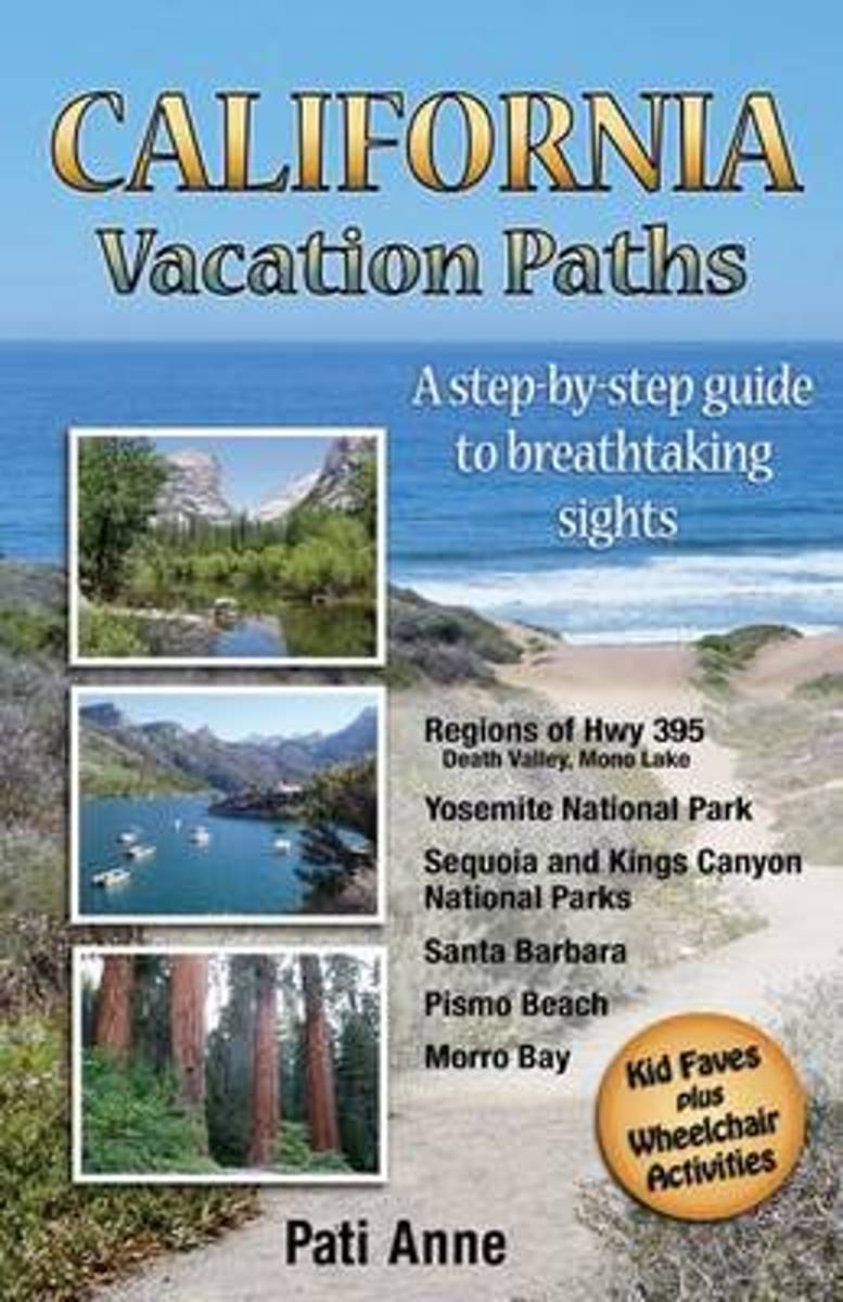
- California Vacation Paths
- Take the path less traveled Everyone is invited to walk a different road with this unique California travel guide. One main path leads visitors through six areas of California which hold some of the world's most breathtaking sights. No planning is needed; just follow this travel guide to activities that are laid out in successive order. Take... Read more
- Also available from:
- Bol.com, Belgium
Bol.com
Belgium
Belgium
- California Vacation Paths
- Take the path less traveled Everyone is invited to walk a different road with this unique California travel guide. One main path leads visitors through six areas of California which hold some of the world's most breathtaking sights. No planning is needed; just follow this travel guide to activities that are laid out in successive order. Take... Read more
Bol.com
Netherlands
Netherlands
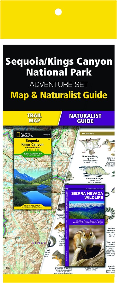
- Sequoia/Kings Canyon National Park Adventure Set
- The Sequoia & Kings Canyon Adventure Set consists of a Pocket Naturalist Guide and National Geographic map. These lightweight references are ideal to take hiking or driving while exploring this spectacular region. Waterford's folding pocket-sized, Sierra Nevada Wildlife guide is a beautifully illustrated reference to over 140 familiar and... Read more
- Also available from:
- Bol.com, Belgium
Bol.com
Belgium
Belgium
- Sequoia/Kings Canyon National Park Adventure Set
- The Sequoia & Kings Canyon Adventure Set consists of a Pocket Naturalist Guide and National Geographic map. These lightweight references are ideal to take hiking or driving while exploring this spectacular region. Waterford's folding pocket-sized, Sierra Nevada Wildlife guide is a beautifully illustrated reference to over 140 familiar and... Read more

- Also available from:
- Bol.com, Netherlands
- Bol.com, Belgium
Bol.com
Netherlands
Netherlands
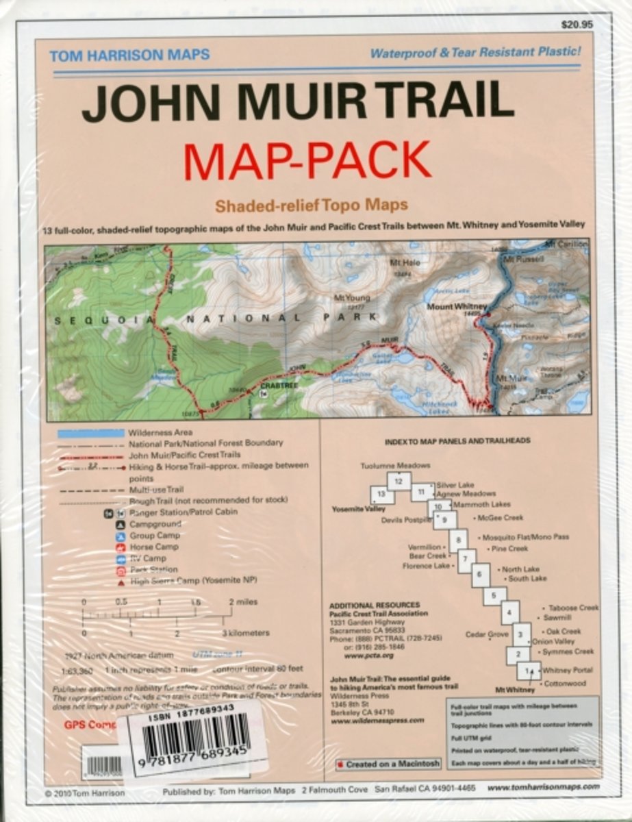
- Map-pack of the John Muir Trail
- Shaded Relief Topo Maps packet of the famous Sierra High Route that will take hikers from Mount Whitney to Yosemite, CA. Well marked trails over USGS topo maps that were beautifully enhanced with shaded relief to better distinguish details. Scale 1:630360. 1 inch on map equals 1 mile. Whitney Portal, Symmes Creek, Onion Valley, Oak Creek,... Read more
Bol.com
Belgium
Belgium
- Map-pack of the John Muir Trail
- Shaded Relief Topo Maps packet of the famous Sierra High Route that will take hikers from Mount Whitney to Yosemite, CA. Well marked trails over USGS topo maps that were beautifully enhanced with shaded relief to better distinguish details. Scale 1:630360. 1 inch on map equals 1 mile. Whitney Portal, Symmes Creek, Onion Valley, Oak Creek,... Read more
Bol.com
Netherlands
Netherlands
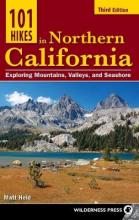
- 101 Hikes in Northern California
- 101 Hikes in Northern California by Matt Heid benefits readers by narrowing down the multitude of options for hiking in Northern California to the very best of the best adventures. It is distinct from other similar guidebooks in that it covers the northern two-thirds of the state, including nearly the entirety of the Sierra Nevadas south to... Read more
- Also available from:
- Bol.com, Belgium
Bol.com
Belgium
Belgium
- 101 Hikes in Northern California
- 101 Hikes in Northern California by Matt Heid benefits readers by narrowing down the multitude of options for hiking in Northern California to the very best of the best adventures. It is distinct from other similar guidebooks in that it covers the northern two-thirds of the state, including nearly the entirety of the Sierra Nevadas south to... Read more

- Also available from:
- Bol.com, Netherlands
- Bol.com, Belgium
Bol.com
Netherlands
Netherlands
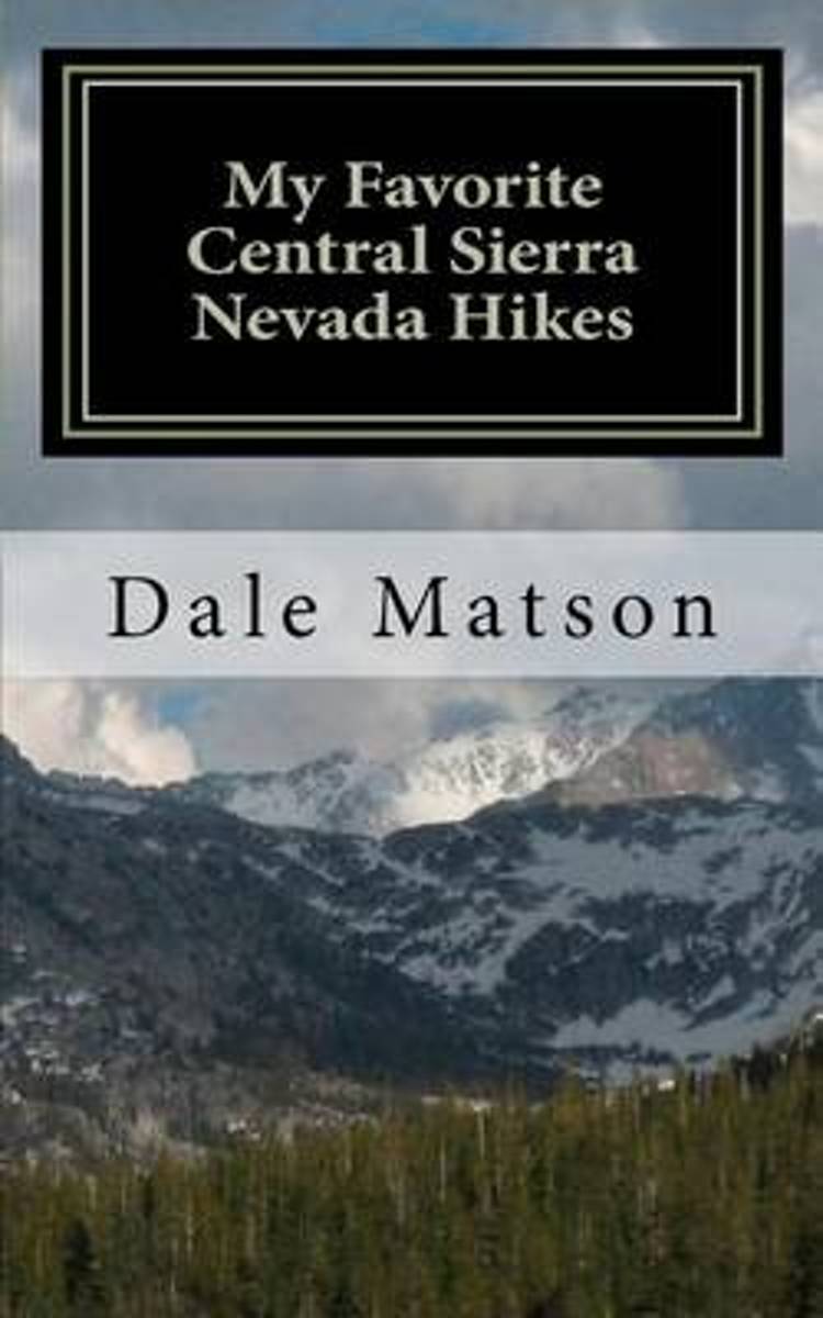
- My Favorite Central Sierra Nevada Hikes
- This book describes my favorite hikes over the last 20 years in the Central Sierra Nevada Mountains. These hikes include Vernal and Nevada Falls, Half Dome, Cloud's Rest, Vogelsang High Sierra Camp, Ostrander Lake, Pohono Trail and Chilnualna Falls in Yosemite National Park. They also include hikes in the Sierra National Forest including... Read more
Bol.com
Belgium
Belgium
- My Favorite Central Sierra Nevada Hikes
- This book describes my favorite hikes over the last 20 years in the Central Sierra Nevada Mountains. These hikes include Vernal and Nevada Falls, Half Dome, Cloud's Rest, Vogelsang High Sierra Camp, Ostrander Lake, Pohono Trail and Chilnualna Falls in Yosemite National Park. They also include hikes in the Sierra National Forest including... Read more

The Book Depository
United Kingdom
United Kingdom
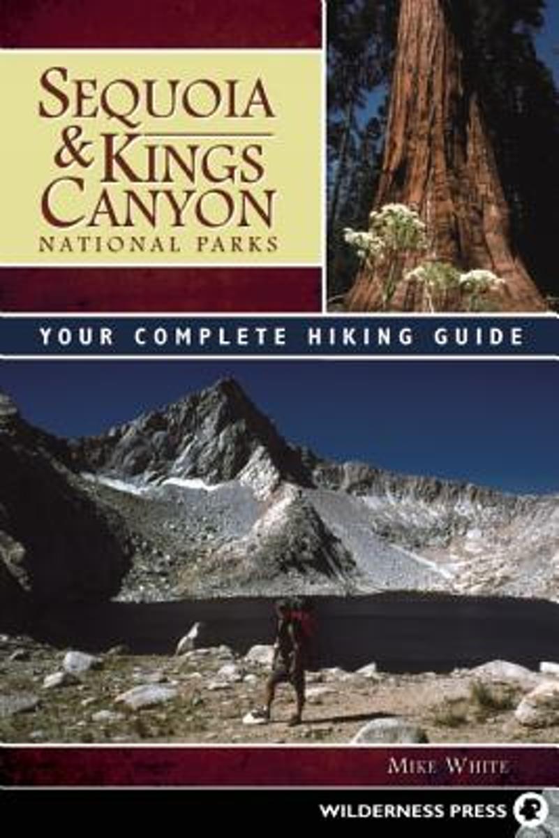
- Sequoia and Kings Canyon National Parks
- Your Complete Hiking Guide Read more
- Also available from:
- Bol.com, Netherlands
- Bol.com, Belgium
Bol.com
Netherlands
Netherlands
- Sequoia and Kings Canyon National Parks
- The southern High Sierra, including Sequoia and Kings Canyon National Parks and the surrounding John Muir, Jennie Lakes, and Monarch Wildernesses, is one of the most magnificent natural areas in the world. Blessed with the largest trees on earth (giant sequoias), one of the deepest canyons in North America (Kings Canyon), and the highest... Read more
Bol.com
Belgium
Belgium
- Sequoia and Kings Canyon National Parks
- The southern High Sierra, including Sequoia and Kings Canyon National Parks and the surrounding John Muir, Jennie Lakes, and Monarch Wildernesses, is one of the most magnificent natural areas in the world. Blessed with the largest trees on earth (giant sequoias), one of the deepest canyons in North America (Kings Canyon), and the highest... Read more

Bol.com
Netherlands
Netherlands
- Sierra High Route
- * Author conceived and pioneered the Sierra High Route * Covers Kings Canyon National Park to northern Yosemite National Park * Each route chapter includes points of interest, maps, approach instructions, and directions No ordinary guidebook, Sierra High Route leads you from point to point through a spectacular 195-mile timberline route in... Read more
- Also available from:
- Bol.com, Belgium
Bol.com
Belgium
Belgium
- Sierra High Route
- * Author conceived and pioneered the Sierra High Route * Covers Kings Canyon National Park to northern Yosemite National Park * Each route chapter includes points of interest, maps, approach instructions, and directions No ordinary guidebook, Sierra High Route leads you from point to point through a spectacular 195-mile timberline route in... Read more
Bol.com
Netherlands
2016
Netherlands
2016
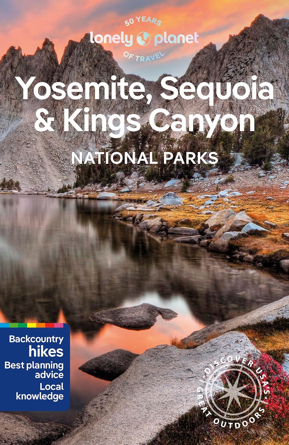
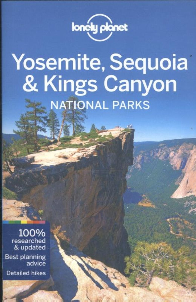
- Lonely Planet Yosemite, Sequoia & Kings Canyon National Parks
- # 1 best-selling guide to Yosemite, Sequoia & Kings Canyon National Parks* Lonely Planet Yosemite, Sequoia & Kings Canyon National Parks is your passport to the most relevant, up-to-date advice on what to see and skip, and what hidden discoveries await you. Go fishing in Yosemite Valley; canoeing and kayaking in Mammoth Lakes, or horseback... Read more
- Also available from:
- Bol.com, Belgium
Bol.com
Belgium
2016
Belgium
2016
- Lonely Planet Yosemite, Sequoia & Kings Canyon National Parks
- # 1 best-selling guide to Yosemite, Sequoia & Kings Canyon National Parks* Lonely Planet Yosemite, Sequoia & Kings Canyon National Parks is your passport to the most relevant, up-to-date advice on what to see and skip, and what hidden discoveries await you. Go fishing in Yosemite Valley; canoeing and kayaking in Mammoth Lakes, or horseback... Read more
Karten

The Book Depository
United Kingdom
United Kingdom
- Sequoia/kings Canyon National Park
- Trails Illustrated National Parks Read more
- Also available from:
- De Zwerver, Netherlands
- Stanfords, United Kingdom
- Bol.com, Netherlands
- Bol.com, Belgium

De Zwerver
Netherlands
Netherlands
- Wandelkaart - Topografische kaart 205 Sequoia - Kings Canyon National Parks | National Geographic
- Prachtige geplastificeerde kaart van het nationaal park. Met alle recreatieve voorzieningen als campsites, maar ook met topografische details en wandelroutes ed. Door uitgekiend kleurgebruik zeer prettig in gebruik. Scheur en watervast! Trails Illustrated maps are the most trusted and popular recreation maps available. Continually setting the... Read more

Stanfords
United Kingdom
United Kingdom
- Sequoia - Kings Canyon National Parks CA NGS Trails Illustrated Map 205
- Map No. 205, Sequoia/Kings Canyon National Park, CA, in an extensive series of GPS compatible, contoured hiking maps of USA’s national and state parks or forests and other popular recreational areas. Cartography based on the national topographic survey, with additional tourist information.The maps, with most titles now printed on light,... Read more

Bol.com
Netherlands
Netherlands
- Sequoia/kings Canyon National Park
- Waterproof Tear-Resistant Topographic MapIn Sequioa and Kings Canyon National Parks you can walk among the world's largest trees, hike the alpine landscape of the Sierra Crest, and marvel at the towering granite cliffs of one of the deepest canyons in the United States. National Geographic's Trails Illustrated map of Sequoia and Kings... Read more
Bol.com
Belgium
Belgium
- Sequoia/kings Canyon National Park
- Waterproof Tear-Resistant Topographic MapIn Sequioa and Kings Canyon National Parks you can walk among the world's largest trees, hike the alpine landscape of the Sierra Crest, and marvel at the towering granite cliffs of one of the deepest canyons in the United States. National Geographic's Trails Illustrated map of Sequoia and Kings... Read more

De Zwerver
Netherlands
Netherlands
- Wandelkaart - Topografische kaart 809 Mammoth Lakes - Mono Divide - Inyo and Sierra National Forests | National Geographic
- Prachtige geplastificeerde kaart van het bekende nationaal park. Met alle recreatieve voorzieningen als campsites, maar ook met topografische details en wandelroutes ed. Door uitgekiend kleurgebruik zeer prettig in gebruik. Scheur en watervast! Trails Illustrated Mammoth Lakes / Mono Divide is the first of five exciting new maps for the... Read more
- Also available from:
- Stanfords, United Kingdom
- Bol.com, Netherlands
- Bol.com, Belgium

Stanfords
United Kingdom
United Kingdom
- Mammoth Lakes - Mono Divide CA
- Map No. 809, Mammoth Lakes / Mono Divide, CA, in an extensive series of GPS compatible, contoured hiking maps of USA’s national and state parks or forests and other popular recreational areas. Cartography based on the national topographic survey, with additional tourist information.The maps, with most titles now printed on light, waterproof and... Read more

Bol.com
Netherlands
Netherlands
- Mammoth Lakes/mono Divide
- Waterproof Tear-Resistant Topographic MapTrails Illustrated Mammoth Lakes / Mono Divide is the first of five exciting new maps for the California Sierra Nevadas that will combine to form seamless coverage of the high-use National Forest areas between Sequoia / Kings Canyon National Parks and Lake Tahoe. This region contains some of the... Read more
Bol.com
Belgium
Belgium
- Mammoth Lakes/mono Divide
- Waterproof Tear-Resistant Topographic MapTrails Illustrated Mammoth Lakes / Mono Divide is the first of five exciting new maps for the California Sierra Nevadas that will combine to form seamless coverage of the high-use National Forest areas between Sequoia / Kings Canyon National Parks and Lake Tahoe. This region contains some of the... Read more