Midlands
Beschreibung
Central England, between Liverpool, Birmingham, and eastward to the Northsea. Generally flat area, but lots to see.
Wanderwege Region
Links
Fakten
Berichte
Führer und Karten
Übernachtung
Organisationen
Reisebüros
GPS
Sonstiges
Bücher

- Also available from:
- De Zwerver, Netherlands
- Stanfords, United Kingdom
De Zwerver
Netherlands
Netherlands

Stanfords
United Kingdom
United Kingdom
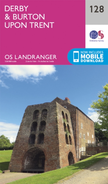
- Derby & Burton upon Trent OS Landranger Map 128 (paper)
- Paper version of map No. 128 from the Ordnance Survey’s Landranger series at 1:50,000, with contoured and GPS compatible topographic mapping plus tourist information.MOBILE DOWNLOADS: As well as the physical edition of the map, each Landranger title now includes a code for downloading after purchase its digital version onto your smartphone or... Read more

The Book Depository
United Kingdom
2015
United Kingdom
2015
- Also available from:
- De Zwerver, Netherlands
- Stanfords, United Kingdom
De Zwerver
Netherlands
2015
Netherlands
2015

Stanfords
United Kingdom
2015
United Kingdom
2015
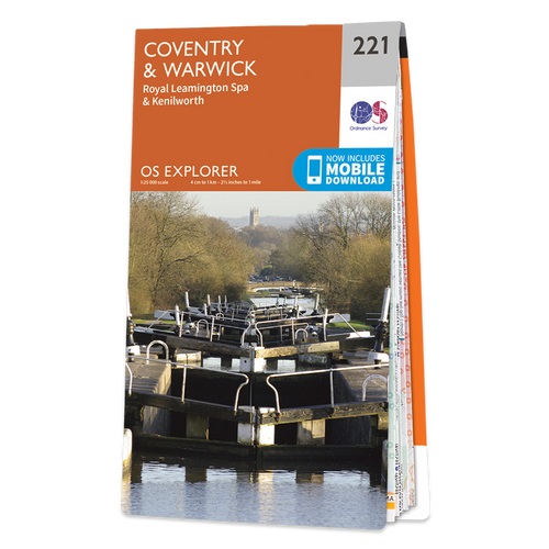
- Coventry & Warwick - Royal Leamington Spa & Kenilworth OS Explorer Map 221 (paper)
- Coventry, Warwick, Royal Leamington Spa and Kenilworth area on a detailed topographic and GPS compatible map No. 221, paper version, from the Ordnance Survey’s 1:25,000 Explorer series.MOBILE DOWNLOADS: this title and all the other OS Explorer maps include a code for downloading after purchase the digital version onto your smartphone or tablet... Read more

The Book Depository
United Kingdom
2019
United Kingdom
2019
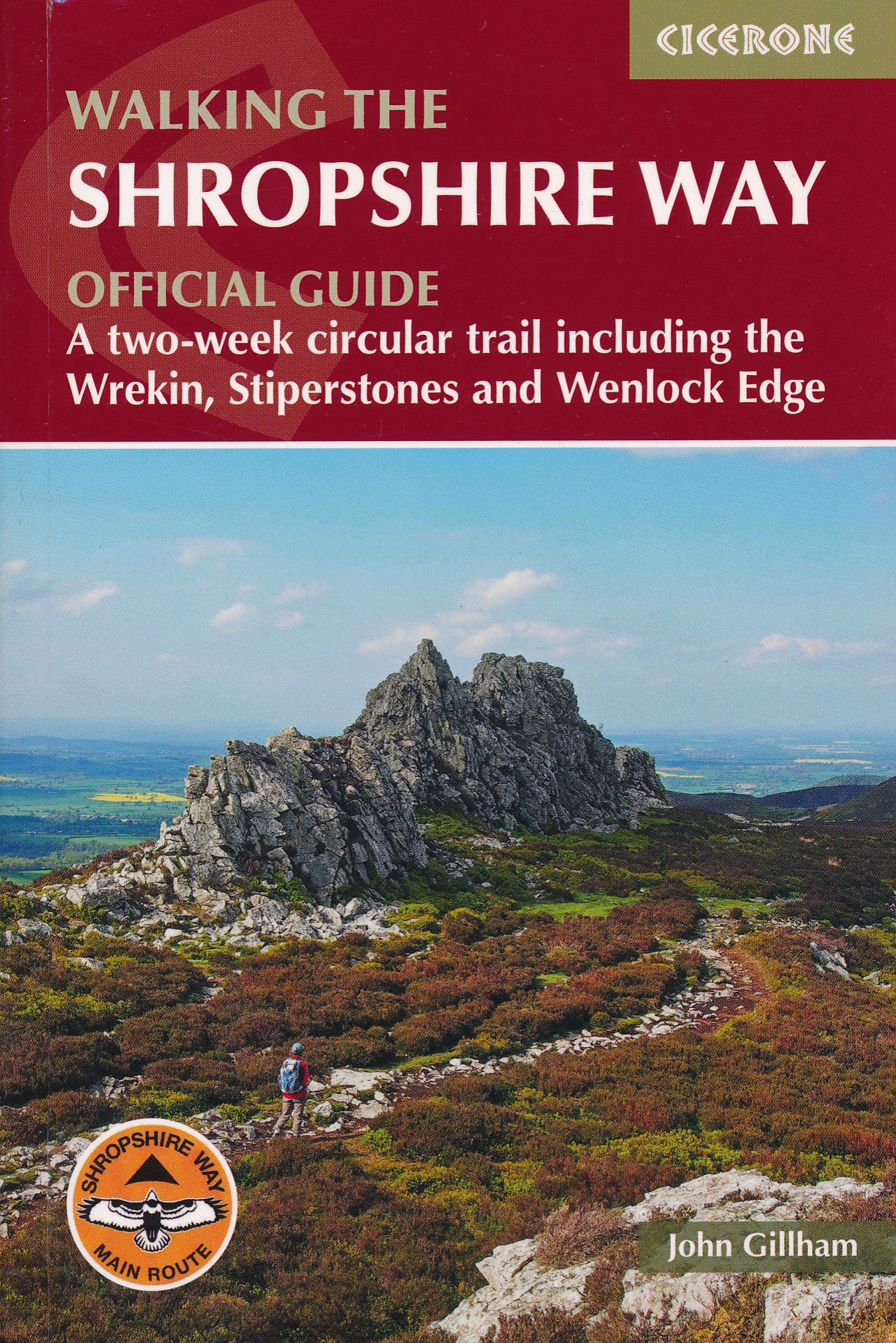
- Walking the Shropshire Way
- A two-week circular trail including the Wrekin, Stiperstones and Wenlock Edge Read more
- Also available from:
- De Zwerver, Netherlands
- Stanfords, United Kingdom
De Zwerver
Netherlands
2019
Netherlands
2019
- Wandelgids Walking the Shropshire Way | Cicerone
- Guidebook describing a 2 week trail around Shropshire. The 180 mile (290km) route is made up of two loops centred on Shrewsbury and visits Stiperstones, Wenlock Edge, Ironbridge and the Wrekin. Also describes the challenging 19½ mile (31.4km) Stretton Skyline Walk. Read more

Stanfords
United Kingdom
2019
United Kingdom
2019
- Walking the Shropshire Way: A two-week circular trail including the Wrekin, Stiperstones and Wenlock Edge
- This guidebook describes a two-week circular trail around Shropshire in West Midlands of England. The 180 mile (290km) route is made up of two loops centred on Shrewsbury, visiting much of the country`s best countryside. The southern loop takes in Stiperstones, Wenlock Edge and the Wrekin, while the northern loop visits Llanymynech, Ellesmere,... Read more

- Also available from:
- De Zwerver, Netherlands
- Stanfords, United Kingdom
De Zwerver
Netherlands
2015
Netherlands
2015

Stanfords
United Kingdom
2015
United Kingdom
2015
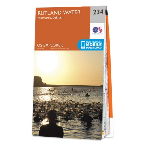
- Rutland Water - Stamford & Oakham OS Explorer Map 234 (paper)
- Rutland Water, Stamford and Oakham area on a detailed topographic and GPS compatible map No. 234, paper version, from the Ordnance Survey’s 1:25,000 Explorer series. MOBILE DOWNLOADS: this title and all the other OS Explorer maps include a code for downloading after purchase the digital version onto your smartphone or tablet for viewing on the... Read more

- Also available from:
- De Zwerver, Netherlands

De Zwerver
Netherlands
Netherlands

- Also available from:
- De Zwerver, Netherlands

- Also available from:
- De Zwerver, Netherlands
- Stanfords, United Kingdom
De Zwerver
Netherlands
Netherlands

Stanfords
United Kingdom
United Kingdom
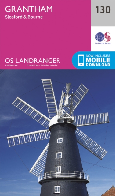
- Grantham, Sleaford & Bourne OS Landranger Map 130 (paper)
- Paper version of map No. 130 from the Ordnance Survey’s Landranger series at 1:50,000, with contoured and GPS compatible topographic mapping plus tourist information.MOBILE DOWNLOADS: As well as the physical edition of the map, each Landranger title now includes a code for downloading after purchase its digital version onto your smartphone or... Read more

- Also available from:
- De Zwerver, Netherlands
- Stanfords, United Kingdom
De Zwerver
Netherlands
2017
Netherlands
2017

Stanfords
United Kingdom
2017
United Kingdom
2017
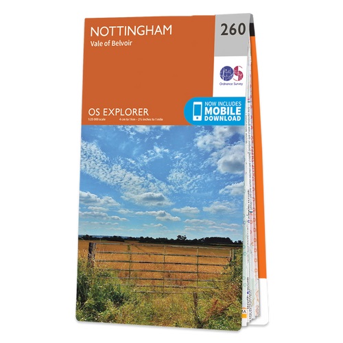
- Nottingham - Vale of Belvoir OS Explorer Map 260 (paper)
- Nottingham and the Vale of Belvoir area on a detailed topographic and GPS compatible map No. 260, paper version, from the Ordnance Survey’s 1:25,000 Explorer series.MOBILE DOWNLOADS: this title and all the other OS Explorer maps include a code for downloading after purchase the digital version onto your smartphone or tablet for viewing on the... Read more

- Also available from:
- De Zwerver, Netherlands
- Stanfords, United Kingdom

De Zwerver
Netherlands
Netherlands

Stanfords
United Kingdom
United Kingdom
- Ely, Wisbech & Downham Market OS Landranger Map 143 (paper)
- Cambridgeshire around Ely, Wisbech and Downham Market, including part of the E2 European Long-distance Path, on a paper version of map No. 143 from the Ordnance Survey’s Landranger series at 1:50,000, with contoured and GPS compatible topographic mapping plus tourist information.MOBILE DOWNLOADS: As well as the physical edition of the map, each... Read more

The Book Depository
United Kingdom
2015
United Kingdom
2015
- Also available from:
- De Zwerver, Netherlands
- Stanfords, United Kingdom
De Zwerver
Netherlands
2015
Netherlands
2015

Stanfords
United Kingdom
2015
United Kingdom
2015
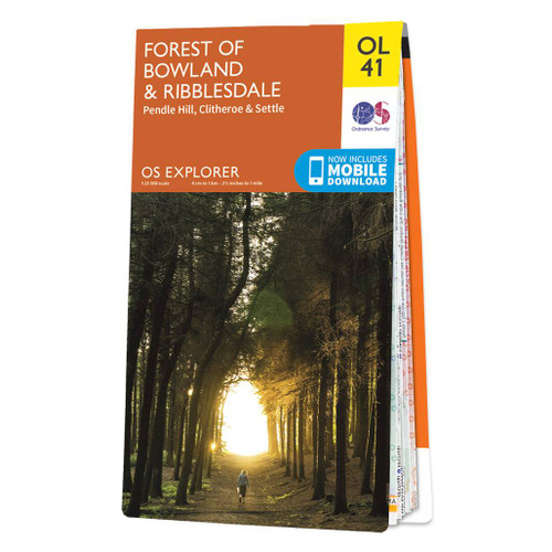
- Forest of Bowland & Ribblesdale - Pendle Hill, Clitheroe & Settle OS Explorer Map OL41 (paper)
- The Forest of Bowland and Ribblesdale on a detailed topographic and GPS compatible map OL41, paper version, from the Ordnance Survey’s 1:25,000 Explorer series. Coverage extends from Lancaster in the west to Settle and Barnoldswick, and includes Barrowford, Clitheroe, Catterall, Hornby, Stocks Reservoir, sections of the Pennine Bridleway... Read more

- Also available from:
- Stanfords, United Kingdom

Stanfords
United Kingdom
United Kingdom
- Worcester, The Malverns, Evesham & Tewkesbury OS Landranger Active Map 150 (waterproof)
- The area around Worcester, Great Malvern, Evesham and Tewkesbury, including the Malvern Hills and part of the Cotswold Way / E2 European Long-distance Path, on a waterproof and tear-resistant OS Active version of map No. 150 from the Ordnance Survey’s Landranger series at 1:50,000, with contoured and GPS compatible topographic mapping plus... Read more

- Also available from:
- Stanfords, United Kingdom

Stanfords
United Kingdom
United Kingdom
- North Pennines: Teesdale & Weardale OS Explorer Active Map OL31 (waterproof)
- The northern part of the Pennines including Teesdale and Weardale on a detailed topographic and GPS compatible map OL31, waterproof version, from the Ordnance Survey’s 1:25,000 Explorer series. Coverage include Barnard Castle, Middleton-in-Teesdale, Stanhope, Blagill, Gilderdale Forest, Milburn Forest, Hamsterley Forest, Middleton Common, the... Read more

- Also available from:
- Stanfords, United Kingdom

Stanfords
United Kingdom
2016
United Kingdom
2016
- Hillwalking in Shropshire: 32 Hill and Country Walks
- Guidebook to 32 walks in the hills of Shropshire. The walks, which are graded easy, moderate or hard, range from 3 miles (5km) to 12 miles (19km) and can be walked in all seasons. The selected routes take in highlights such as The Wrekin, Wenlock Edge, Long Mynd and Stiperstones, Castle Ring and Bury Ditches. Featuring 1:50K OS mapping (shown... Read more

- Also available from:
- De Zwerver, Netherlands
- Stanfords, United Kingdom

De Zwerver
Netherlands
Netherlands

Stanfords
United Kingdom
United Kingdom
- Maidstone, Royal Tunbridge Wells, Sevenoaks & Tonbridge OS Landranger Map 188 (paper)
- Maidstone, Tunbridge Wells and the High Weald area, including a section of the North Downs Way / E2 European Long-distance Path, on a paper version of map No. 188 from the Ordnance Survey’s Landranger series at 1:50,000, with contoured and GPS compatible topographic mapping plus tourist information.MOBILE DOWNLOADS: As well as the physical... Read more

- Also available from:
- Stanfords, United Kingdom

Stanfords
United Kingdom
United Kingdom
- Aldershot, Guildford, Camberley & Haslemere OS Landranger Active Map 186 (waterproof)
- Aldershot and Guildford area, including the northern part of the South Downs National Park and a section of the North Downs Way / E2 European Long-distance Path, on a waterproof and tear-resistant OS Active version of map No. 186 from the Ordnance Survey’s Landranger series at 1:50,000, with contoured and GPS compatible topographic mapping plus... Read more
Karten

The Book Depository
United Kingdom
2015
United Kingdom
2015
- Peak District North
- The northern part of the Peak District at 1:25,000 on a light, waterproof and tear-resistant, GPS compatible, double-sided map from Harvey Map Services in their Superwalker series. Coverage extends from Marsden and Holmbridge in the north to beyond Glossop in the south, and includes the Bottoms / Valehouse / Rhodeswood / Torside / Woodhead... Read more
- Also available from:
- De Zwerver, Netherlands
- Stanfords, United Kingdom

De Zwerver
Netherlands
2015
Netherlands
2015
- Wandelkaart Peak District Noord | Harvey Maps
- The northern part of the Peak District at 1:25,000 on a light, waterproof and tear-resistant, GPS compatible, double-sided map from Harvey Map Services in their Superwalker series. Coverage extends from Marsden and Holmbridge in the north to beyond Glossop in the south, and includes the Bottoms / Valehouse / Rhodeswood / Torside / Woodhead... Read more

Stanfords
United Kingdom
2015
United Kingdom
2015
- Peak District North Harvey Superwalker XT25
- The northern part of the Peak District at 1:25,000 on a light, waterproof and tear-resistant map from Harvey Map Services in their Superwalker series. Coverage extends from Marsden and Holmbridge in the north to beyond Glossop in the south, and includes the Bottoms / Valehouse / Rhodeswood / Torside / Woodhead Reservoirs, Howden / Derwent... Read more

The Book Depository
United Kingdom
2015
United Kingdom
2015
- Peak District Central XT25
- The central part of the Peak District at 1:25,000 on a light, waterproof and tear-resistant, GPS compatible, double-sided map from Harvey Map Services in their Superwalker series. Coverage extends from west of New Mills and Whaley Bridge in the west to Sheffield and from the Derwent Reservoir in the north to Buxton, and includes... Read more
- Also available from:
- Stanfords, United Kingdom

Stanfords
United Kingdom
2015
United Kingdom
2015
- Peak District Central Harvey Superwalker XT25
- The central part of the Peak District at 1:25,000 on a light, waterproof and tear-resistant map from Harvey Map Services in their Superwalker series. Coverage extends from west of New Mills and Whaley Bridge in the west to Sheffield, and from the Derwent Reservoir in the north to Buxton, and includes Chapel-en-le-Firth, Castleton, Kinder Scout,... Read more

- Also available from:
- De Zwerver, Netherlands


- Also available from:
- De Zwerver, Netherlands
- Stanfords, United Kingdom
De Zwerver
Netherlands
Netherlands
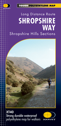
- Wandelkaart Shropshire Way | Harvey Maps
- The Shropshire Way, created from hiking trails in the county which can be combined into long-distance routes or circuits, presented at 1:40,000 on a light, waterproof and tear-resistant map from Harvey Map Services. The map presents the heart of Shropshire between Ludlow and Much Wenlock on one large panel, with an inset extending it eastwards... Read more

Stanfords
United Kingdom
United Kingdom
- Shropshire Way Harvey National Trail XT40
- The Shropshire Way, created from hiking trails in the county which can be combined into long-distance routes or circuits, presented at 1:40,000 on a light, waterproof and tear-resistant map from Harvey Map Services. The map presents the heart of Shropshire between Ludlow and Much Wenlock on one large panel, with an inset extending it eastwards... Read more

The Book Depository
United Kingdom
2016
United Kingdom
2016
- Yorkshire Dales South & Western
- Southern and western area of the Yorkshire Dales on a detailed topographic and GPS compatible map OL2, paper version, from the Ordnance Survey`s 1:25,000 Explorer series. Coverage includes Wharfedale with Grassington and Hebden, the upper part of the Ribblesdale with Settle and Horton, Yorkshire’s Three Peaks area of Whernside, Ingleborough and... Read more
- Also available from:
- De Zwerver, Netherlands
- Stanfords, United Kingdom

De Zwerver
Netherlands
2016
Netherlands
2016
- Wandelkaart - Topografische kaart OL02 OS Explorer Map Yorkshire Dales - Southern & Western Area | Ordnance Survey
- Southern and western area of the Yorkshire Dales on a detailed topographic and GPS compatible map OL2, paper version, from the Ordnance Survey`s 1:25,000 Explorer series. Coverage includes Wharfedale with Grassington and Hebden, the upper part of the Ribblesdale with Settle and Horton, Yorkshire’s Three Peaks area of Whernside, Ingleborough and... Read more

Stanfords
United Kingdom
2016
United Kingdom
2016
- Yorkshire Dales Southern & Western - Whernside, Ingleborough & Pen-y-ghent OS Explorer OL2
- Southern and western area of the Yorkshire Dales on a detailed topographic and GPS compatible map OL2, paper version, from the Ordnance Survey`s 1:25,000 Explorer series. Coverage includes Wharfedale with Grassington and Hebden, the upper part of the Ribblesdale with Settle and Horton, Yorkshire’s Three Peaks area of Whernside, Ingleborough and... Read more

The Book Depository
United Kingdom
United Kingdom
- Yorkshire Dales South & Western
- Southern and western area of the Yorkshire Dales on a detailed topographic and GPS compatible map OL2, waterproof version, from the Ordnance Survey`s 1:25,000 Explorer series. Coverage includes Wharfedale with Grassington and Hebden, the upper part of the Ribblesdale with Settle and Horton, Yorkshire’s Three Peaks area of Whernside,... Read more
- Also available from:
- Stanfords, United Kingdom

Stanfords
United Kingdom
United Kingdom
- Yorkshire Dales Southern & Western - Whernside, Ingleborough & Pen-y-ghent OS Explorer OL2 ACTIVE
- Southern and western area of the Yorkshire Dales on a detailed topographic and GPS compatible map OL2, waterproof version, from the Ordnance Survey`s 1:25,000 Explorer series. Coverage includes Wharfedale with Grassington and Hebden, the upper part of the Ribblesdale with Settle and Horton, Yorkshire’s Three Peaks area of Whernside,... Read more

De Zwerver
Netherlands
Netherlands
- Wandelkaart Sredna Gora - Bulgarije | Domino
- Pirin Mountains at 1:50,000 on a large, double-sided, contoured map with GPS waypoints for shelters and chalets, peaks, etc. and highlighting hiking routes. Topography is shown by contours at 40m intervals with additional relief shading and graphics and colouring for sandstone stacks, single rocks over 5m high, marshlands and different types of... Read more

De Zwerver
Netherlands
Netherlands
- Wandelkaart Pennine Way South | Harvey Maps
- The southern section of the Pennine Way between Edale and Horton in Ribblesdale on a waterproof and tear-resistant map at 1:40,000 from Harvey Map Services presenting the route accompanied by extensive additional tourist information.Divided into six panels, the route is shown on mapping with contours at 15m intervals enhanced by additional... Read more
- Also available from:
- Stanfords, United Kingdom

Stanfords
United Kingdom
United Kingdom
- Pennine Way South Harvey XT40 National Trail Map
- The southern section of the Pennine Way between Edale and Horton in Ribblesdale on a waterproof and tear-resistant map at 1:40,000 from Harvey Map Services presenting the route accompanied by extensive additional tourist information.Divided into six panels, the route is shown on mapping with contours at 15m intervals enhanced by additional... Read more
De Zwerver
Netherlands
2022
Netherlands
2022
.png)
De Zwerver
Netherlands
Netherlands
- Wegenkaart - landkaart 502 Northern England - Noord Engeland - Midlands | Michelin
- MICHELIN REGION MIDLANDS ANGLETERRE NORD Read more

De Zwerver
Netherlands
Netherlands
- Wandelkaart 3 Stara Planina gebergte | Domino
- Stara Planina Western: Belogradchik to Berkovita map at 1:50,000 from Bulgarian publishers Domino, contoured and GPS compatible, with hiking trails, accommodation options including a list of local mountain refuges, etc. The map is double-sided and covers the mountains from the peak of Byala Voda near Belogradchik eastwards to just beyond... Read more
- Also available from:
- Stanfords, United Kingdom

Stanfords
United Kingdom
United Kingdom
- Stara Planina Western: Belogradchik to Berkovita Domino Map
- Stara Planina Western: Belogradchik to Berkovita map at 1:50,000 from Bulgarian publishers Domino, contoured and GPS compatible, with hiking trails, accommodation options including a list of local mountain refuges, etc. The map is double-sided and covers the mountains from the peak of Byala Voda near Belogradchik eastwards to just beyond... Read more
De Zwerver
Netherlands
Netherlands
- Wegenkaart - landkaart 503 Wales, The Midlands, Southwest - zuidwest | Michelin
- Des Beatles à Liverpool au rugby du Pays de Galles, 3 régions sur une seule carte Read more
De Zwerver
Netherlands
Netherlands
- Wegenkaart - landkaart 504 Southeast England - Zuid oost Engeland - Kent | Michelin
- MICHELIN REGION MIDLANDS EST-ANGLIELondres, Birmingham, Ile de Wight, Canterbury, Manchester , 3 régions sur une seule carte Read more

De Zwerver
Netherlands
Netherlands
- Wandelkaart 4 Stara Planina gebergte | Domino
- Stara Planina Western: Berkovita to Zlatitsa map at 1:50,000 from Bulgarian publishers Domino, contoured and GPS compatible, with hiking trails, accommodation options including a list of local mountain refuges, etc. The map is double-sided and covers the mountains from Varshets (directly north of Sofia) to just beyond Etrepole.Maps in the... Read more
- Also available from:
- Stanfords, United Kingdom

Stanfords
United Kingdom
United Kingdom
- Stara Planina Western: Berkovita to Zlatitsa Domino Map
- Stara Planina Western: Berkovita to Zlatitsa map at 1:50,000 from Bulgarian publishers Domino, contoured and GPS compatible, with hiking trails, accommodation options including a list of local mountain refuges, etc. The map is double-sided and covers the mountains from Varshets (directly north of Sofia) to just beyond Etrepole.Maps in the... Read more
Weitere …