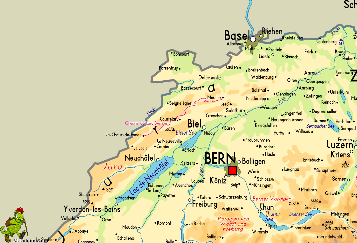
Chemin du Jura Bernois
Beschreibung
- Name Chemin du Jura Bernois
- Länge von Wanderweg 64 km, 40 Meilen
- Länge in Tagen 4 Tage
- Anfang von Wanderweg Moutier
- Ende von Wanderweg La Chaux-de-Fonds
- Traildino Schwierigkeit EW, Leichte Wanderung, Naturwanderweg

91
64 km. Moutier to La Chaux-de-Fonds.
Karte
Links
Fakten
Berichte
Führer und Karten
Übernachtung
Organisationen
Reisebüros
GPS
Sonstiges
Karten

Stanfords
United Kingdom
United Kingdom
- Chasseral
- Chasseral - Bieler See area of the Swiss Jura at 1:50,000 in a series from Hallwag covering Switzerland’s popular hiking regions on light, waterproof and tear-resistant maps highlighting long-distance paths: the nine national routes plus special regional routes, as well as other local hiking trails.Cartography is similar to that used both in... Read more


