
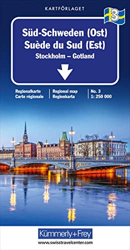
Skåne
Beschreibung
Wanderwege Landesteil
Links
Fakten
Berichte
Führer und Karten
Übernachtung
Organisationen
Reisebüros
GPS
Sonstiges
Bücher
De Zwerver
Netherlands
2022
Netherlands
2022

Stanfords
United Kingdom
United Kingdom
- Istria Kompass 238
- Istria at 1:75,000 on a double-sided, waterproof and tear-resistant, detailed contoured map from Kompass, with hiking and cycling routes, street plans of 10 main towns, plus tourist information. Coverage extends north beyond the Croatian border to include Trieste and the coast of Slovenia. Contours at 50m intervals and spot heights present the... Read more
Karten

The Book Depository
United Kingdom
United Kingdom
- Prespa - Vitsi - Voras
- Uitstekende topografische kaarten van een deel van Griekenland: zonder meer hele goede kaarten voor wandeltochten in een onbekend stuk Griekenland! Ze zijn gedrukt op scheurvast en watervast papier op een schaal van 1:50.000 met een UTM grid voor GPS gebruikers. Op de meeste kaarten is geven de hoogtelijnen een interval van 20m. aan. Met... Read more
- Also available from:
- De Zwerver, Netherlands
- Stanfords, United Kingdom

De Zwerver
Netherlands
Netherlands
- Wandelkaart 6.2 Prespa - Vitsi - Voras | Anavasi
- Uitstekende topografische kaarten van een deel van Griekenland: zonder meer hele goede kaarten voor wandeltochten in een onbekend stuk Griekenland! Ze zijn gedrukt op scheurvast en watervast papier op een schaal van 1:50.000 met een UTM grid voor GPS gebruikers. Op de meeste kaarten is geven de hoogtelijnen een interval van 20m. aan. Met... Read more

Stanfords
United Kingdom
United Kingdom
- Prespa - Vitsi - Voras Anavasi 6.2
- Prespa - Vitsi – Voras area of northern Greece at 1:50,000 on a light, waterproof and tear-resistant, GPS compatible, contoured map from Anavasi, with recommendations for three hiking trails and notes on the E4 and E6 cross-European trails. The map is double-sided; coverage in the west starts from the Prespa Lake on the border with Albania and... Read more
De Zwerver
Netherlands
Netherlands
De Zwerver
Netherlands
Netherlands
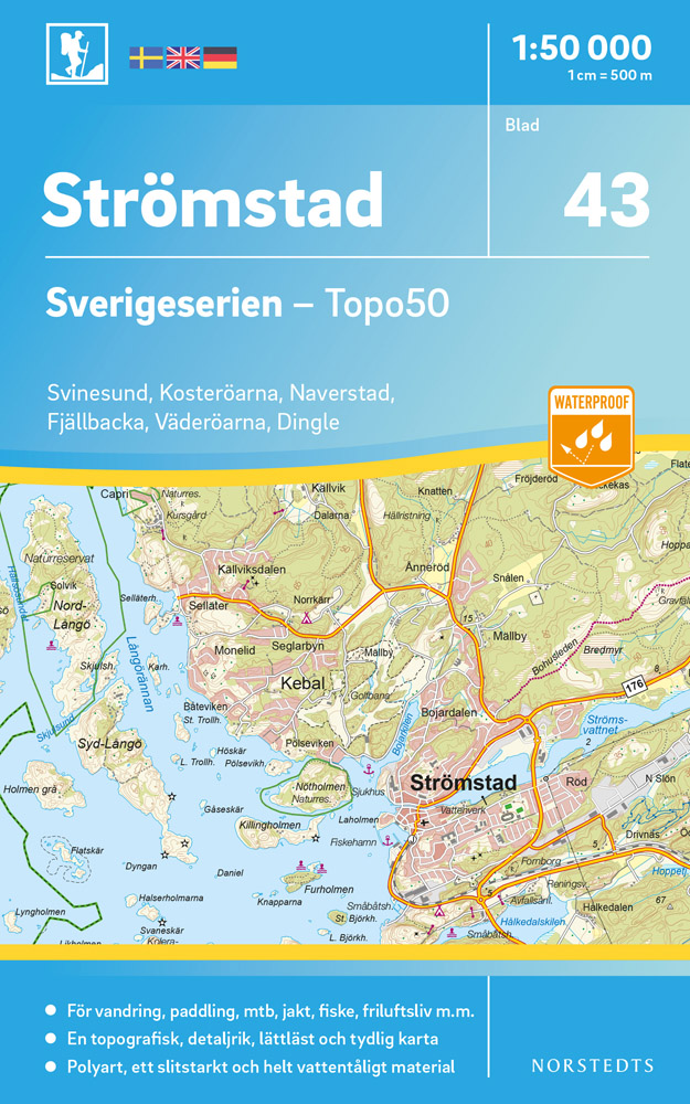
- Wandelkaart - Topografische kaart 43 Sverigeserien Strömstad | Norstedts
- Sverigeserien is an outdoor map series consisting of 116 sheets with coverage of southern and central Sweden and the northern coastline. The map is suitable for outdoor activities such as hiking, excursions, trail running, hunting, fishing, riding, cycling, mountain biking, paddling, skating and much more. Every sheet covers an area of... Read more
De Zwerver
Netherlands
Netherlands
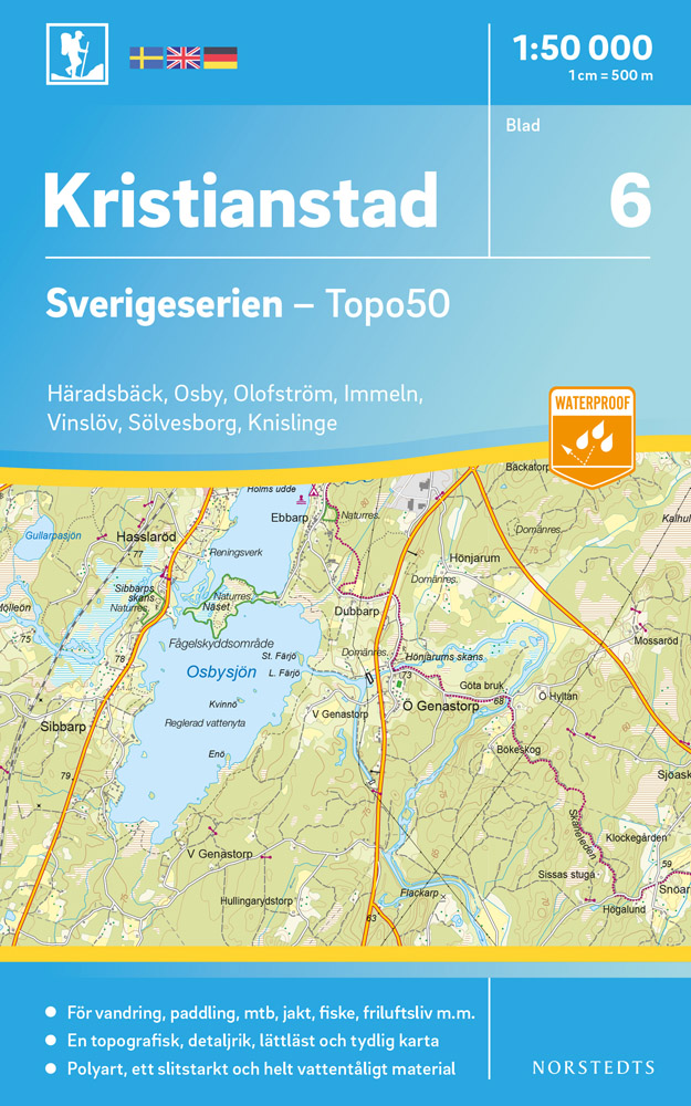
- Wandelkaart - Topografische kaart 06 Sverigeserien Kristianstad | Norstedts
- Sverigeserien is an outdoor map series consisting of 116 sheets with coverage of southern and central Sweden and the northern coastline. The map is suitable for outdoor activities such as hiking, excursions, trail running, hunting, fishing, riding, cycling, mountain biking, paddling, skating and much more. Every sheet covers an area of... Read more
De Zwerver
Netherlands
Netherlands
De Zwerver
Netherlands
Netherlands
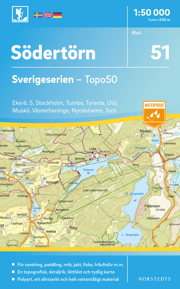
- Wandelkaart - Topografische kaart 51 Sverigeserien Södertörn | Norstedts
- Sverigeserien is an outdoor map series consisting of 116 sheets with coverage of southern and central Sweden and the northern coastline. The map is suitable for outdoor activities such as hiking, excursions, trail running, hunting, fishing, riding, cycling, mountain biking, paddling, skating and much more. Every sheet covers an area of... Read more
De Zwerver
Netherlands
Netherlands
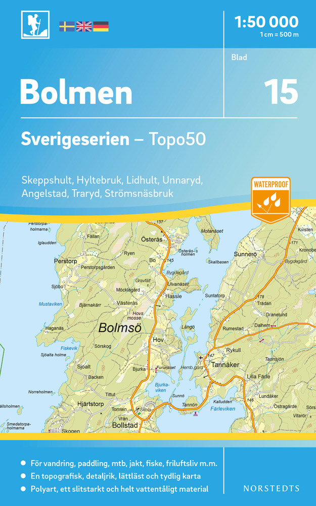
- Wandelkaart - Topografische kaart 15 Sverigeserien Bolmen | Norstedts
- Sverigeserien is an outdoor map series consisting of 116 sheets with coverage of southern and central Sweden and the northern coastline. The map is suitable for outdoor activities such as hiking, excursions, trail running, hunting, fishing, riding, cycling, mountain biking, paddling, skating and much more. Every sheet covers an area of... Read more
De Zwerver
Netherlands
Netherlands
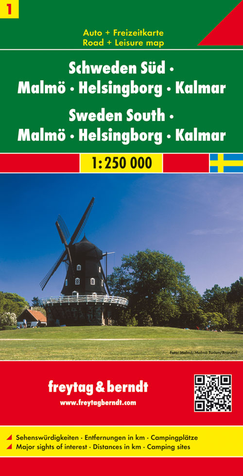
- Wegenkaart - landkaart 01 Schweden Süd - Malmö - Helsingborg - Kalmar ( Zweden ) | Freytag & Berndt
- FuB Schweden 01 Süd, Malmö, Helsingborg, Kalmar 1 : 250 000. Autokarte ab 10.9 EURO Sehenswürdigkeiten. Entfernungen in km. Campingplätze Schweden Freytag & Berndt Autokarte. Neuauflage, Laufzeit bis 2019 Read more

De Zwerver
Netherlands
Netherlands
De Zwerver
Netherlands
Netherlands
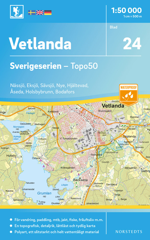
- Wandelkaart - Topografische kaart 24 Sverigeserien Vetlanda | Norstedts
- Sverigeserien is an outdoor map series consisting of 116 sheets with coverage of southern and central Sweden and the northern coastline. The map is suitable for outdoor activities such as hiking, excursions, trail running, hunting, fishing, riding, cycling, mountain biking, paddling, skating and much more. Every sheet covers an area of... Read more
De Zwerver
Netherlands
2017
Netherlands
2017
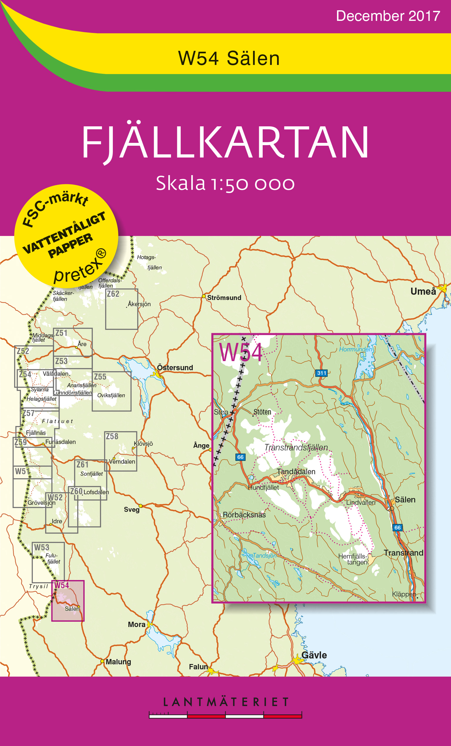
- Wandelkaart W54 Fjällkartan Salen | Lantmäteriet
- Mountain areas of central and northern Sweden on waterproof and tear-resistant, GPS compatible topographic �Fj�llkartan� maps at 1:100,000 and 1:50,000 from Lantm�teriet - the country�s national survey organization, with hiking and ski routes, campsites and youth hostels, etc. Relief is shown by contours at 20m intervals and enhanced by relief ... Read more
- Also available from:
- Stanfords, United Kingdom

Stanfords
United Kingdom
2017
United Kingdom
2017
- Sälen Lantmateriet W54
- Mountain areas of central and northern Sweden on waterproof and tear-resistant, GPS compatible topographic “Fjällkartan” maps at 1:100,000 and 1:50,000 from Lantmäteriet - the country’s national survey organization, with hiking and ski routes, campsites and youth hostels, etc. Relief is shown by contours at 20m intervals and enhanced by relief... Read more
De Zwerver
Netherlands
Netherlands
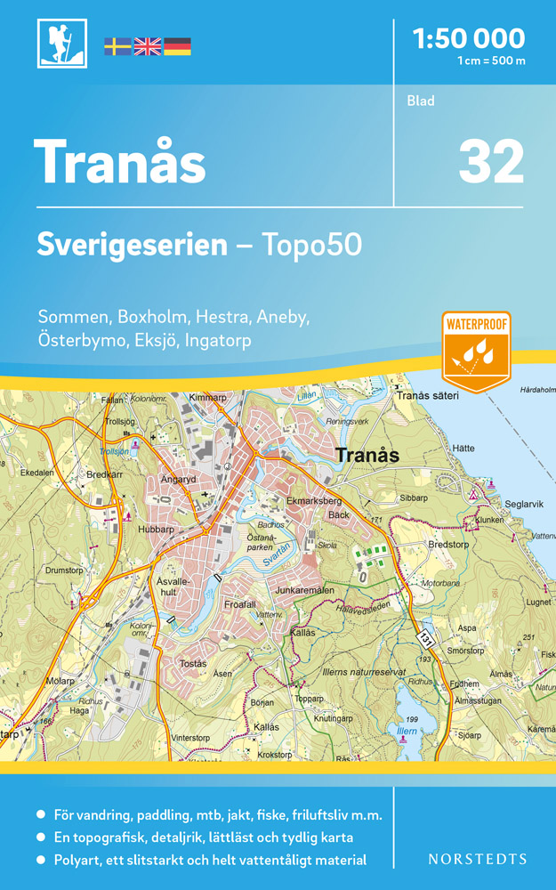
- Wandelkaart - Topografische kaart 32 Sverigeserien Tranås - Tranas | Norstedts
- Sverigeserien is an outdoor map series consisting of 116 sheets with coverage of southern and central Sweden and the northern coastline. The map is suitable for outdoor activities such as hiking, excursions, trail running, hunting, fishing, riding, cycling, mountain biking, paddling, skating and much more. Every sheet covers an area of... Read more
De Zwerver
Netherlands
2015
Netherlands
2015
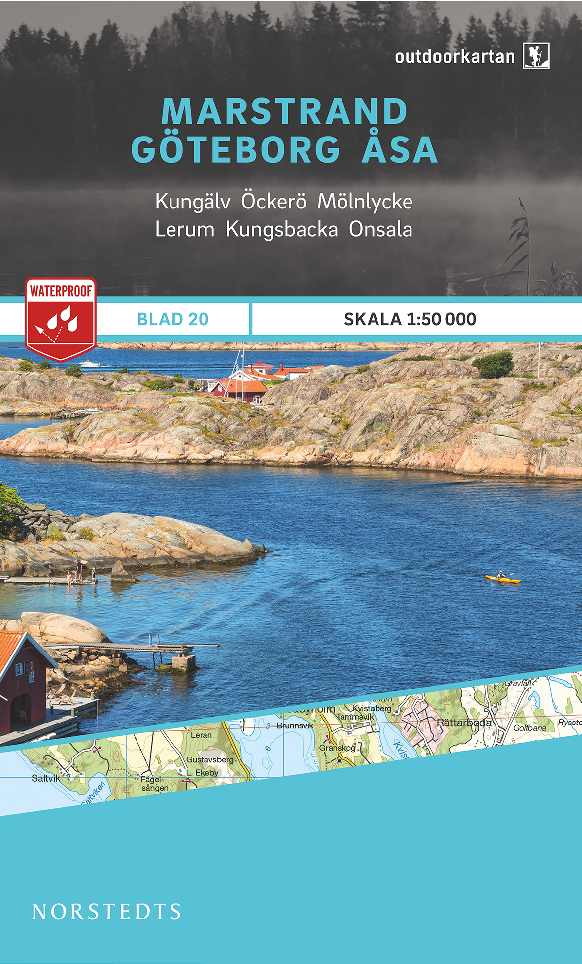
- Wandelkaart 20 Outdoorkartan Marstrand - Göteborg - Åsa | Norstedts
- This map of Marstrand Goteborg Asa in 1:50,000 is part of a series of topographic maps from Norstedts Kartforlaget which includes 28 outdoor maps covering the mountain areas and popular recreation areas in southern Sweden. The maps in this series have a new look and are printed on a durable and water resistant paper. Cartography, material and... Read more
- Also available from:
- Stanfords, United Kingdom

Stanfords
United Kingdom
2015
United Kingdom
2015
- Marstrand - Gothenburg - Asa
- This map of Marstrand Goteborg Asa in 1:50,000 is part of a series of topographic maps from Norstedts Kartforlaget which includes 28 outdoor maps covering the mountain areas and popular recreation areas in southern Sweden. The maps in this series have a new look and are printed on a durable and water resistant paper. Cartography, material and... Read more