
Gran Canaria, Canarias
Beschreibung

Gran Canaria is the third largest of Canary Islands, and is synonym to beach holidays. The shape is that of an orange with a very eroded and rugged interior. The mountains reach 1.949 metres, and here shrub and some forests enliven the otherwise rather bare and arid mountain slopes. The valleys are usually inhabited and cultivated.
The island has no great importance for hiking. The terrain is difficult. There are no obvious volcanic features, although the island is of course entirely of volcanic origin like all of the Canaries. Organised hiking is done on the island, and small trails have been marked. For those who have time and patience, interesting routes must be possible. Much of the island is protected. Especially the western part of Gran Canaria offers interesting natural and rural values.
Check the complete list of Canary Islands.
Karte

Links
Fakten
Berichte
Führer und Karten
Übernachtung
Organisationen
Reisebüros
GPS
Sonstiges
Bücher

United Kingdom
2020
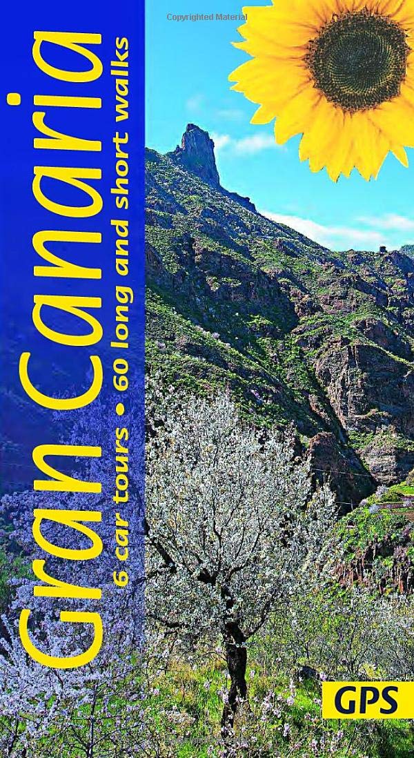
- Gran Canaria
- 6 car tours, 60 long and short walks with GPS Read more
- Also available from:
- De Zwerver, Netherlands
- Stanfords, United Kingdom
Netherlands
2020
- Wandelgids Gran Canaria | Sunflower books
- 6 car tours, 60 long and short walks with GPS Read more

United Kingdom
2020
- Gran Canaria Sunflower Landscape Guide
- The go-to Gran Canaria travel guide for discovering the best walks and car tours. Strap on your boots and discover Gran Canaria on foot with the Sunflower Gran Canaria travel guide. And on the days when your feet may have had enough, enjoy some spectacular scenery on one of our legendary car tours. The Sunflower Gran Canaria guide is... Read more

United Kingdom
2022
- Gran Canaria walking guide 72 walks 2022
- The Finest Valley And Mountain Walks - Roth.E4816 Read more
- Also available from:
- De Zwerver, Netherlands
- Stanfords, United Kingdom
Netherlands
2022
- Wandelgids Gran Canaria | Rother Bergverlag
- The Finest Valley And Mountain Walks - Roth.E4816 Read more

United Kingdom
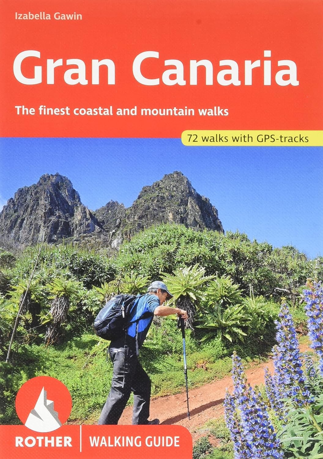
2022
- Gran Canaria Rother Guide
- Gran Canaria not only enjoys a fabulous reputation as a paradise of sunshine and beaches; it can also be described as one of the most versatile hiking islands of the Canary Archipelago. Connoisseurs praise it as a miniature continent because of its diversity of landscapes: shimmering dunes in contrast with luscious subtropical valleys, deep... Read more

United Kingdom
2022
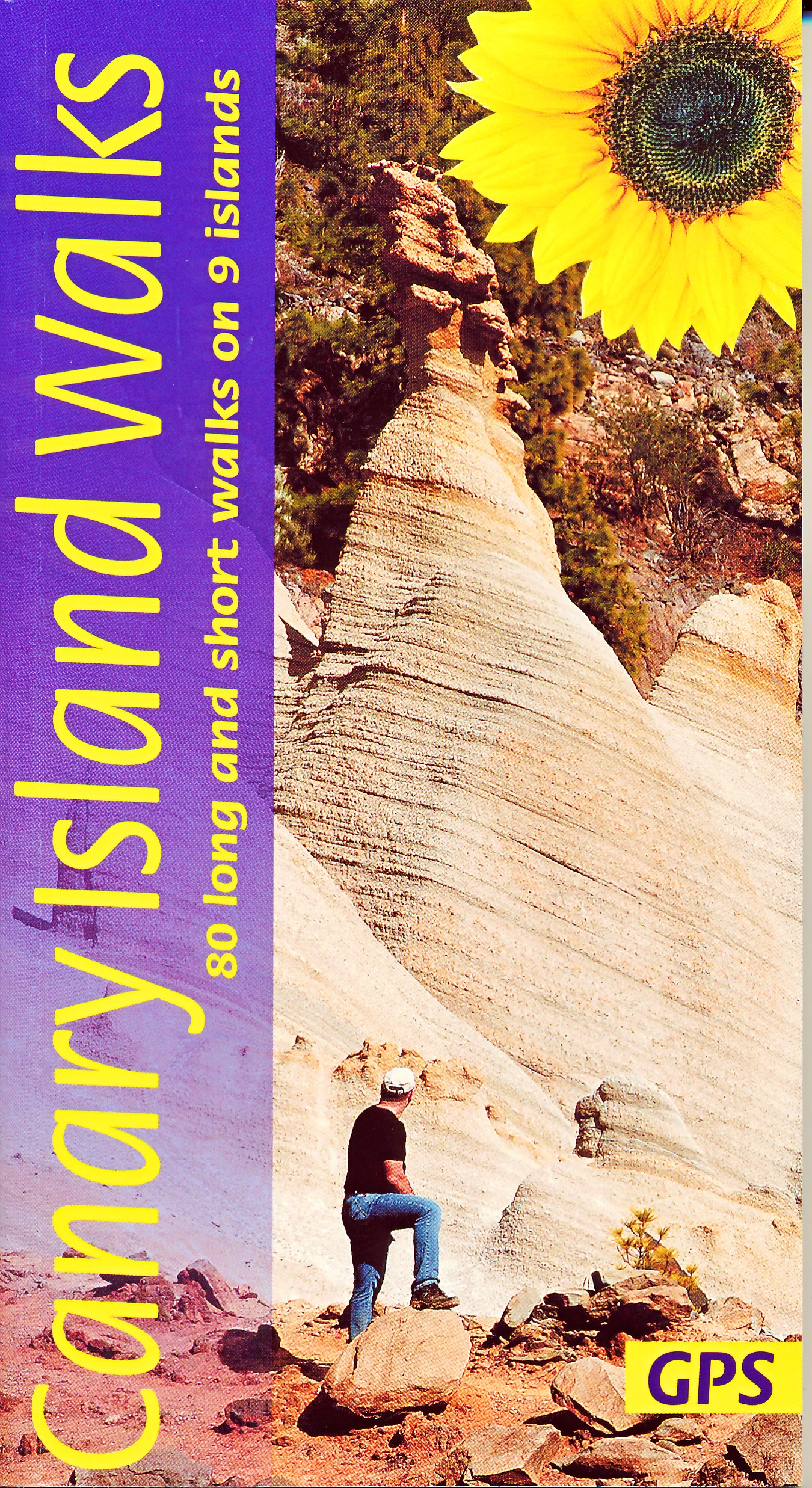
- Canary Islands Walks Sunflower Guide
- 80 long and short walks on the Canary Islands Read more
- Also available from:
- De Zwerver, Netherlands
- Stanfords, United Kingdom
Netherlands
2022
- Wandelgids Canary Islands Walks | Sunflower books
- The go-to travel guide for discovering the best walks on the Canary Islands; Strap on your boots and discover the Canary Islands on foot with the Sunflower Canary Islands Walks travel guide. The Sunflower Canary Islands Walks guide is indispensable for walking and hiking on all 7 Canary Islands - Tenerife, Gran Canaria, Lanzarote,... Read more

United Kingdom
2022
- Canary Islands Walks Sunflower Guide: 90 long and short walks on the Canary Islands
- The go-to travel guide for discovering the best walks on the Canary Islands; Strap on your boots and discover the Canary Islands on foot with the Sunflower Canary Islands Walks travel guide. The Sunflower Canary Islands Walks guide is indispensable for walking and hiking on all 7 Canary Islands - Tenerife, Gran Canaria, Lanzarote,... Read more

United Kingdom

United Kingdom
2019
- Trekking in the Canary Islands
- The GR131 island-hopping route Read more
- Also available from:
- De Zwerver, Netherlands
- Stanfords, United Kingdom

Netherlands
2019
- Wandelgids Trekking in the Canary Islands: The GR131 Island Hopping Route | Cicerone
- Guidebook to the GR131, an island-hopping trail that runs coast to coast across each of the 7 Canary Islands, a sub-tropical Spanish archipelago. Described over 32 stages, the route begins on Lanzarote, finishes on El Hierro, measures 560km (348 miles) and would take an average trekker about 1 month to complete. Read more

United Kingdom
2019
- Trekking in the Canary Islands: The GR131 island-hopping route
- This guidebook provides a comprehensive and detailed description of the GR131, an island-hopping trail across the seven Canary Islands. The 560km (348 mile) route begins on Lanzarote and finishes on El Hierro and is presented in 32 daily stages. The route is well waymarked but some navigational skills are required, and the remote and occasional... Read more

United Kingdom
2020
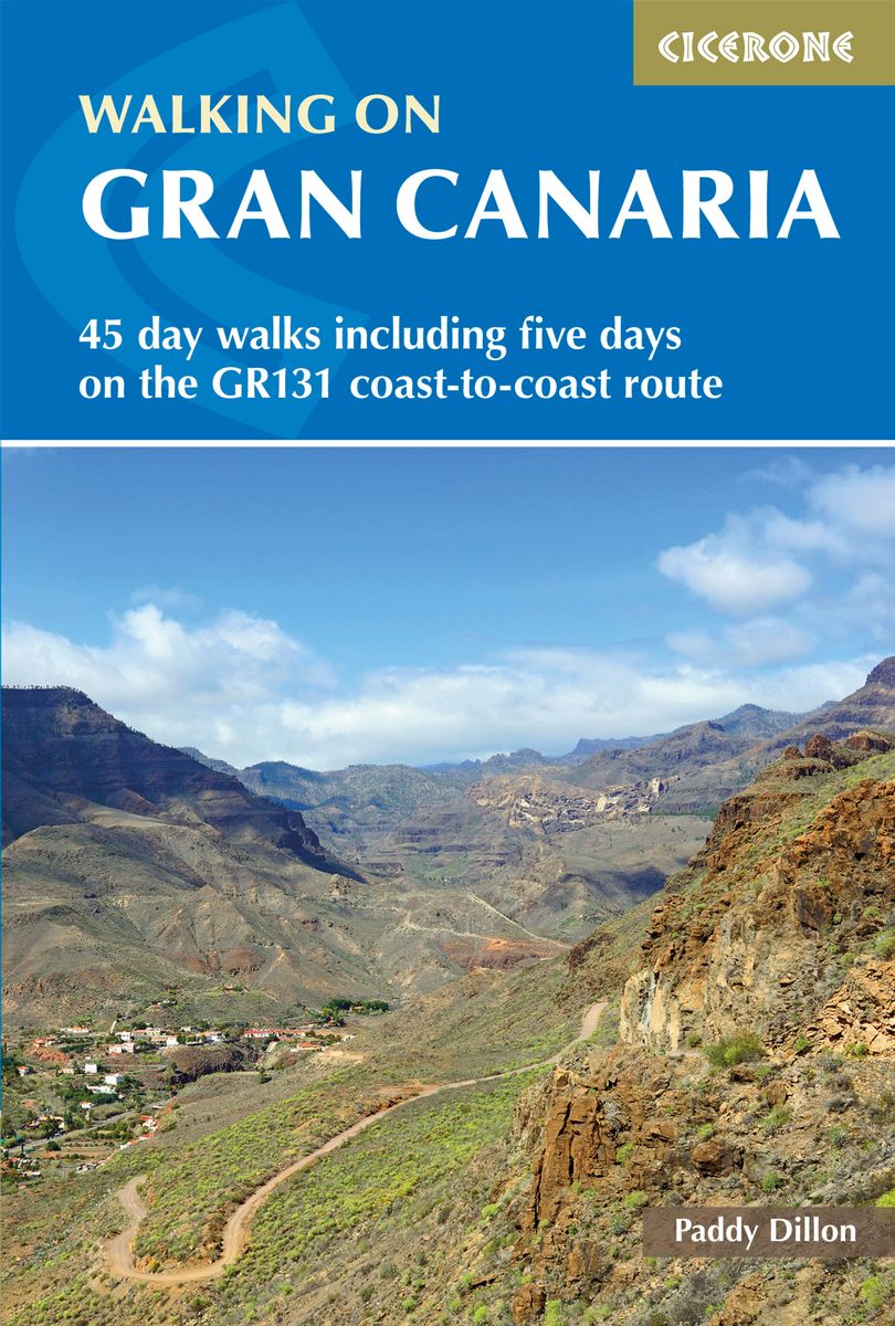
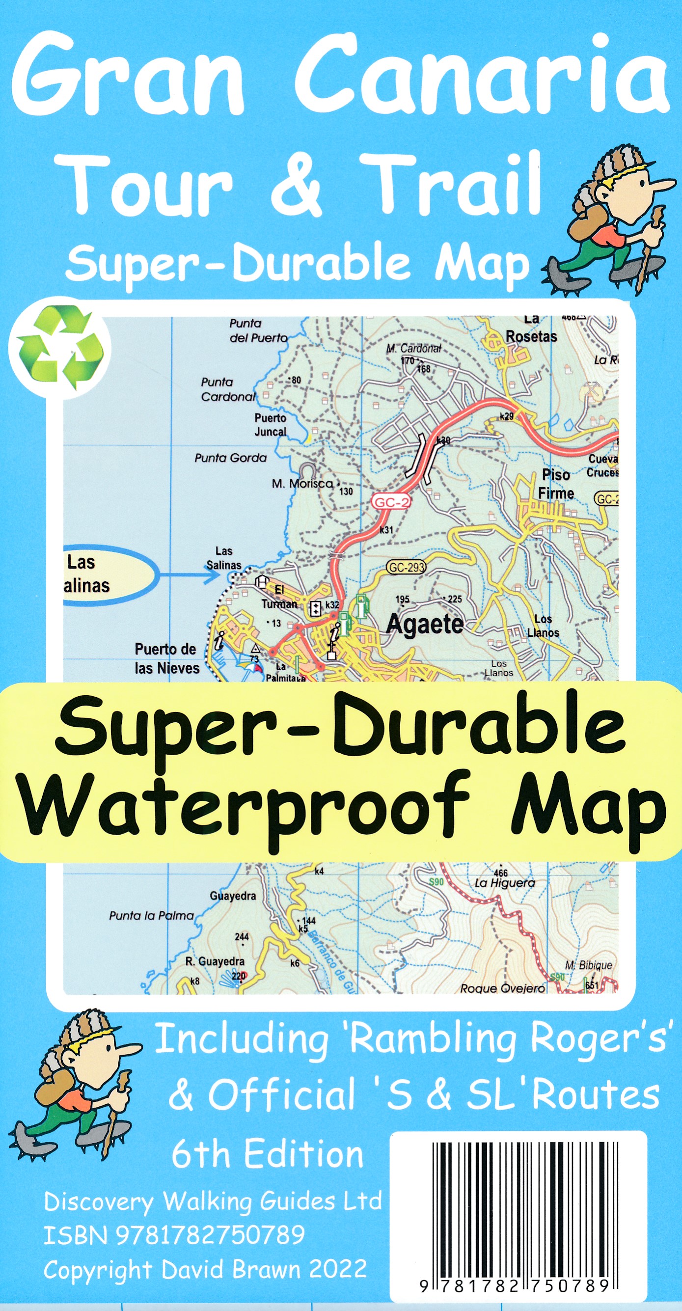
- Walking on Gran Canaria
- 45 day walks including five days on the GR131 coast-to-coast route Read more
- Also available from:
- De Zwerver, Netherlands
- Stanfords, United Kingdom
Netherlands
2020
- Wandelgids Walking on Gran Canaria | Cicerone
- Guidebook describing 45 day walks on Gran Canaria, generally averaging 10 to 12km each. A long-distance coast-to-coast route on the GR131 is included, and shorter walks can be linked to form longer itineraries. One of the larger Canary Islands, Gran Canaria is a popular destination but offers many peaceful, rural areas perfect for walking. Read more

United Kingdom
2020
- Walking on Gran Canaria: 45 day walks including five days on the GR131 coast-to-coast route
- The guidebook describes 45 day walks across eight areas of Gran Canaria, including Las Palmas in the north to Playa del Ingles in the south. Also included is a five-day coast-to-coast route on the GR131, an island-hopping long-distance trail stretching across all seven of the Canary Islands. There are walks suitable for those of all abilities,... Read more

Netherlands
2016
- Wandelgids Gran Canaria | Uitgeverij Elmar
- de mooiste kust- en bergwandelingen Read more
Karten

United Kingdom
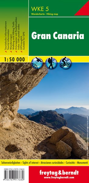
- Gran Canary Hiking + Leisure Map 1:50 000
- Gran Canaria at 1:75,000 from Freytag & Berndt on a road map clearly presenting its network of main roads and various places of interest or tourist facilities, whilst also including topographic information and selected hiking routes.The map has contours with relief shading and spot heights to show the island’s topography. Road network includes... Read more
- Also available from:
- De Zwerver, Netherlands
- Stanfords, United Kingdom
Netherlands
- Wandelkaart WKE5 Gran Canaria | Freytag & Berndt
- Gran Canaria at 1:75,000 from Freytag & Berndt on a road map clearly presenting its network of main roads and various places of interest or tourist facilities, whilst also including topographic information and selected hiking routes.The map has contours with relief shading and spot heights to show the island’s topography. Road network includes... Read more

United Kingdom
- Gran Canaria F&B WKE5
- Gran Canaria at 1:75,000 from Freytag & Berndt on a road map clearly presenting its network of main roads and various places of interest or tourist facilities, whilst also including topographic information and selected hiking routes.The map has contours with relief shading and spot heights to show the island’s topography. Road network includes... Read more
- Also available from:
- De Zwerver, Netherlands


Netherlands
2015
- Wegenkaart - landkaart Spanje | Borch
- Espana (Spanien) 1 : 1 875 000 ab 9.9 EURO Espana del Oeste, Espana del Este, Islas Canarias Borch Map. 9. Auflage Read more
Netherlands
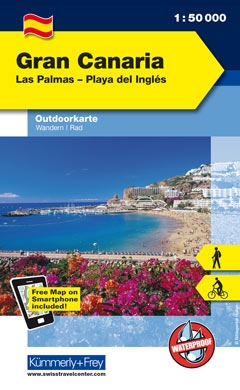
- Wandelkaart Outdoorkarte Gran Canaria | Kümmerly & Frey
- Gran Canaria at 1:50,000 on a sturdy, waterproof and tear-resistant, GPS compatible map from K Read more
- Also available from:
- Stanfords, United Kingdom

United Kingdom
- Gran Canaria K+F Outdoor Map
- Gran Canaria at 1:50,000 on a sturdy, waterproof and tear-resistant, GPS compatible map from Kümmerly + Frey. The map divides the island north/south, with an overlap between the sides, presenting its topography by contours at 100m intervals and light relief shading, plus colouring for woodlands; boundaries of the protected areas are marked.... Read more

United Kingdom
- San Nicolas de Tolentino CNIG Topo 1103-4
- Topographic coverage of the Canary Islands at 1:25,000 published by the Instituto Geográfico Nacional – Centro Nacional de Información Geografica, the country’s civilian survey organization. The maps have contours at 10m intervals and colouring and/or graphics to show different types of vegetation or land use. Boundaries of national parks and... Read more

United Kingdom
- Ingenio CNIG Topo 1107
- Ingenio area of Gran Canaria, map No. 1107 in the topographic coverage of the Canary Islands at 1:50,000 from the Instituto Geográfico Nacional - Centro Nacional de Información Geograficá, Spain’s civilian survey organization. Maps in the MTN50 (Mapa Topográfico Nacional) series begun in late 1990s have contours at 20m intervals enhanced by... Read more

United Kingdom
- Canary Islands West: Gran Canaria, Tenerife, La Palma, Gomera, Hierro 500K CNIG Regional Map No. 14
- Western Canary Islands (Gran Canaria, Tenerife, La Palma, Gomera and Hierro) at 1:500,000 in a series of regional road map of Spain from the country’s civilian survey organization IGN-CNIG (Instituto Geográfico Nacional - Centro Nacional de Información Geográfica), vividly presenting the topography by altitude colouring, boundaries of... Read more
United Kingdom
- Teror 25K Gran Canaria CNIG Topographic Survey Map No. 1104-I
- Topographic coverage of the Canary Islands at 1:25,000 published by the Instituto Geográfico Nacional – Centro Nacional de Información Geografica, the country’s civilian survey organization. The maps have contours at 10m intervals and colouring and/or graphics to show different types of vegetation or land use. Boundaries of national parks and... Read more
United Kingdom
- Playa del Ingles CNIG Topo 1109
- Playa del Ingles area of Gran Canaria, map No. 1109 in the topographic coverage of the Canary Islands at 1:50,000 from the Instituto Geográfico Nacional - Centro Nacional de Información Geograficá, Spain’s civilian survey organization. Maps in the MTN50 (Mapa Topográfico Nacional) series begun in late 1990s have contours at 20m intervals... Read more

United Kingdom
- Canary Islands East: Gran Canaria, Fuerteventura, Lanzarote 500K CNIG Regional Map No.
- Eastern Canary Islands (Gran Canaria, Fuerteventure and Lanzarote) at 1:500,000 in a series of regional road map of Spain from the country’s civilian survey organization IGN-CNIG (Instituto Geográfico Nacional - Centro Nacional de Información Geográfica), vividly presenting the topography by altitude colouring, boundaries of national/natural... Read more
United Kingdom
- Playa del Ingles CNIG Topographic Map 1109-1
- Topographic coverage of the Canary Islands at 1:25,000 published by the Instituto Geográfico Nacional – Centro Nacional de Información Geografica, the country’s civilian survey organization. The maps have contours at 10m intervals and colouring and/or graphics to show different types of vegetation or land use. Boundaries of national parks and... Read more
United Kingdom
- Telde CNIG Topo 1104
- Telde area of Gran Canaria, map No. 1104 in the topographic coverage of the Canary Islands at 1:50,000 from the Instituto Geográfico Nacional - Centro Nacional de Información Geograficá, Spain’s civilian survey organization. Maps in the MTN50 (Mapa Topográfico Nacional) series begun in late 1990s have contours at 20m intervals enhanced by... Read more