
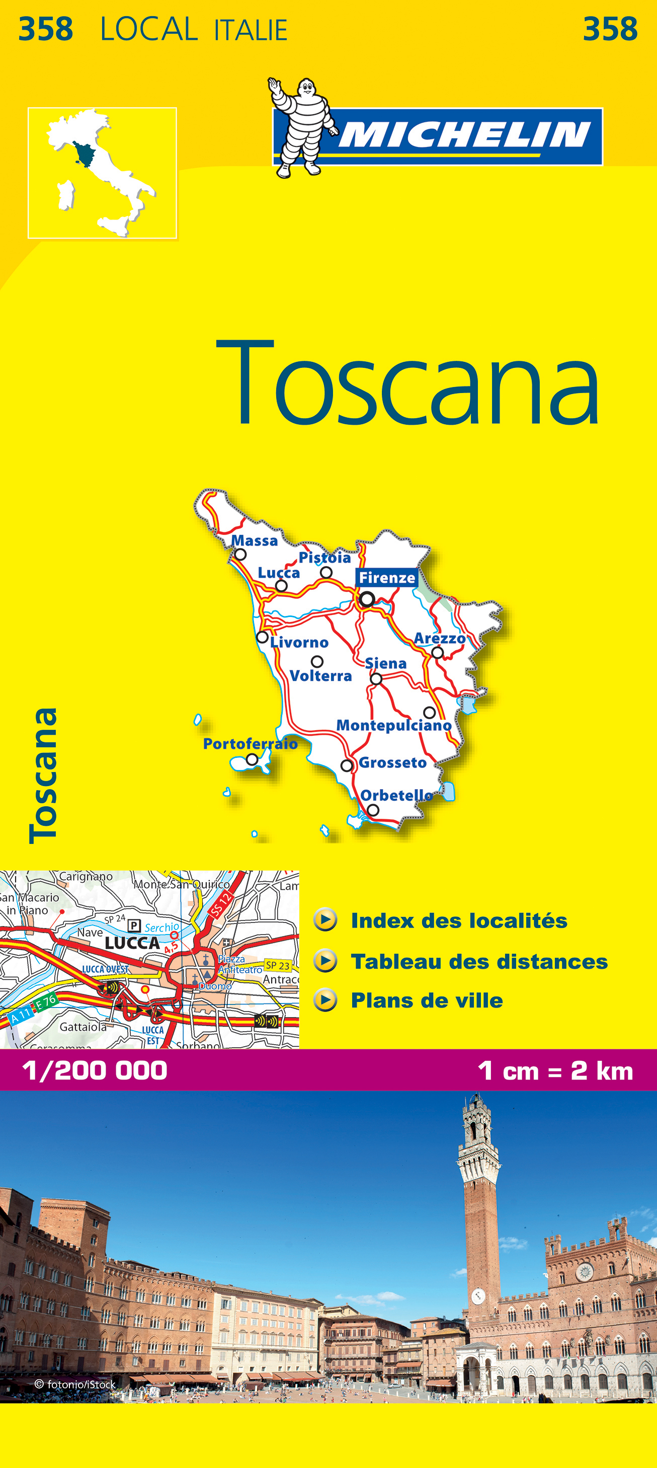
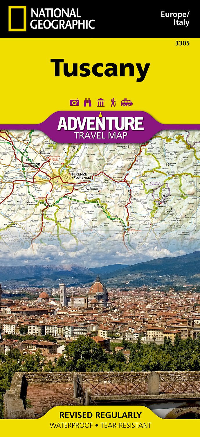
Toscana
Beschreibung
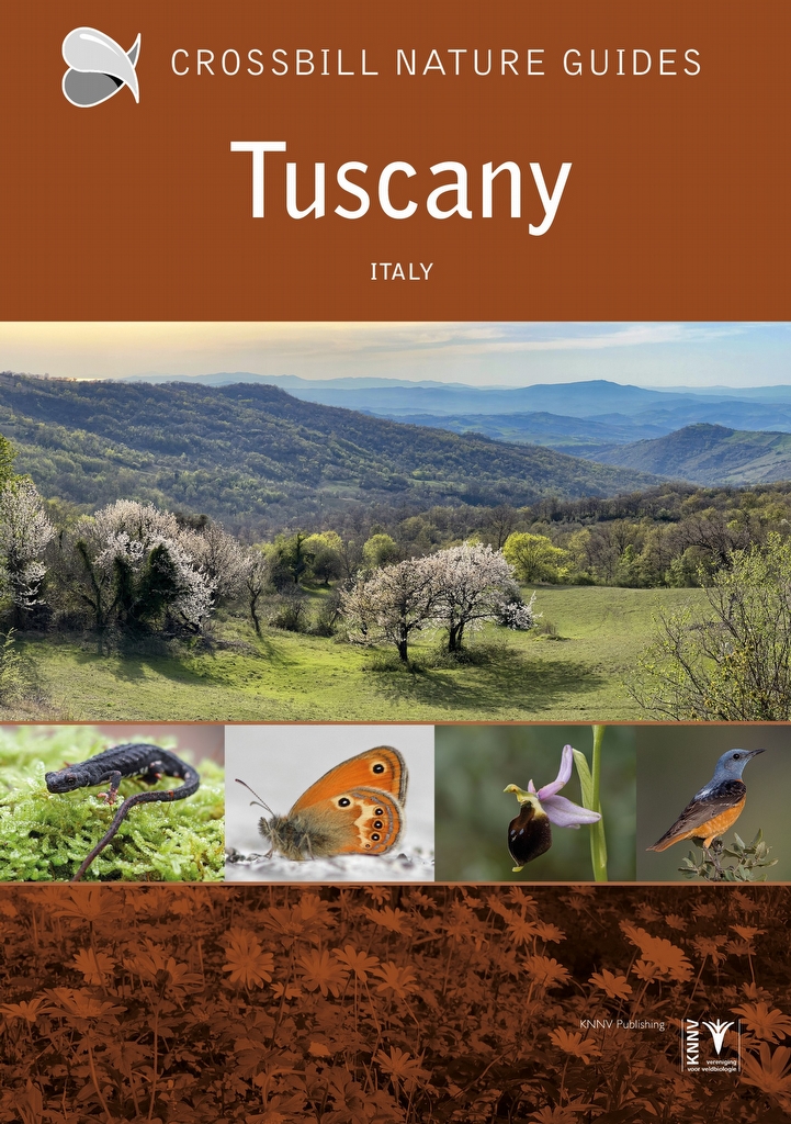
Famous and picturesque region between Florence (Firenze) and Sienna.
Wanderwege Region
Links
Fakten
Berichte
Führer und Karten
Übernachtung
Organisationen
Reisebüros
GPS
Sonstiges
Bücher

- Also available from:
- De Zwerver, Netherlands
- Stanfords, United Kingdom

Stanfords
United Kingdom
2018
United Kingdom
2018
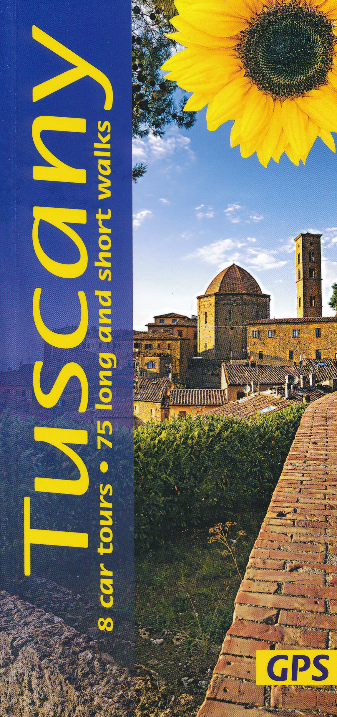
- Tuscany Sunflower Landscape Guide
- This book features walks and car tours from Carrara marble quarries in the northwest down to southern Tuscany, with particular emphasis on the countryside around Florence and in the Chianti. While the region`s historic towns and architectural highlights are often focal points for these excursions, the role of the Tuscan peasant in creating this... Read more

- Also available from:
- De Zwerver, Netherlands
- Stanfords, United Kingdom


Stanfords
United Kingdom
2021
United Kingdom
2021
- Lonely Planet Best Day Walks Italy
- Lonely Planet`s Best Day Walks Italy is your passport to 60 easy escapes into nature. Stretch your legs outside the city by picking a hike that works for you, from just a couple of hours to a full day, from easy to hard. Hike the Dolomites, explore the Italian Lakes, and stroll Sardinia`s coast. Get to the heart of Italy and begin your journey... Read more

The Book Depository
United Kingdom
2019
United Kingdom
2019
- Walking in Umbria
- 40 walks in the 'Green Heart' of Italy Read more
- Also available from:
- De Zwerver, Netherlands
- Stanfords, United Kingdom

De Zwerver
Netherlands
2019
Netherlands
2019
- Wandelgids Walking in Umbria - Umbrië | Cicerone
- This guidebook describes 40 walks in Umbria, among the ancient towns of Assisi, Perugia, Orvieto and Norcia. Known as the 'green heart' of Italy, the region of Umbria is home to hills reaching up to the Apennines and Sibillini mountains, as well as ancient villages, Roman and Etruscan ruins, dense woodland and nature reserves. Read more

Stanfords
United Kingdom
2019
United Kingdom
2019
- Walking in Umbria: 40 walks in the `Green Heart` of Italy
- This guidebook by Italian walking expert Gillian Price describes 40 varied day walks in the region of Umbria, taking in the towns of Assisi, Perugia, Orvieto and Norcia. The walks range from 2.5km to 19km in length, the majority of the routes are circular, and several wonderful traverses have been included, with the return to the start point... Read more

The Book Depository
United Kingdom
2018
United Kingdom
2018
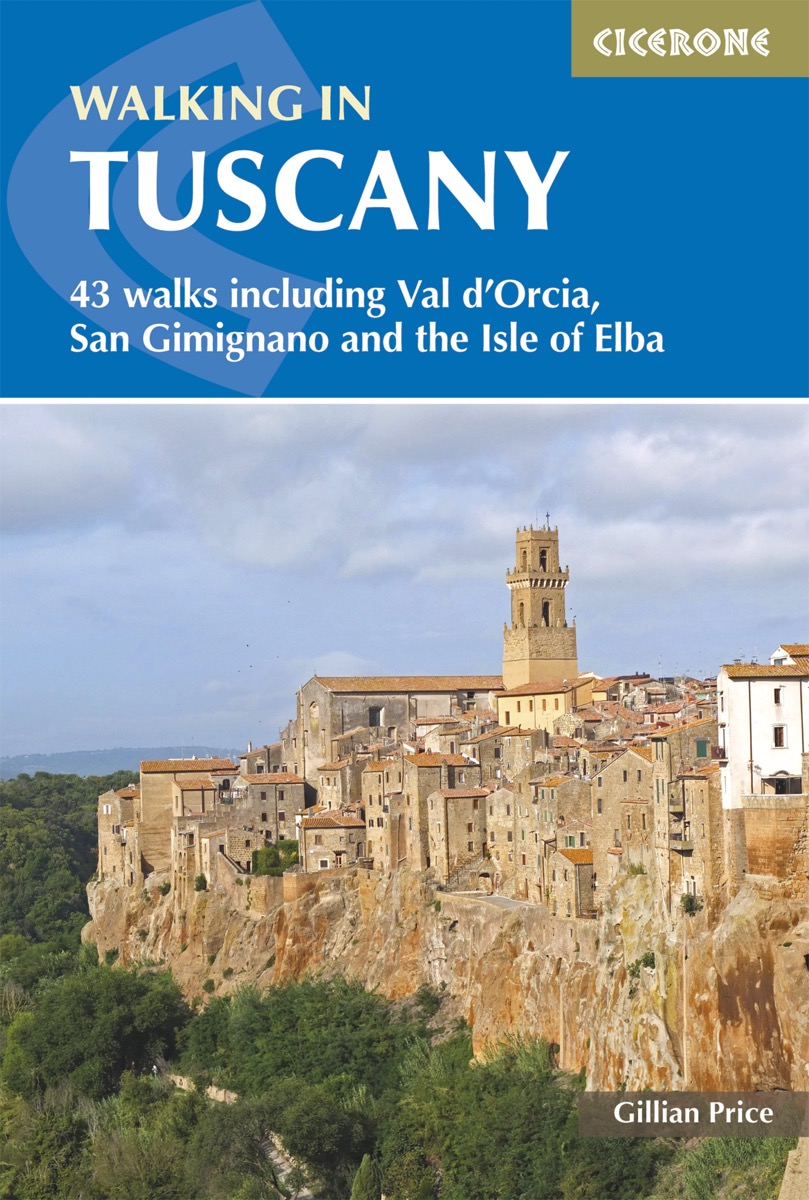
- Walking in Tuscany
- 43 walks including Val d'Orcia, San Gimignano and the Isle of Elba Read more
- Also available from:
- De Zwerver, Netherlands
- Stanfords, United Kingdom
De Zwerver
Netherlands
2018
Netherlands
2018
- Wandelgids Walking in Tuscany - Toscane | Cicerone
- Guidebook to 43 graded, mostly easy walks in Tuscany. Taking in the Renaissance splendour of Florence and Siena, the World Heritage scenery of Val d'Orcia and San Gimignano and the stunning island of Elba, the routes use historical pathways used by traders, pilgrims and armies, and include some brief, trouble-free climbs/descents. Read more

Stanfords
United Kingdom
2018
United Kingdom
2018
- Walking in Tuscany
- A guidebook to walks in the Italian region of Tuscany. 43 graded routes range from 2.5 to 18km, and take in the Renaissance splendour of Florence and Siena, the World Heritage scenery of Val d`Orcia and San Gimignano and the stunning island of Elba. Alongside detailed route descriptions and clear mapping there is essential practical information... Read more
De Zwerver
Netherlands
2019
Netherlands
2019
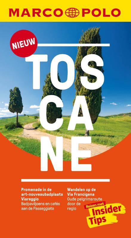
- Reisgids Marco Polo NL Toscane | 62Damrak
- Marco Polo reisgids voor Toscane. Handig pocketformaat, boordevol informatie, met uitneembare kaart achter in het boek en atlas-pagina's. Met Insider Tips om Toscane écht te ontdekken en de TOP 15 van bezienswaardigheden in één oogopslag. Veel up-to-date informatie in overzichtelijke hoofdstukken: sightseeing, eten & drinken, winkelen, uitgaan,... Read more
De Zwerver
Netherlands
2017
Netherlands
2017
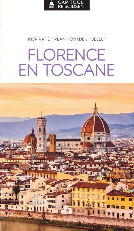
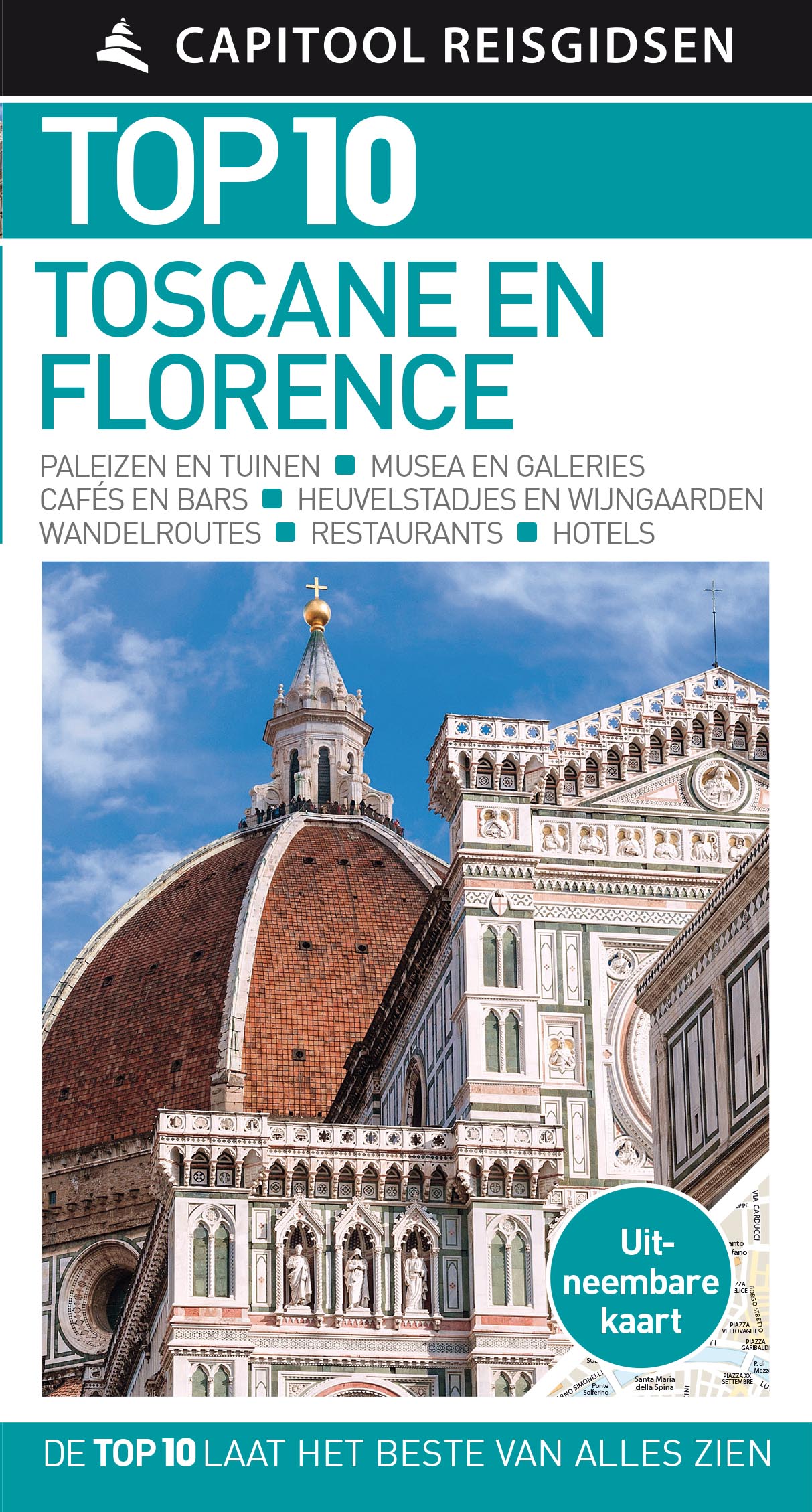
- Reisgids Capitool Top 10 Toscane en Florence | Unieboek
- Een compacte versie van de veel geprezen Capitool serie. Eigenlijk vergelijkbaar met veel illustraties, veel aandacht voor cultuur en bevolking en hier en daar praktische informatie. Kleine versie, handig in de binnenzak. Capitool Top 10 Toscane en Florence - Top 10 van onder andere de beste restaurants, de mooiste bezienswaardigheden en de... Read more
De Zwerver
Netherlands
2024
Netherlands
2024

De Zwerver
Netherlands
2023
Netherlands
2023
- Wandelgids 313 Toskana (Toscane) Süd | Rother Bergverlag
- Uitstekende wandelgids met een groot aantal dagtochten in dal en hooggebergte. Met praktische informatie en beperkt kaartmateriaal! Wandelingen in verschillende zwaarte weergegeven in rood/blauw/zwart Die Toskana ist einzigartig! Angesichts der geballten Konzentration von Historie, Kunst und Kultur kann kaum ein anderer Flecken in Europa... Read more
De Zwerver
Netherlands
2023
Netherlands
2023
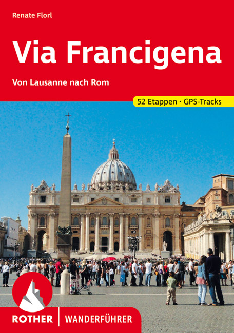
- Wandelgids - Pelgrimsroute Via Francigena - Lausanne naar Rome | Rother Bergverlag
- Von Lausanne nach Rom. 52 Etappen. Mit GPS-Daten Rother Wanderführer. 1., Auflage. Read more
De Zwerver
Netherlands
2021
Netherlands
2021
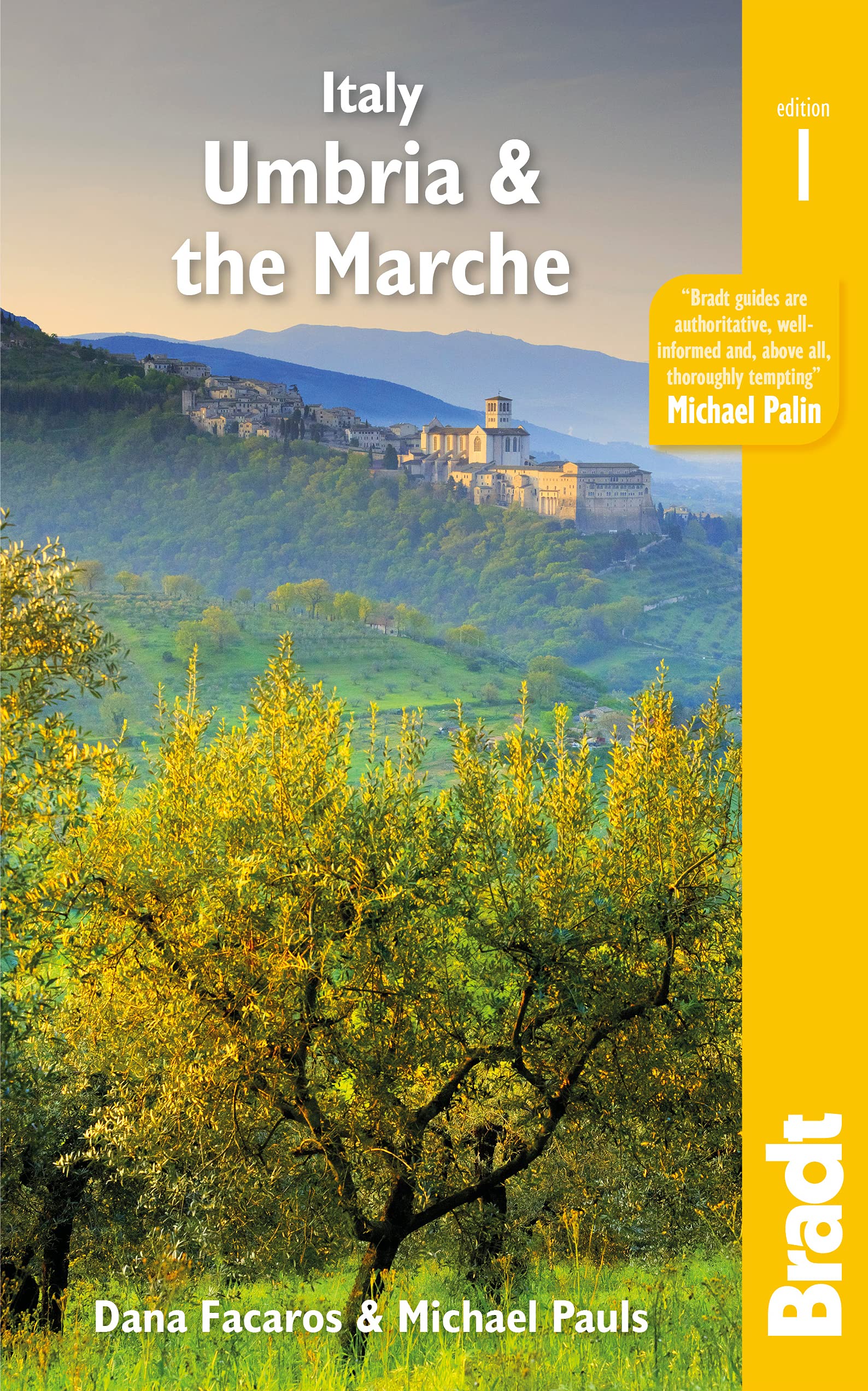
- Reisgids Italy: Umbria and the Marches | Bradt Travel Guides
- Bradt`s Umbria & the Marche is the most detailed guide to combine these two small central Italian regions, which offer all the beauty, history and culture of neighbouring Tuscany only without the crowds, the traffic or eye-popping prices. Dana Facaros and Michael Pauls (authors of the original Cadogan guide to the area) lived in Umbria in the... Read more
- Also available from:
- Stanfords, United Kingdom

Stanfords
United Kingdom
2021
United Kingdom
2021
- Italy: Umbria & The Marches
- Bradt`s Umbria & the Marche is the most detailed guide to combine these two small central Italian regions, which offer all the beauty, history and culture of neighbouring Tuscany only without the crowds, the traffic or eye-popping prices. Dana Facaros and Michael Pauls (authors of the original Cadogan guide to the area) lived in Umbria in the... Read more
Weitere Bücher…
Karten
- Also available from:
- Stanfords, United Kingdom

Stanfords
United Kingdom
United Kingdom
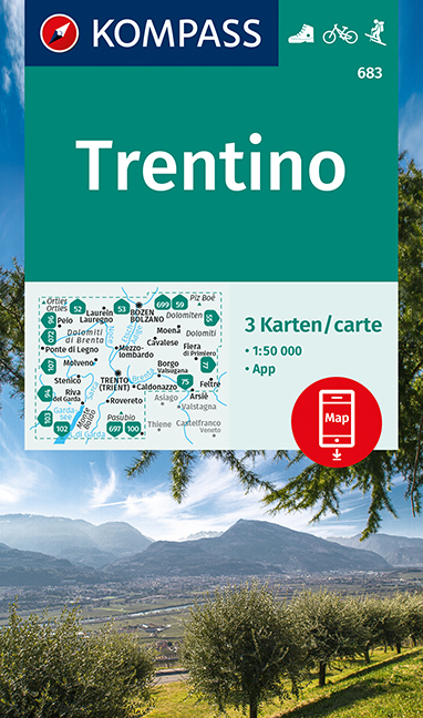
- Trentino 3-Map Set Kompass 683
- Trentino region of Italy on a set of three double-sided, GPS compatible and contoured maps at 1:50,000 from Kompass, with hiking trails, cycling, ski and horse riding routes, various recreational facilities, etc. The set provides very wide coverage of this popular part of Italy, extending from north of Bolzano southwards to include the northern... Read more
De Zwerver
Netherlands
2023
Netherlands
2023
- Also available from:
- Stanfords, United Kingdom

Stanfords
United Kingdom
United Kingdom
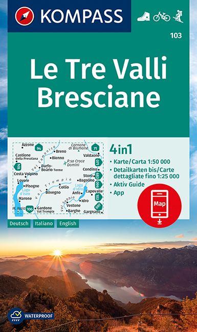
- Le Tre Valli Bresciane Kompass 103
- Map No. 103, Le Tre Valli Bresciane, from Kompass in a series of walking maps of selected areas of Italy at 1:50,000, with hiking routes on a topographic base, various types of accommodation, recreational facilities, places of interest, etc. Kompass are Europe’s largest publishers of walking maps, with extensive coverage of hiking areas in... Read more
De Zwerver
Netherlands
Netherlands
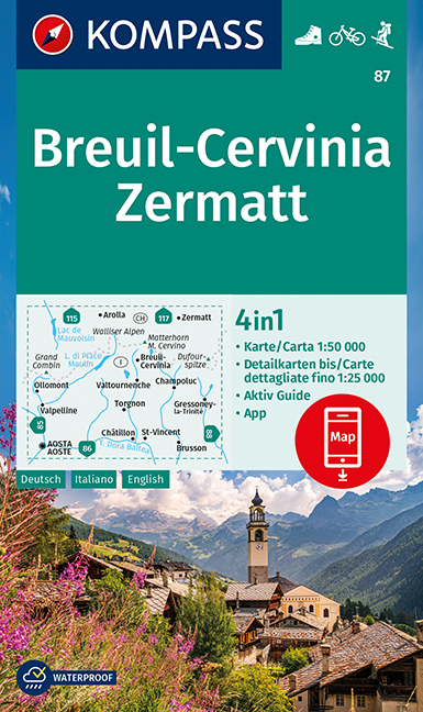
- Wandelkaart 87 Breuil-Cervinia - Zermatt | Kompass
- Breuil-Cervinia - Matterhorn - Zermatt area straddling the border of Italy and Switzerland on a GPS compatible hiking and recreational map at 1:50,000 from Kompass, printed on durable, waterproof and tear-resistant synthetic paper. Coverage extends north to Arolla and east to Monte Rosa, with Aosta in the south-western corner of the map, and... Read more
- Also available from:
- Stanfords, United Kingdom

Stanfords
United Kingdom
United Kingdom
- Breuil-Cervinia - Zermatt Kompass 87
- Breuil-Cervinia - Matterhorn - Zermatt area straddling the border of Italy and Switzerland on a GPS compatible hiking and recreational map at 1:50,000 from Kompass, printed on durable, waterproof and tear-resistant synthetic paper. Coverage extends north to Arolla and east to Monte Rosa, with Aosta in the south-western corner of the map, and... Read more
De Zwerver
Netherlands
Netherlands
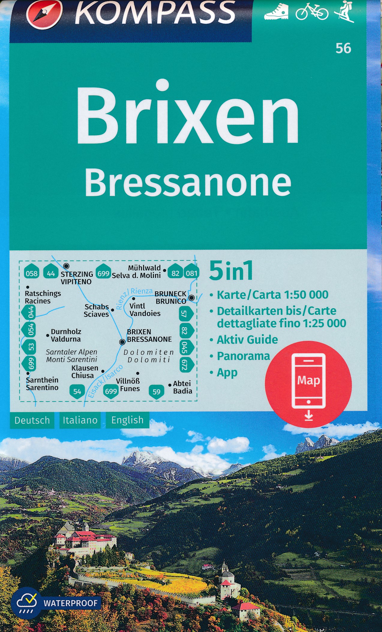
- Wandelkaart 56 Brixen - Bressanone | Kompass
- Bressanone/Brixen and its environs in the Dolomites on a GPS compatible hiking and recreational map at 1:50,000 from Kompass, printed on durable, waterproof and tear-resistant synthetic paper. KOMPASS HIKING MAPS OF ITALY: this title is part of an extensive series of walking maps from Kompass covering selected areas of Italy at mainly... Read more
- Also available from:
- Stanfords, United Kingdom

Stanfords
United Kingdom
United Kingdom
- Bressanone / Brixen Kompass 56
- Bressanone/Brixen and its environs in the Dolomites on a GPS compatible hiking and recreational map at 1:50,000 from Kompass, printed on durable, waterproof and tear-resistant synthetic paper. KOMPASS HIKING MAPS OF ITALY: this title is part of an extensive series of walking maps from Kompass covering selected areas of Italy at mainly... Read more
De Zwerver
Netherlands
Netherlands
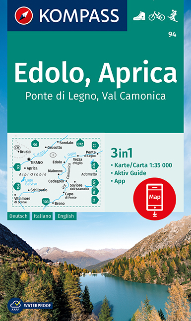
- Wandelkaart 94 Edolo - Aprica | Kompass
- Map No. 94, Edolo - Aprica, from Kompass in a series of walking maps of selected areas of Italy at 1:50,000, with hiking routes on a topographic base, various types of accommodation, recreational facilities, places of interest, etc. Kompass are Europe’s largest publishers of walking maps, with extensive coverage of hiking areas in other... Read more
- Also available from:
- Stanfords, United Kingdom

Stanfords
United Kingdom
United Kingdom
- Edolo - Aprica - Ponte di Legno - Val Camonica Kompass 94
- Map No. 94, Edolo - Aprica, from Kompass in a series of walking maps of selected areas of Italy at 1:50,000, with hiking routes on a topographic base, various types of accommodation, recreational facilities, places of interest, etc. Kompass are Europe’s largest publishers of walking maps, with extensive coverage of hiking areas in other... Read more
De Zwerver
Netherlands
Netherlands
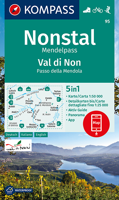
- Wandelkaart 95 Valle di Non/Nonstal | Kompass
- Valle di Non (Nonstal) area of the Dolomites west of Bolzano on a GPS compatible hiking and recreational map at 1:50,000 from Kompass.KOMPASS HIKING MAPS OF ITALY:This title is part of an extensive series of walking maps from Kompass covering selected areas of Italy at mainly 1:50,000, with a GPS compatible, contoured topographic base,... Read more
- Also available from:
- Stanfords, United Kingdom

Stanfords
United Kingdom
United Kingdom
- Valle di Non / Nonstal - Passo della Mendola / Mendelpass Kompass 95
- Valle di Non (Nonstal) area of the Dolomites west of Bolzano on a GPS compatible hiking and recreational map at 1:50,000 from Kompass.KOMPASS HIKING MAPS OF ITALY:This title is part of an extensive series of walking maps from Kompass covering selected areas of Italy at mainly 1:50,000, with a GPS compatible, contoured topographic base,... Read more
De Zwerver
Netherlands
Netherlands
De Zwerver
Netherlands
Netherlands
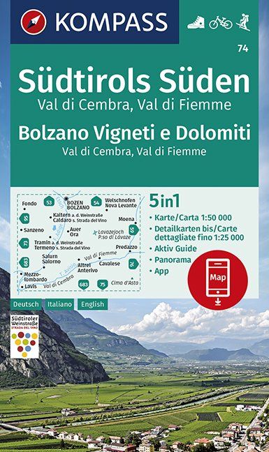
- Wandelkaart 74 Südtirols Süden - Bolzano Vigneti e Dolomiti | Kompass
- Map No. 74, Termeno/Tramin - Cavalese - with a panorama map on the reverse, from Kompass in a series of walking maps of selected areas of Italy at 1:50,000, with hiking routes on a topographic base, various types of accommodation, recreational facilities, places of interest, etc. Kompass are Europe’s largest publishers of walking maps, with... Read more
- Also available from:
- Stanfords, United Kingdom

Stanfords
United Kingdom
United Kingdom
- Bolzano Vignetei e Dolomiti / Southern South Tyrol Kompass 74
- Map No. 74, Termeno/Tramin - Cavalese - with a panorama map on the reverse, from Kompass in a series of walking maps of selected areas of Italy at 1:50,000, with hiking routes on a topographic base, various types of accommodation, recreational facilities, places of interest, etc. Kompass are Europe’s largest publishers of walking maps, with... Read more
De Zwerver
Netherlands
Netherlands
- Also available from:
- Stanfords, United Kingdom
Stanfords
United Kingdom
United Kingdom
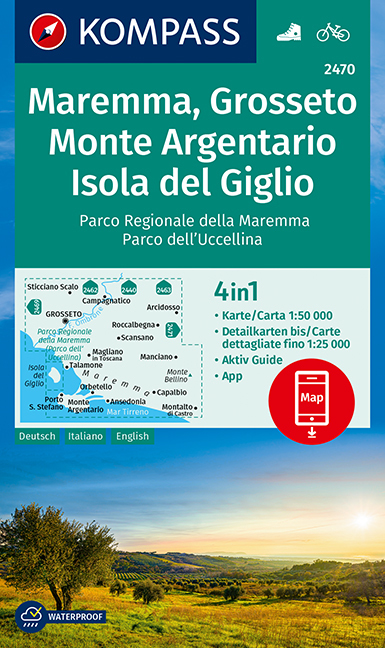
- Maremma - Grosseto - Monte Argentario - Isola di Giglio Kompass 2470
- Maremma - Grosseto - Monte Argentario - Isola di Giglio area on a double-sided map at 1:50,000 from Kompass, printed on durable, waterproof and tear-resistant synthetic paper. Coverage includes Parco Regionale della Maremma, Parco Naturale dell’Iccellina, Monte Bellino, etc. Contours are at 40m intervals, with a 2-km UTM grid. Extensive... Read more
De Zwerver
Netherlands
Netherlands
- Wegenkaart - landkaart Toscane Zuid - Toskana sud | Freytag & Berndt
- FuB Toskana Süd 1 : 200 000 World Compact Series ab 10.9 EURO 1:200. 000 freytag & berndt Auto + Freizeitkarten. Neuauflage, Laufzeit bis 2015. Read more