
Dolomiti
Beschreibung
Karte

Wanderwege Region
- Alta Via Dolomiti 1GPX
- Alta Via Dolomiti 10
- Alta Via Dolomiti 2GPX
- Alta Via Dolomiti 3GPX
- Alta Via Dolomiti 4GPX
- Alta Via Dolomiti 5
- Alta Via Dolomiti 6GPX
- Alta Via Dolomiti 7
- Alta Via Dolomiti 8
- Alta Via Dolomiti 9
- Südalpenweg - 3GPX
- Sentiero della PaceGPX
- Tiroler Höhenweg
- Traumpfad München-VenedigGPX
- Via AlpinaGPX
Links
Fakten
Berichte
Führer und Karten
Übernachtung
Organisationen
Reisebüros
GPS
Sonstiges
Bücher

The Book Depository
United Kingdom
2018
United Kingdom
2018
- The Karnischer Hohenweg
- A 1-2 week trek on the Carnic Peace Trail: Austria and Italy Read more
- Also available from:
- De Zwerver, Netherlands

De Zwerver
Netherlands
2018
Netherlands
2018
- Wandelgids Trekking the Karnischer Höhenweg | Cicerone
- English-language guidebook to the Karnischer Höhenweg, a 206km waymarked hut-to-hut trek along the border between Italy and Austria. Also known as the Carnic Peace Trail, it runs west to east along the Ridge of the Carnic Alps, the site of the WW1 front line. With information on planning your trip, accommodation and the history of the area. Read more

The Book Depository
United Kingdom
2022
United Kingdom
2022
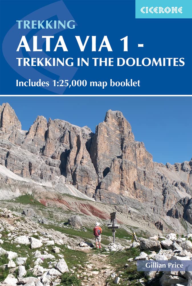
- Alta Via 1 - Trekking in the Dolomites
- Includes 1:25,000 map booklet Read more
- Also available from:
- De Zwerver, Netherlands
De Zwerver
Netherlands
2022
Netherlands
2022
- Wandelgids Alta Via 1 - Trekking in the Dolomites | Cicerone
- Includes 1:25,000 map booklet Read more

- Also available from:
- De Zwerver, Netherlands
- Stanfords, United Kingdom


Stanfords
United Kingdom
2021
United Kingdom
2021
- Lonely Planet Best Day Walks Italy
- Lonely Planet`s Best Day Walks Italy is your passport to 60 easy escapes into nature. Stretch your legs outside the city by picking a hike that works for you, from just a couple of hours to a full day, from easy to hard. Hike the Dolomites, explore the Italian Lakes, and stroll Sardinia`s coast. Get to the heart of Italy and begin your journey... Read more


The Book Depository
United Kingdom
2023
United Kingdom
2023
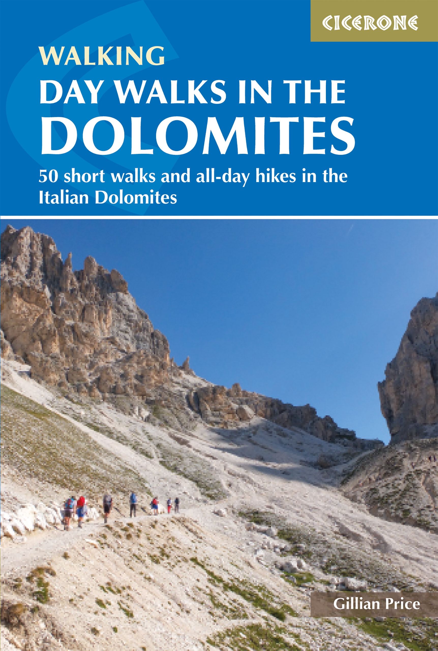
- Day Walks in the Dolomites
- 50 short walks and all-day hikes in the Italian Dolomites Read more
- Also available from:
- De Zwerver, Netherlands
De Zwerver
Netherlands
2023
Netherlands
2023
- Wandelgids Day Walks in the Dolomites - Dolomieten | Cicerone
- 50 short walks and all-day hikes in the Italian Dolomites Read more

The Book Depository
United Kingdom
2018
United Kingdom
2018
- Fastpacking
- Multi-day running adventures: tips, stories and route ideas Read more

The Book Depository
United Kingdom
2014
United Kingdom
2014
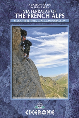
- Via Ferratas of the French Alps
- 66 routes between Geneva and Briancon Read more
- Also available from:
- De Zwerver, Netherlands
- Stanfords, United Kingdom
De Zwerver
Netherlands
2014
Netherlands
2014
- Wandelgids - Klimgids - Klettersteiggids Via Ferratas of the French Alps | Cicerone
- This guidebook covers 66 varied via ferratas in the French Alps. The routes are spread over six areas: Geneva and the Northern Alps, Chambéry, Tarentaise and Maurienne valleys, Grenoble and Briançon, amid the Mont Blanc, Vanoise and Queyras ranges. Difficulty ranges from easy, protected routes through to exposed, technical challenges. Read more

Stanfords
United Kingdom
2014
United Kingdom
2014
- French Alps - Via Ferratas - 66 Routes Between Geneva and Briançon
- Via Ferratas of the French Alps by Cicerone covers 66 varied routes across six areas: Geneva and the Northern Alps, Chambéry, Tarentaise and Maurienne valleys, Grenoble and Briançon, amid the Mont Blanc, Vanoise and Queyras ranges. Difficulty ranges from easy, protected routes through to exposed, technical challenges. The routes in this... Read more
De Zwerver
Netherlands
2022
Netherlands
2022
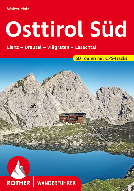
- Wandelgids Osttirol Süd | Rother Bergverlag
- Uitstekende wandelgids met een groot aantal dagtochten in dal en hooggebergte. Met praktische informatie en beperkt kaartmateriaal! Wandelingen in verschillende zwaarte weergegeven in rood/blauw/zwart. Osttirol liegt südlich der Hohen Tauern, der höchsten Alpenkette Österreichs, die so manche Regenfront aus dem Norden abhält. Von Süden her tun... Read more
De Zwerver
Netherlands
2020
Netherlands
2020
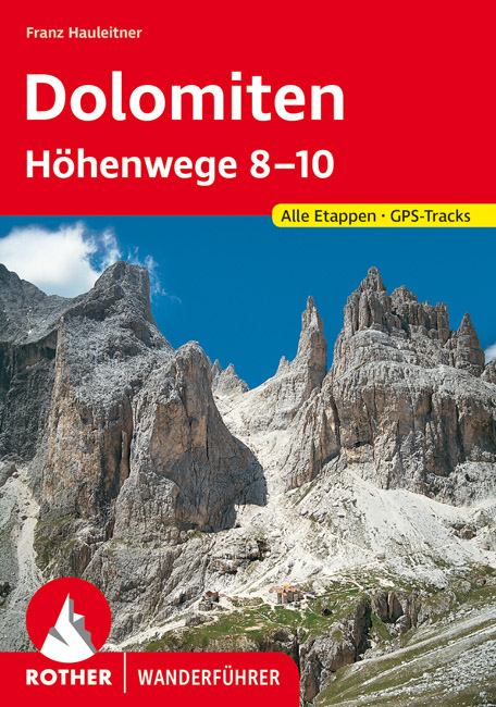
- Wandelgids Dolomiten-Höhenwege 8-10 (Dolomieten) | Rother Bergverlag
- Der Band ´´Dolomiten-Höhenwege 8-10´´ wurde grundlegend aktualisiert und überarbeitet. Es handelt sich dabei um vorwiegend leichte, teils aber auch anspruchsvolle Steige, die in 13 bis 18 Tagesetappen durch ständig wechselnde Landschaften und gewaltige Hochgebirgsszenerien mit eindrucksvollen Fernblicken führen: Der 160 km lange Höhenweg Nr. 8... Read more
De Zwerver
Netherlands
2021
Netherlands
2021
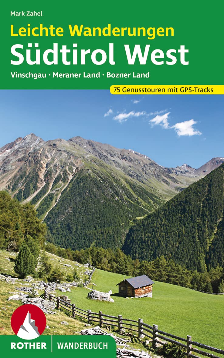
- Wandelgids Leichte Wanderungen Südtirol West - Dolomieten | Rother Bergverlag
- De ‘Rother Wanderbücher’ behandelen telkens de 50 mooiste wandelingen, die variëren van eenvoudige kindvriendelijke wandelingen tot routes die aanzienlijk meer ervaring vereisen. Uitvoerige routebeschrijvingen, een aantrekkelijke lay-out met vele kleurenfoto’s; niets aan duidelijkheid te wensen gelaten hoogteprofielen, kaartjes met de... Read more
De Zwerver
Netherlands
2022
Netherlands
2022
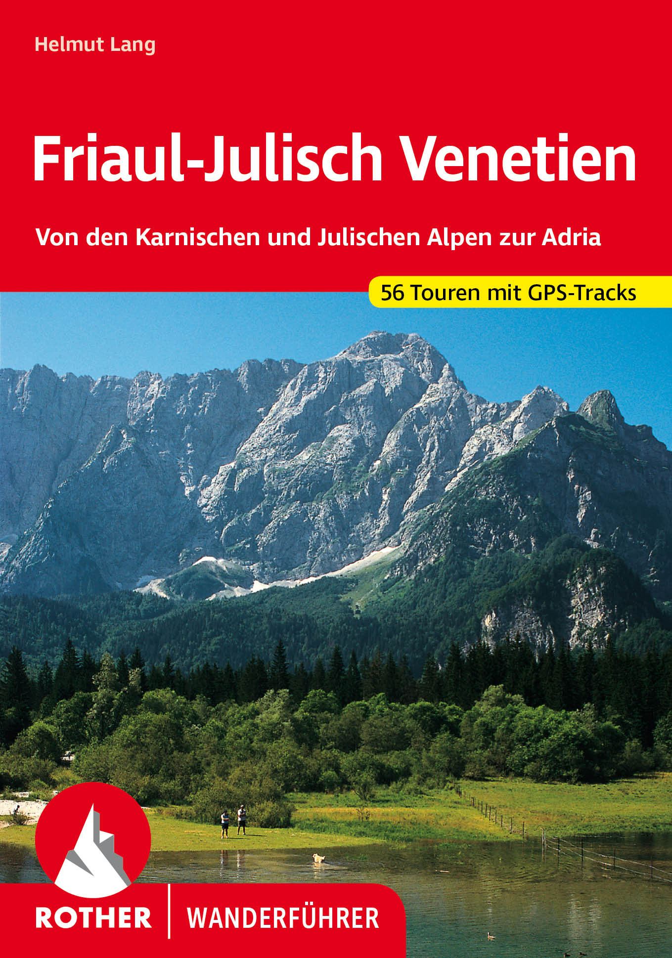
- Wandelgids 40 Friaul - Julisch Venetien - Venetië | Rother Bergverlag
- Duitstalige wandelgids met zeer goed beschreven wandelingen in de genoemde gebieden. Redelijk kaartmateriaal, vooral de beschrijving van de route en de praktische info die er bij hoort is meer dan goed. Over alle eilanden verspreid. Friaul-Julisch Venetien welch geheimnisvoller Zauber schwingt in diesen Worten mit! Sie bezeichnen eine Region im... Read more
Karten

The Book Depository
United Kingdom
United Kingdom
- Alpi Carniche Orientali / Canal del Ferro
- Alpi Carniche Orientali - Canal del Ferro area in a series of Tabacco maps at 1:25,000 covering the Dolomites and the mountains of north-eastern Italy - Stanfords Read more

The Book Depository
United Kingdom
United Kingdom
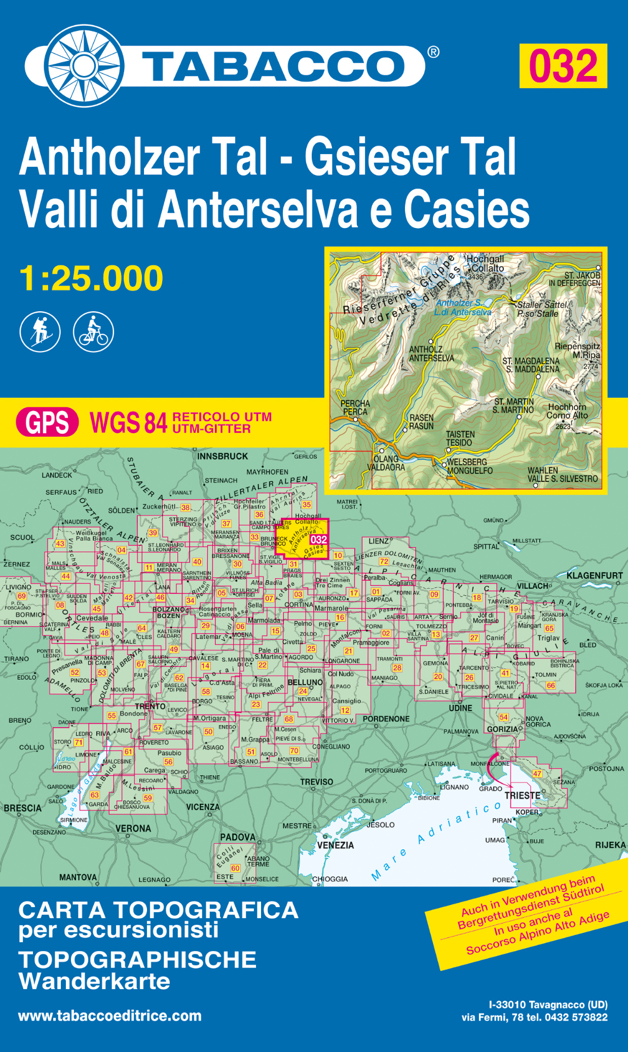
- Vallee di Anterselva / Casies
- Dolomiti di Braies/Pragser Dolomiten - Marebbe/Ennberg area in a series of Tabacco maps at 1:25,000 covering the Dolomites and the mountains of north-eastern Italy - Stanfords Read more
- Also available from:
- De Zwerver, Netherlands
- Stanfords, United Kingdom
De Zwerver
Netherlands
Netherlands
- Wandelkaart 032 Antholzer Tal - Gsieser Tal - Valli di Anterselva e Casies | Tabacco Editrice
- Dolomiti di Braies/Pragser Dolomiten - Marebbe/Ennberg area in a series of Tabacco maps at 1:25,000 covering the Dolomites and the mountains of north-eastern Italy - Stanfords Read more

Stanfords
United Kingdom
United Kingdom
- Val Anterselva / Antholz - Val Casies / Gsieser Tal Tabacco 032
- Dolomiti di Braies/Pragser Dolomiten - Marebbe/Ennberg area in a series of Tabacco maps at 1:25,000 covering the Dolomites and the mountains of north-eastern Italy - Stanfords’ most popular coverage for this region, with excellent cartography and extensive overprint for hiking routes and other recreational activities, local bus stops, etc.... Read more

The Book Depository
United Kingdom
United Kingdom
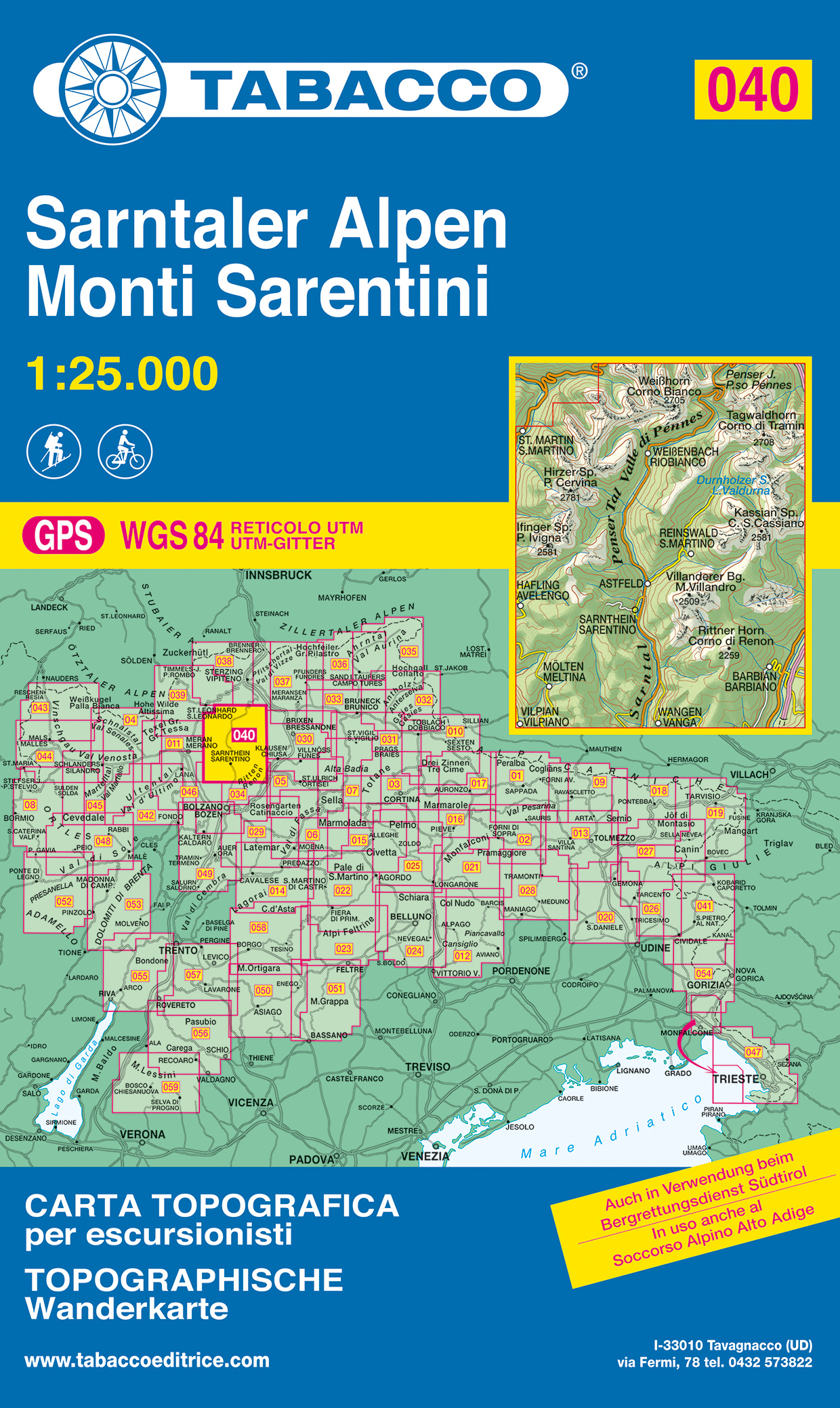
- Monti Sarentini
- Monti Sarentini/Sarntaler Alpen area in a series of Tabacco maps at 1:25,000 covering the Dolomites and the mountains of north-eastern Italy - Stanfords Read more
- Also available from:
- De Zwerver, Netherlands
- Stanfords, United Kingdom
De Zwerver
Netherlands
Netherlands
- Wandelkaart 040 Sarntaler Alpen - Monti Sarentini | Tabacco Editrice
- Monti Sarentini/Sarntaler Alpen area in a series of Tabacco maps at 1:25,000 covering the Dolomites and the mountains of north-eastern Italy - Stanfords Read more

Stanfords
United Kingdom
United Kingdom
- Monti Sarentini / Sarntaler Alpen Tabacco 040
- Monti Sarentini/Sarntaler Alpen area in a series of Tabacco maps at 1:25,000 covering the Dolomites and the mountains of north-eastern Italy - Stanfords’ most popular coverage for this region, with excellent cartography and extensive overprint for hiking routes and other recreational activities, local bus stops, etc. Additional overprint in... Read more

The Book Depository
United Kingdom
2022
United Kingdom
2022
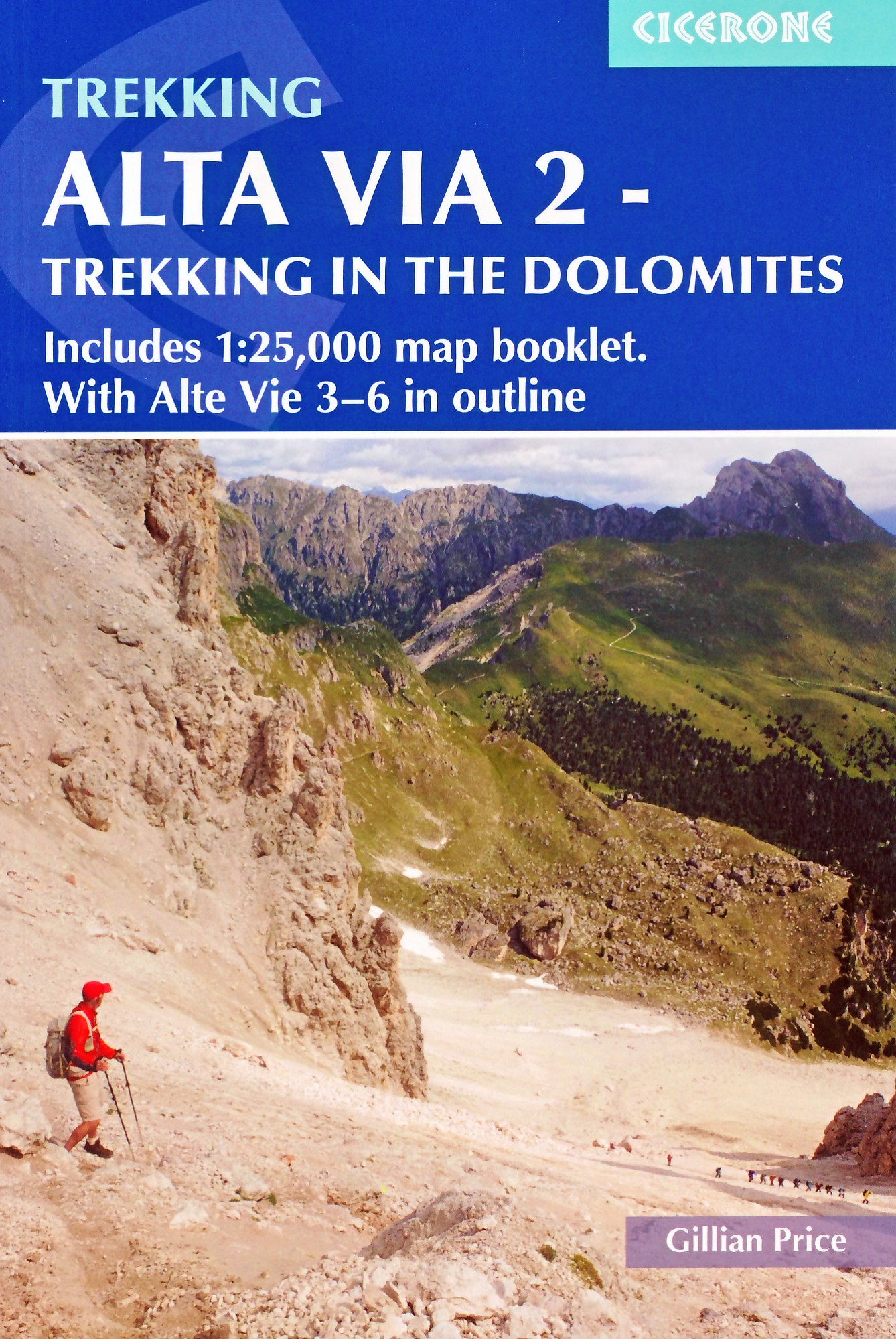
- Alta Via 2 - Trekking in the Dolomites
- Includes 1:25,000 map booklet. With Alta Vie 3-6 in outline Read more
- Also available from:
- De Zwerver, Netherlands
- Stanfords, United Kingdom
De Zwerver
Netherlands
2022
Netherlands
2022
- Wandelgids Alta Via 2 - Trekking in the Dolomites | Cicerone
- Guidebook describing Alta Via 2, a challenging hut-to-hut trek through the Italian Dolomites. Stretching 174km from Bressanone (Brixen) to Feltre, the route involves some aided and exposed sections (although several can be bypassed) calling for a sure foot and a good head for heights. It can be walked in under a fortnight - although it is also... Read more

Stanfords
United Kingdom
2022
United Kingdom
2022
- Alta Via 2 - Trekking in the Dolomites: Includes 1:25,000 map booklet. With Alta Vie 3-6 in outline
- Guidebook describing Alta Via 2, a challenging hut-to-hut trek through the Italian Dolomites. Stretching 174km from Bressanone (Brixen) to Feltre, the route involves some aided and exposed sections (although several can be bypassed) calling for a sure foot and a good head for heights. It can be walked in under a fortnight - although it is also... Read more

The Book Depository
United Kingdom
United Kingdom
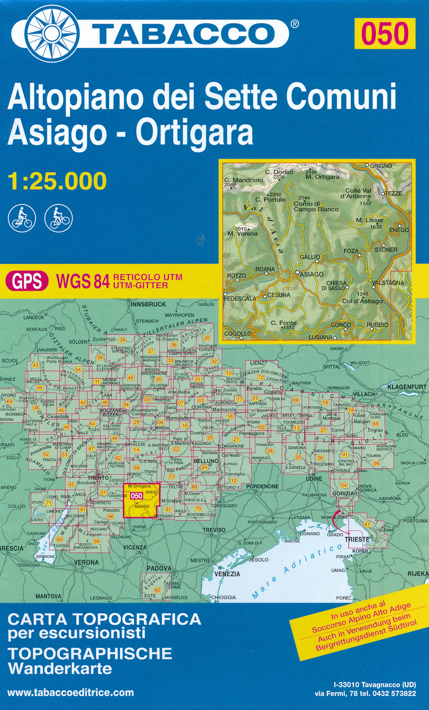
- Altopiano dei sette comuni
- Altopiano dei Sette Comuni - Asiago in a series of Tabacco maps at 1:25,000 covering the Dolomites and the mountains of north-eastern Italy - Stanfords’ most popular coverage for this region, with excellent cartography and extensive overprint for hiking routes and other recreational activities, local bus stops, etc. Additional overprint in this... Read more
- Also available from:
- De Zwerver, Netherlands
- Stanfords, United Kingdom
De Zwerver
Netherlands
Netherlands
- Wandelkaart 050 Altopiano dei Sette Comuni - Asiago - Ortigara | Tabacco Editrice
- Altopiano dei Sette Comuni - Asiago in a series of Tabacco maps at 1:25,000 covering the Dolomites and the mountains of north-eastern Italy - Stanfords’ most popular coverage for this region, with excellent cartography and extensive overprint for hiking routes and other recreational activities, local bus stops, etc. Additional overprint in this... Read more

Stanfords
United Kingdom
United Kingdom
- Altopiano dei Sette Comuni - Asiago - Ortigara Tabacco 050
- Altopiano dei Sette Comuni - Asiago in a series of Tabacco maps at 1:25,000 covering the Dolomites and the mountains of north-eastern Italy - Stanfords’ most popular coverage for this region, with excellent cartography and extensive overprint for hiking routes and other recreational activities, local bus stops, etc. Additional overprint in this... Read more

The Book Depository
United Kingdom
United Kingdom
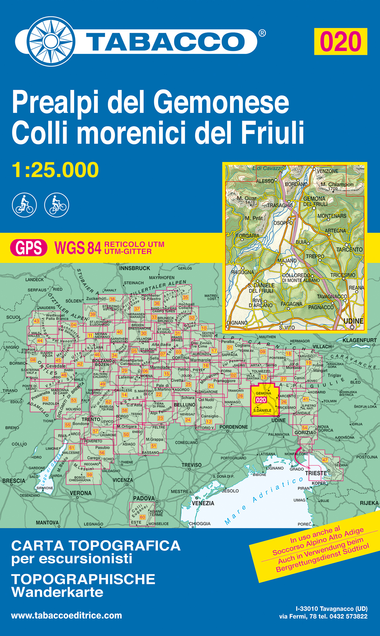
- Prealpi Carniche E Giulie
- Prealpi Carniche e Giuli de Gemonese area in a series of Tabacco maps at 1:25,000 covering the Dolomites and the mountains of north-eastern Italy - Stanfords Read more
- Also available from:
- De Zwerver, Netherlands
- Stanfords, United Kingdom
De Zwerver
Netherlands
Netherlands
- Wandelkaart 020 Prealpi del Gemonese - Colli morecini del Friuli | Tabacco Editrice
- Prealpi Carniche e Giuli de Gemonese area in a series of Tabacco maps at 1:25,000 covering the Dolomites and the mountains of north-eastern Italy - Stanfords Read more

Stanfords
United Kingdom
United Kingdom
- Prealpi Carniche e Giuli de Gemonese Tabacco 020
- Prealpi Carniche e Giuli de Gemonese area in a series of Tabacco maps at 1:25,000 covering the Dolomites and the mountains of north-eastern Italy - Stanfords’ most popular coverage for this region, with excellent cartography and extensive overprint for hiking routes and other recreational activities, local bus stops, etc. Additional overprint... Read more

The Book Depository
United Kingdom
United Kingdom
- Val Pusteria, Brunico 2017
- Val Pusteria/Pustertal - Brunico/Bruneck area in a series of Tabacco maps at 1:25,000 covering the Dolomites and the mountains of north-eastern Italy - Stanfords Read more
- Also available from:
- De Zwerver, Netherlands
- Stanfords, United Kingdom
De Zwerver
Netherlands
Netherlands
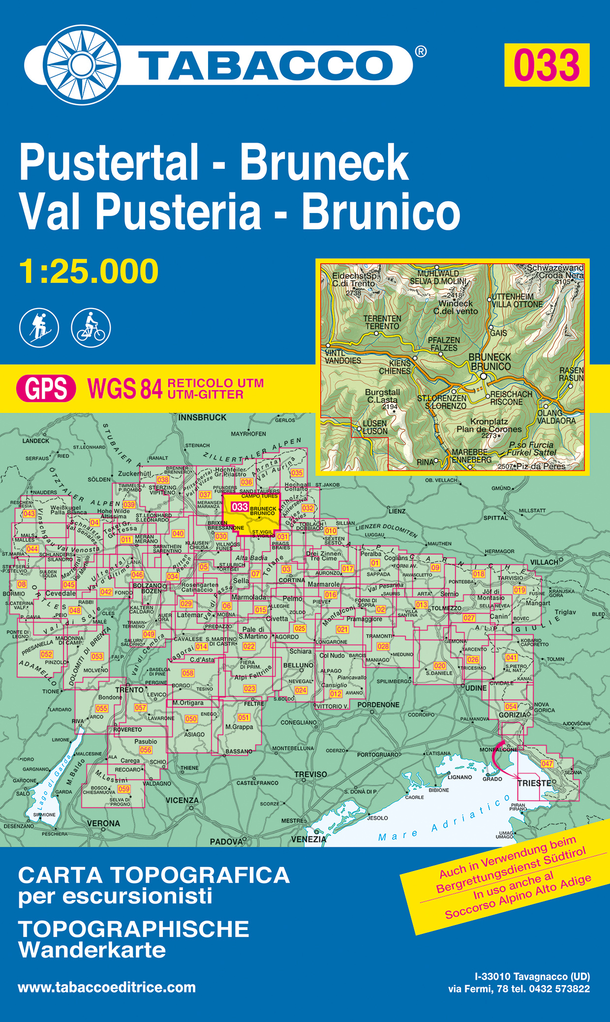
- Wandelkaart 033 Pustertal - Bruneck - Val Pusteria - Brunico | Tabacco Editrice
- Val Pusteria/Pustertal - Brunico/Bruneck area in a series of Tabacco maps at 1:25,000 covering the Dolomites and the mountains of north-eastern Italy - Stanfords Read more

Stanfords
United Kingdom
United Kingdom
- Val Pusteria / Pustertal - Brunico / Bruneck Tabacco 033
- Val Pusteria/Pustertal - Brunico/Bruneck area in a series of Tabacco maps at 1:25,000 covering the Dolomites and the mountains of north-eastern Italy - Stanfords’ most popular coverage for this region, with excellent cartography and extensive overprint for hiking routes and other recreational activities, local bus stops, etc. Additional... Read more

- Also available from:
- De Zwerver, Netherlands

The Book Depository
United Kingdom
2019
United Kingdom
2019
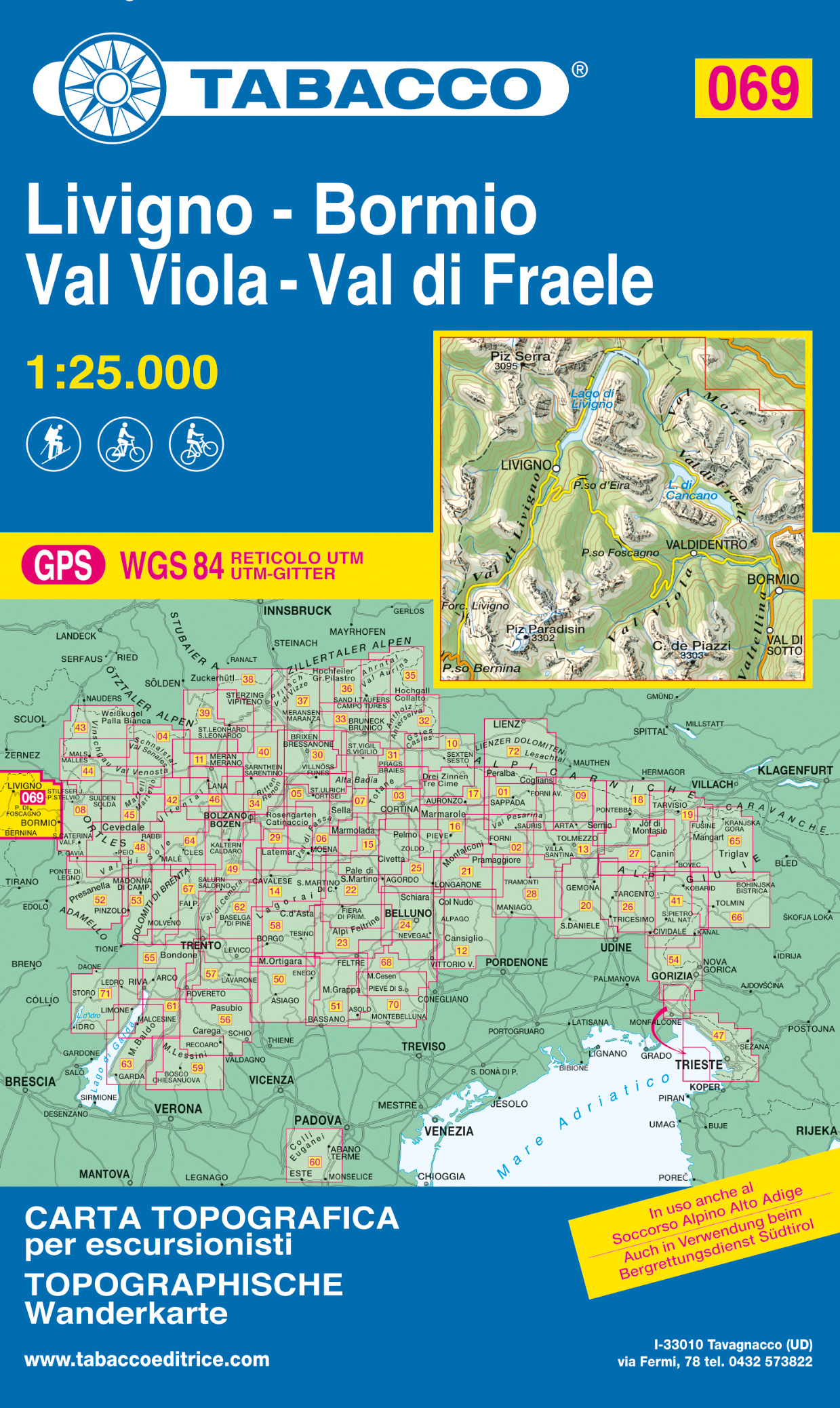
- Livigno / Bormio / Passo del Bernina
- De beste wandelkaarten voor de Dolomieten. Zeer veel topografische details met secure hoogtelijnen (25 meter interval), helder kleurgebruik en bijna alle Tabacco kaarten hebben een UTM grid (voor GPS toepasbaar). Daarnaast zijn op deze wandelkaarten wandelroutes ingetekend met nummering gelijk aan markering onderweg aangebracht door de lokale... Read more
- Also available from:
- De Zwerver, Netherlands
De Zwerver
Netherlands
2019
Netherlands
2019
- Wandelkaart 069 Livigno - Bormio - Val Viola - Val di Fraele | Tabacco Editrice
- De beste wandelkaarten voor de Dolomieten. Zeer veel topografische details met secure hoogtelijnen (25 meter interval), helder kleurgebruik en bijna alle Tabacco kaarten hebben een UTM grid (voor GPS toepasbaar). Daarnaast zijn op deze wandelkaarten wandelroutes ingetekend met nummering gelijk aan markering onderweg aangebracht door de lokale... Read more

The Book Depository
United Kingdom
United Kingdom
- Dolomiti di Sinistra Piave
- Dolomiti di Sinistra Piave area in a series of Tabacco maps at 1:25,000 covering the Dolomites and the mountains of north-eastern Italy - Stanfords Read more
- Also available from:
- De Zwerver, Netherlands
- Stanfords, United Kingdom
De Zwerver
Netherlands
Netherlands
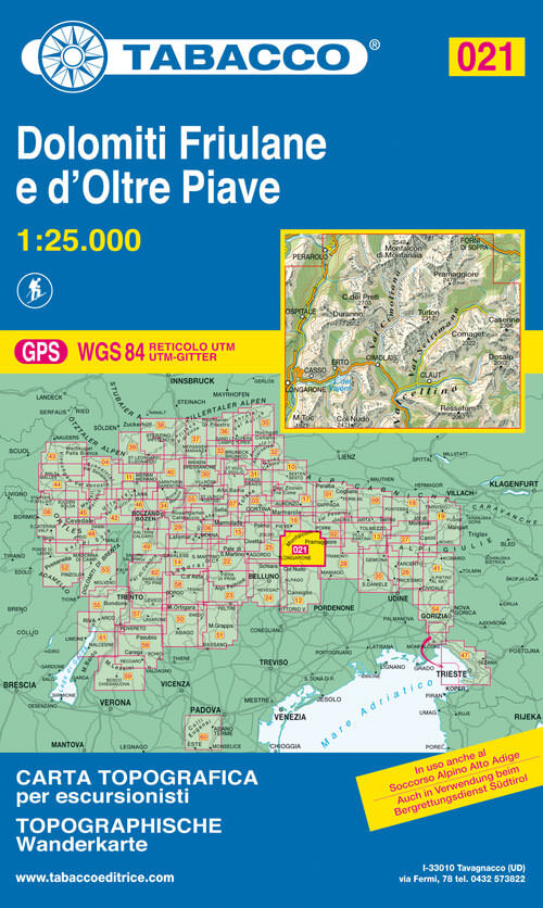
- Wandelkaart 021 Dolomiti Friulane e d'Oltre Piave | Tabacco Editrice
- Dolomiti di Sinistra Piave area in a series of Tabacco maps at 1:25,000 covering the Dolomites and the mountains of north-eastern Italy - Stanfords Read more

Stanfords
United Kingdom
United Kingdom
- Dolomiti di Sinistra Piave Tabacco 021
- Dolomiti di Sinistra Piave area in a series of Tabacco maps at 1:25,000 covering the Dolomites and the mountains of north-eastern Italy - Stanfords’ most popular coverage for this region, with excellent cartography and extensive overprint for hiking routes and other recreational activities, local bus stops, etc. Additional overprint in this... Read more

The Book Depository
United Kingdom
United Kingdom
- Bolzano, Renon 2021
- Bolzano/Bozen - Renon/Ritten area in a series of Tabacco maps at 1:25,000 covering the Dolomites and the mountains of north-eastern Italy - Stanfords Read more
- Also available from:
- Stanfords, United Kingdom

Stanfords
United Kingdom
United Kingdom
- Bolzano / Bozen - Renon / Ritten Tabacco 034
- Bolzano/Bozen - Renon/Ritten area in a series of Tabacco maps at 1:25,000 covering the Dolomites and the mountains of north-eastern Italy - Stanfords’ most popular coverage for this region, with excellent cartography and extensive overprint for hiking routes and other recreational activities, local bus stops, etc. Additional overprint in this... Read more

The Book Depository
United Kingdom
United Kingdom
- Alta Val Venosta
- Alta Val Venosta/Vinschgauer Oberland area in a series of Tabacco maps at 1:25,000 covering the Dolomites and the mountains of north-eastern Italy - Stanfords Read more

The Book Depository
United Kingdom
2021
United Kingdom
2021
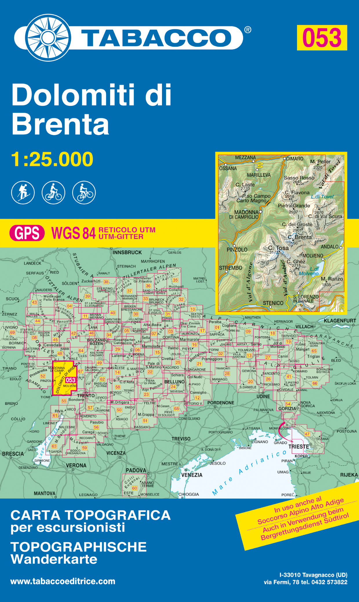
- Dolomiti di Brenta 2021
- Dolomiti di Brenta area in a series of Tabacco maps at 1:25,000 covering the Dolomites and the mountains of north-eastern Italy - Stanfords Read more
- Also available from:
- De Zwerver, Netherlands
- Stanfords, United Kingdom
De Zwerver
Netherlands
2021
Netherlands
2021
- Wandelkaart 053 Dolomiti di Brenta | Tabacco Editrice
- Dolomiti di Brenta area in a series of Tabacco maps at 1:25,000 covering the Dolomites and the mountains of north-eastern Italy - Stanfords Read more

Stanfords
United Kingdom
2021
United Kingdom
2021
- Dolomiti di Brenta Tabacco 053
- Dolomiti di Brenta area in a series of Tabacco maps at 1:25,000 covering the Dolomites and the mountains of north-eastern Italy - Stanfords’ most popular coverage for this region, with excellent cartography and extensive overprint for hiking routes and other recreational activities, local bus stops, etc. Additional overprint in this title shows... Read more

- Also available from:
- De Zwerver, Netherlands
De Zwerver
Netherlands
2022
Netherlands
2022

The Book Depository
United Kingdom
United Kingdom
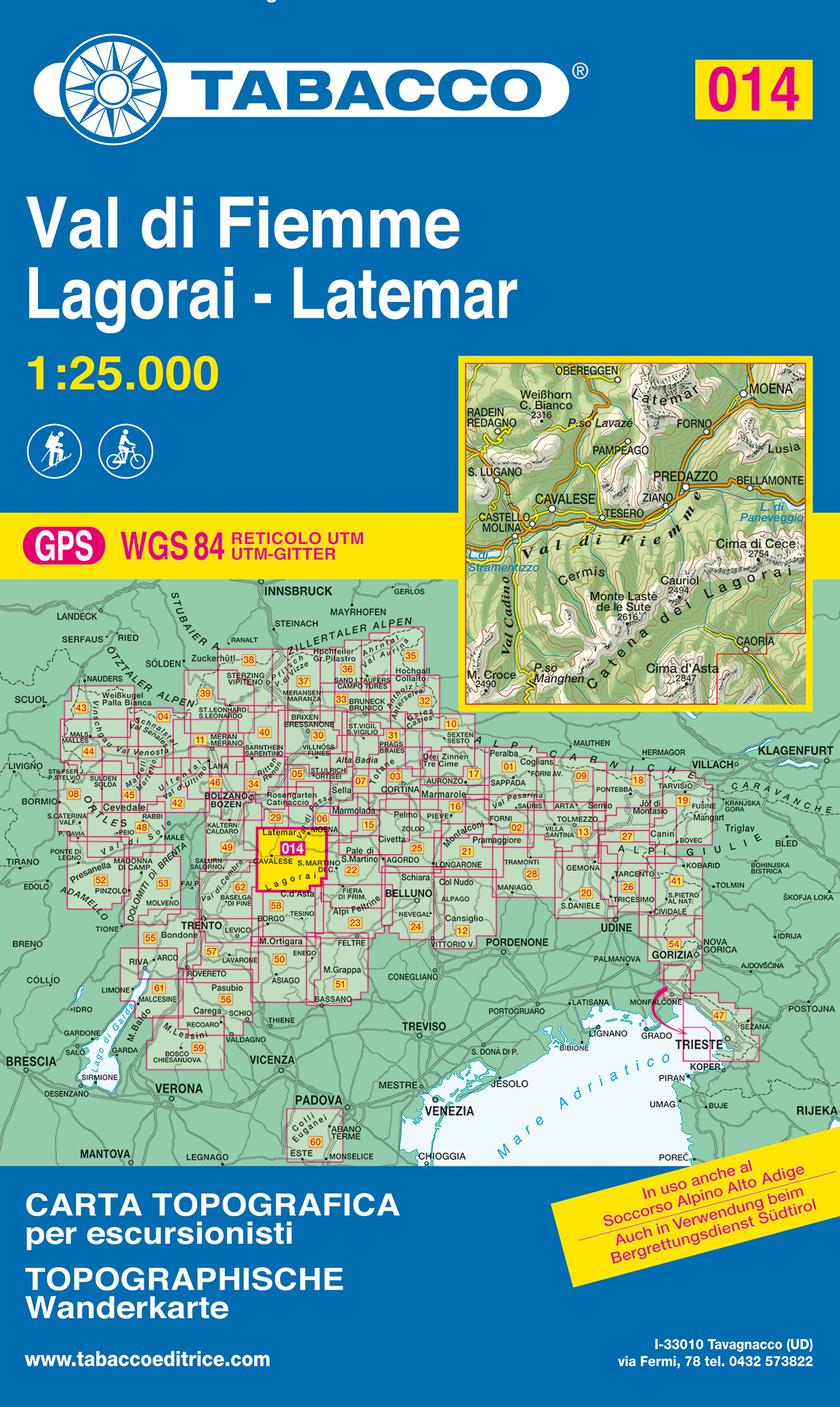
- Val di Fiemme, Lagorai
- De beste wandelkaarten voor de Dolomieten. Zeer veel topografische details met secure hoogtelijnen (25 meter interval), helder kleurgebruik en bijna alle Tabacco kaarten hebben een UTM grid (voor GPS toepasbaar). Daarnaast zijn op deze wandelkaarten wandelroutes ingetekend met nummering gelijk aan markering onderweg aangebracht door de lokale... Read more
- Also available from:
- De Zwerver, Netherlands
- Stanfords, United Kingdom
De Zwerver
Netherlands
Netherlands
- Wandelkaart 014 Val di Fiemme - Lagorai - Latemar | Tabacco Editrice
- De beste wandelkaarten voor de Dolomieten. Zeer veel topografische details met secure hoogtelijnen (25 meter interval), helder kleurgebruik en bijna alle Tabacco kaarten hebben een UTM grid (voor GPS toepasbaar). Daarnaast zijn op deze wandelkaarten wandelroutes ingetekend met nummering gelijk aan markering onderweg aangebracht door de lokale... Read more

Stanfords
United Kingdom
United Kingdom
- Val di Fiemme - Lagorai - Latemar Tabacco 014
- Val di Fiemme - Lagorai – Latemar area in a series of Tabacco maps at 1:25,000 covering the Dolomites and the mountains of north-eastern Italy - Stanfords’ most popular coverage for this region, with excellent cartography and extensive overprint for hiking routes and other recreational activities, local bus stops, etc. Additional overprint in... Read more