
Haute Savoie
Beschreibung
Wanderwege Region
Links
Fakten
Berichte
Führer und Karten
Übernachtung
Organisationen
Reisebüros
GPS
Sonstiges
Bücher


- Also available from:
- De Zwerver, Netherlands

De Zwerver
Netherlands
2021
Netherlands
2021

The Book Depository
United Kingdom
2018
United Kingdom
2018
- The GR5 Trail - Benelux and Lorraine
- The North Sea to Schirmeck in the Vosges mountains Read more
- Also available from:
- De Zwerver, Netherlands

De Zwerver
Netherlands
2018
Netherlands
2018
- Wandelgids The GR5 Trail Benelux and Lorraine | Cicerone
- Guidebook to walking the northern section of the GR5 - 1000km starting in Hoek van Holland and passing through the Netherlands, Belgium, Luxembourg and Lorraine to Schirmeck in France. A long-distance route covering a variety of cultures and landscapes. The full GR5 from the North Sea to the Mediterranean is one of the world's greatest trails. Read more

The Book Depository
United Kingdom
2020
United Kingdom
2020
- Tour du Mont Blanc
- The most iconic long-distance, circular trail in the Alps with customised itinerary planning for walkers, trekkers, fastpackers and trail runners Read more
- Also available from:
- De Zwerver, Netherlands
- Stanfords, United Kingdom
De Zwerver
Netherlands
2020
Netherlands
2020
- Wandelgids Tour du Mont Blanc | Vertebrate Publishing
- The most iconic long-distance, circular trail in the Alps with customised itinerary planning for walkers, trekkers, fastpackers and trail runners Read more

Stanfords
United Kingdom
2020
United Kingdom
2020
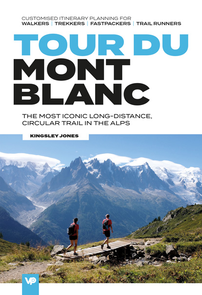
- Tour du Mont Blanc: The most iconic long-distance, circular trail in the Alps with customised itinerary planning for walkers, trekkers, fastpackers and trail runners
- Tour du Mont Blanc is the definitive guidebook for one of the most famous long-distance treks in the world. This trek circles the entire Mont Blanc massif, passing through spectacular scenery in France, Italy and Switzerland. You`ll traverse high mountain passes, see stunning glaciers, pass azure lakes, wander through tranquil green valleys and... Read more

The Book Depository
United Kingdom
2022
United Kingdom
2022
- Also available from:
- De Zwerver, Netherlands


- Also available from:
- Stanfords, United Kingdom

Stanfords
United Kingdom
2021
United Kingdom
2021
- Tour des Monts d`Aubrac GRP/GR60/GR6
- Tour des Monts d`Aubrac, FFRP topoguide Ref. No. 616, covering 259kms of hiking circuits in the Massif Central along the GR6, GR60 and GR65. Current edition of this title was published in May 2016.ABOUT THE FFRP (Fédération française de la randonnée pédestre) TOPOGUIDES: published in a handy A5 paperback format, the guides are the best... Read more

The Book Depository
United Kingdom
2020
United Kingdom
2020
- Tour du Mont Blanc
- Easy-to-use folding map and essential information, with custom itinerary planning for walkers, trekkers, fastpackers and trail runners Read more
- Also available from:
- De Zwerver, Netherlands
- Stanfords, United Kingdom
De Zwerver
Netherlands
2020
Netherlands
2020
- Wandelkaart Tour du Mont Blanc Guidemap | Vertebrate Publishing
- Easy-to-use folding map and essential information, with custom itinerary planning for walkers, trekkers, fast packers and trail runners Read more

Stanfords
United Kingdom
2020
United Kingdom
2020
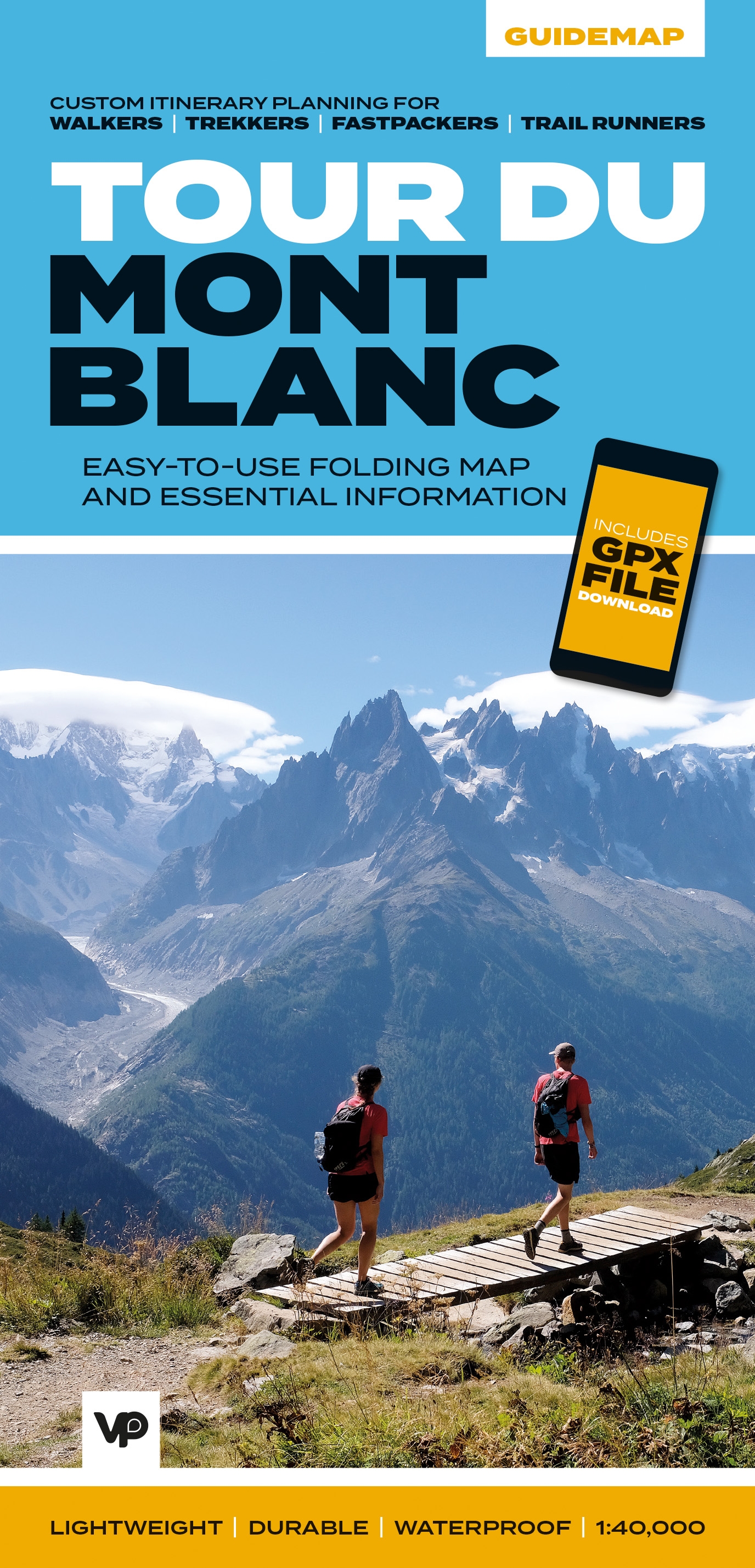
- Tour du Mont Blanc - Easy-to-use Folding Map and Essential Information
- The white dome of Mont Blanc looms over France, Italy and Switzerland, and it is no wonder that the 169-kilometre Tour du Mont Blanc (TMB) has captured the public imagination to become one of Europe`s most popular long-distance trails. The TMB appeals to people who have different levels of experience and travel at all speeds, and this... Read more


The Book Depository
United Kingdom
2019
United Kingdom
2019
- Tour du Mont Blanc
- The World's most famous trek - everything you need to know to plan and walk it Read more
- Also available from:
- De Zwerver, Netherlands
- Stanfords, United Kingdom
De Zwerver
Netherlands
2019
Netherlands
2019
- Wandelgids Tour Du Mont Blanc | Knife Edge Outdoor
- The World's most famous trek - everything you need to know to plan and walk it Read more

Stanfords
United Kingdom
2019
United Kingdom
2019
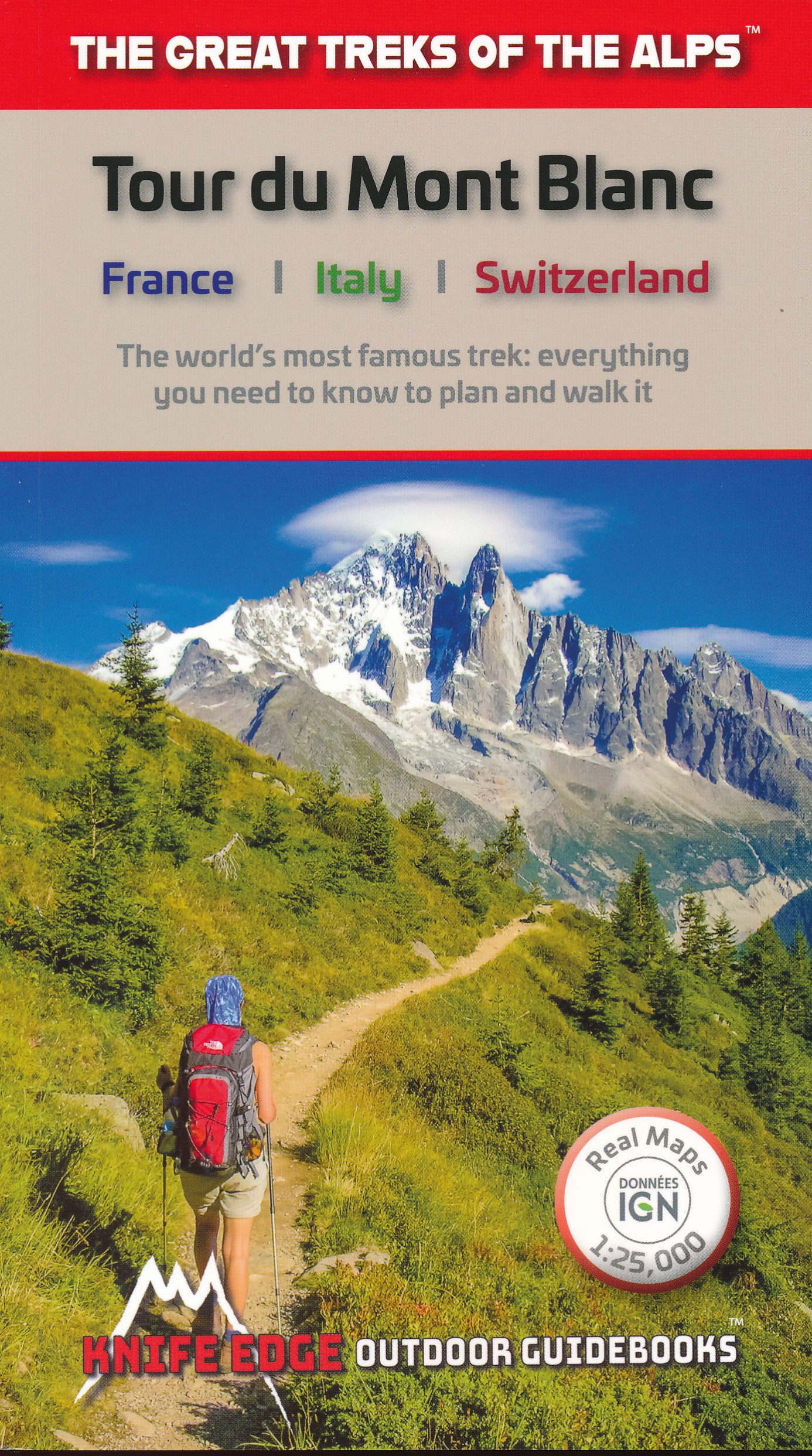
- Tour du Mont Blanc: The World`s most famous trek - everything you need to know to plan and walk it
- The world`s most famous trek: everything you need to know to plan and walk the Tour du Mont Blanc which starts near Chamonix. An epic journey around the mighty Mont Blanc, the highest peak in the Alps. 174km; 7-12 days; 9700m of altitude gain; 14 mountain passes; 3 countries, France, Italy and Switzerland. Unspoilt and remote high mountain... Read more

The Book Depository
United Kingdom
2022
United Kingdom
2022
- Camino de Santiago - Via Podiensis
- Le Puy to the Pyrenees on the GR65 Read more
- Also available from:
- De Zwerver, Netherlands

De Zwerver
Netherlands
2022
Netherlands
2022
- Wandelgids Camino de Santiago - Via Podiensis GR65 | Cicerone
- Le Puy to the Pyrenees on the GR65 Read more
De Zwerver
Netherlands
2022
Netherlands
2022
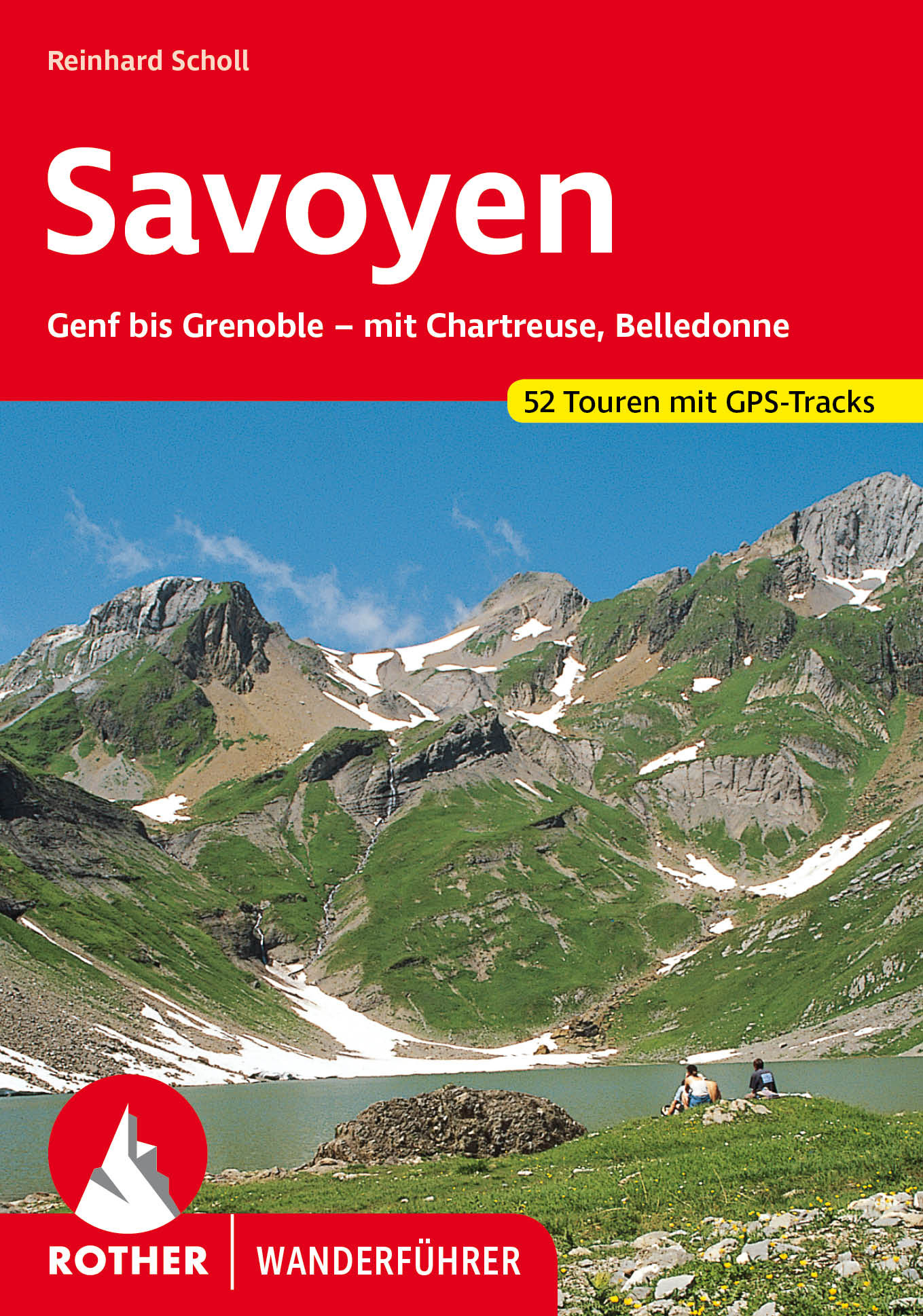
- Wandelgids 84 Savoie - Savoyen | Rother Bergverlag
- Uitstekende wandelgids met een groot aantal dagtochten in dal en hooggebergte. Met praktische informatie en beperkt kaartmateriaal! Wandelingen in verschillende zwaarte weergegeven in rood/blauw/zwart. Savoyen, zwischen Genfer See und Grenoble, ist ein Wandergebiet par excellence, ein Gebiet, in dem das tiefe Grün der Wälder mit dem sanften... Read more

De Zwerver
Netherlands
2021
Netherlands
2021

De Zwerver
Netherlands
2014
Netherlands
2014
- Wandelgids 901 Tours et traversées dans l'Ain GR9, GR9A, GR59 | FFRP
- Guide FFRandonnée Tours et Traversée dans l'ain. GR 59, 9, 9A. Etangs de la Dombes, monts et cluses du Revermont ou bocages de la Bresse. Plus de 50 jours de randonnée.Depuis les Monts du Jura, du Revermont ou du Bugey, ces itinéraires en boucle ou en ligne offrent aux randonneurs des vues imprenables. voici à l'est le Mont Blanc et les... Read more
- Also available from:
- Stanfords, United Kingdom

Stanfords
United Kingdom
2014
United Kingdom
2014
- GR59/GR9/GRP: Tours et Traversées de l`Ain FFRP Topo-guide No. 901
- Tours et Traversées de l`Ain, FFRP topoguide, Ref. No. 901, covering in all 949km of hiking trails in the French Jura between Lons-le-Saunier and the confluence of the Ain and the Rhône, including sections of GR 5, 9 and 9A. Current edition of this title was published in June 2014.ABOUT THE FFRP (Fédération française de la randonnée pédestre)... Read more

De Zwerver
Netherlands
2022
Netherlands
2022
Karten

The Book Depository
United Kingdom
United Kingdom
- Leman et Mont Blanc entre - Chablais Faucigny
- Selected tourist regions of the France on GPS compatible, contoured TOP 75 maps at 1:75,000 from the IGN, highlighting local and long-distance hiking paths, cycling routes and sites for other recreational activities. Each title includes five large panels with mapping at 1:25,000 to cover its most popular areas in greater detail. Cartography of... Read more
- Also available from:
- De Zwerver, Netherlands
- Stanfords, United Kingdom

De Zwerver
Netherlands
Netherlands
- Fietskaart - Wandelkaart 07 Entre Léman et Mont Blanc | IGN - Institut Géographique National
- Selected tourist regions of the France on GPS compatible, contoured TOP 75 maps at 1:75,000 from the IGN, highlighting local and long-distance hiking paths, cycling routes and sites for other recreational activities. Each title includes five large panels with mapping at 1:25,000 to cover its most popular areas in greater detail. Cartography of... Read more

Stanfords
United Kingdom
United Kingdom
- Lake Geneva and Mont Blanc IGN 75007
- Selected tourist regions of the France on GPS compatible, contoured TOP 75 maps at 1:75,000 from the IGN, highlighting local and long-distance hiking paths, cycling routes and sites for other recreational activities. Each title includes five large panels with mapping at 1:25,000 to cover its most popular areas in greater detail. Cartography of... Read more

The Book Depository
United Kingdom
2020
United Kingdom
2020
- Tour et travers�es du Massif des Bauges GR96/GRP
- Tours et Traversées du Massif des Bauges, FFRP topoguide Ref. no. 902, covering 500kms of routes in the French Alps between Annecy, Aix-les-Bains, Chambéry and Albertville. Current edition of this title was published in May 2015.ABOUT THE FFRP (Fédération française de la randonnée pédestre) TOPOGUIDES: published in a handy A5 paperback format,... Read more
- Also available from:
- Stanfords, United Kingdom
Stanfords
United Kingdom
2020
United Kingdom
2020
- Tours et Traversées du Massif des Bauges GR96
- Tours et Traversées du Massif des Bauges, FFRP topoguide Ref. no. 902, covering 500kms of routes in the French Alps between Annecy, Aix-les-Bains, Chambéry and Albertville. Current edition of this title was published in May 2015.ABOUT THE FFRP (Fédération française de la randonnée pédestre) TOPOGUIDES: published in a handy A5 paperback format,... Read more

- Also available from:
- De Zwerver, Netherlands


The Book Depository
United Kingdom
2020
United Kingdom
2020
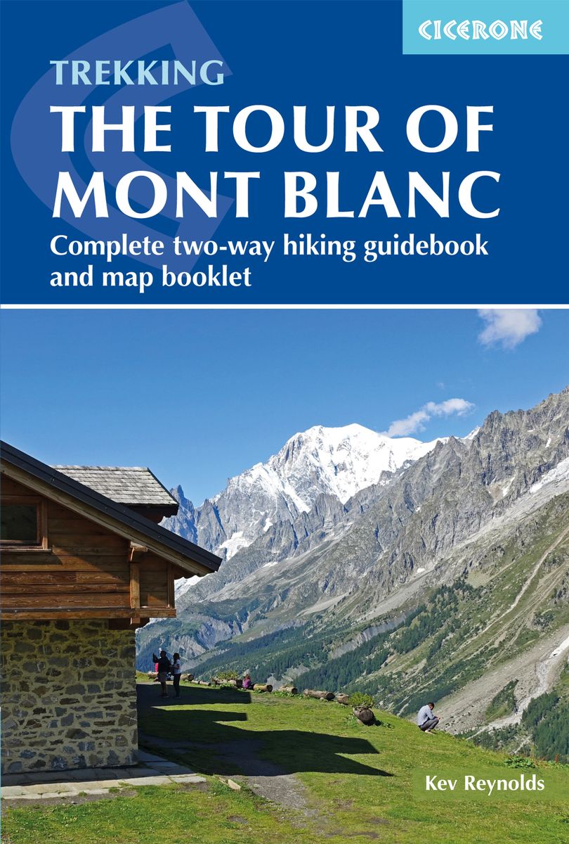
- Trekking the Tour of Mont Blanc
- Complete two-way hiking guidebook and map booklet Read more
- Also available from:
- De Zwerver, Netherlands
- Stanfords, United Kingdom
De Zwerver
Netherlands
2020
Netherlands
2020
- Wandelgids Tour of Mont Blanc | Cicerone
- The Tour of Mont Blanc is one of the world`s classic treks. This guidebook to hiking the 170km TMB contains in-depth route description and mapping for both the classic 11 day anti-clockwise circuit and an alternative 10 day clockwise circuit. This well-signed but demanding route, starting from Les Houches or Champex, is suitable for fit... Read more

Stanfords
United Kingdom
2020
United Kingdom
2020
- Trekking the Tour of Mont Blanc: Complete two-way hiking guidebook and map booklet
- The Tour of Mont Blanc is one of the world`s classic treks. This guidebook to hiking the 170km TMB contains in-depth route description and mapping for both the classic 11 day anti-clockwise circuit and an alternative 10 day clockwise circuit. This well-signed but demanding route, starting from Les Houches or Champex, is suitable for fit... Read more

De Zwerver
Netherlands
2020
Netherlands
2020
- Wandelatlas - Pelgrimsroute (kaart) 161 Chemins de Compostelle GR65 | Michelin
- Véritable petit atlas détaillant chaque étape avec indications précises concernant les villes de départ et d'arrivée ainsi que pour les localités traversées (auberges, refuges, restaurants, pharmacies, gare, épiceries, Km parcourus, Km restants....).Ce petit atlas suit le chemin du... Read more


De Zwerver
Netherlands
2014
Netherlands
2014
- Wandelkaart 07 Mercantour & Alpi-Maritieme | Didier Richard
- Mercantour National Park and the Maritime Alps on a large, double-sided, contoured and GPS compatible map from Editions Didier Richard highlighting local walking trails and long-distance hiking routes including the GR5. Coverage extends from well north of Col de Larch to Sospel, Levens and Roquestéron in the mountains north of the French... Read more
- Also available from:
- Stanfords, United Kingdom

Stanfords
United Kingdom
2014
United Kingdom
2014
- Mercantour & Alpi-Marittime Didier Richard 07
- Mercantour National Park and the Maritime Alps on a large, double-sided, contoured and GPS compatible map from Editions Didier Richard highlighting local walking trails and long-distance hiking routes including the GR5. Coverage extends from well north of Col de Larch to Sospel, Levens and Roquestéron in the mountains north of the French... Read more

De Zwerver
Netherlands
Netherlands
- Wandelkaart 05 Outdoorkarte FR Elsass - Colmar - Sélestat - Elzas | Kümmerly & Frey
- The central part of Alsace around Colmar and Sélestat on a GPS compatible, double-sided map at 1:50,000 from Kümmerly+Frey printed on sturdy, waterproof and tear-resistant synthetic paper; contoured, with hiking and cycling routes, sites for other recreational activities, various accommodation options, restaurants and ferme-auberge locations,... Read more
- Also available from:
- Stanfords, United Kingdom

Stanfords
United Kingdom
United Kingdom
- Alsace - Colmar - Sélestat - Freiburg im Breisgau - Lahr K+F Outdoor Map 5
- The central part of Alsace around Colmar and Sélestat on a GPS compatible, double-sided map at 1:50,000 from Kümmerly+Frey printed on sturdy, waterproof and tear-resistant synthetic paper; contoured, with hiking and cycling routes, sites for other recreational activities, various accommodation options, restaurants and ferme-auberge locations,... Read more
De Zwerver
Netherlands
Netherlands
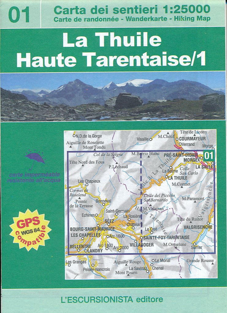
- Wandelkaart 01 La Thuile - Haute Tarentaise | L'Escursionista editore
- Dit is een grensoverschrijdende kaart net ten zuiden van het Mont Blanc gebied. Voor weinig gebieden in Italië zijn echt goede wandelkaarten beschikbaar. Dit is gelukkig zo'n serie: voor de noordwestelijke Alpen van Italië, Gran Paradiso, Mont Blanc en Aosta en omgeving. Met GPS grid uitgeruste detailkaart, schaal 1:25.000 met alle... Read more

De Zwerver
Netherlands
2015
Netherlands
2015
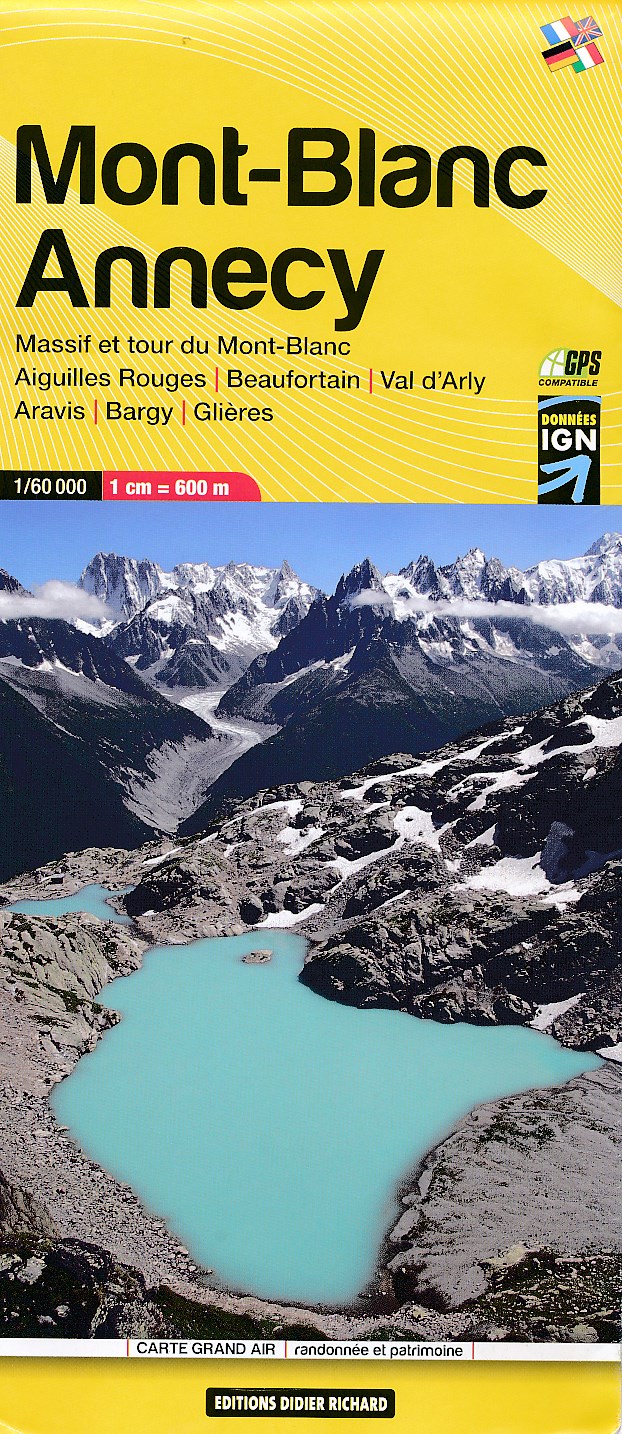
- Wandelkaart 02 Mont Blanc - Aiguilles Rouges - Aravis - Val d'Arly | Didier Richard
- Mont Blanc Massif and the adjoining region of the French Alps at 1:60,000 on a contoured and GPS compatible map from Didier Richard with a base derived from IGN Read more
- Also available from:
- Stanfords, United Kingdom

Stanfords
United Kingdom
2015
United Kingdom
2015
- Mont-Blanc - Annecy Didier Richard 02
- Mont Blanc Massif and the adjoining region of the French Alps at 1:60,000 on a contoured and GPS compatible map from Didier Richard with a base derived from IGN’s topographic survey, highlighting both local hiking routes and the GR network of long-distance paths, gîtes and mountain refuges, interesting natural and cultural sites, etc. The map... Read more

De Zwerver
Netherlands
Netherlands
- Wandelkaart 07 Outdoorkarte FR Elsass, Vogesen - Alsace, Strasbourg Elzas - Vogezen | Kümmerly & Frey
- The central part of Alsace around Strasbourg and Saverne on a GPS compatible, double-sided map at 1:50,000 from K Read more
- Also available from:
- Stanfords, United Kingdom

Stanfords
United Kingdom
United Kingdom
- Alsace - Strasbourg - Saverne - Barr - Offenburg K+F Outdoor Map 7
- The central part of Alsace around Strasbourg and Saverne on a GPS compatible, double-sided map at 1:50,000 from Kümmerly+Frey printed on sturdy, waterproof and tear-resistant synthetic paper; contoured, with hiking and cycling routes, sites for other recreational activities, various accommodation options, restaurants and ferme-auberge... Read more