
Karawanken
Beschreibung

The Karawanken constitute the border between Austria and Slovenia. The area is best known with tourists by the Karawanken Tunnel between Villach in Austria and Ljubljana in Slovenia. From this road, you won't see much of these interesting limestone mountains.
The area forms part of the Southern Limestone Alps. To the west you will find the Karnische (Carnic) Alps, and to the east the higher and steeper Kanmik Savinja Alps. To the south are the Julian Alps with Slovenia's highest mountain, Triglav.
Highest summit in the Karawanken is the Hochsthul or Stol, 2.236 m. This summit, and many others in the region, are good for walking, and easily accessible for the experienced hiker, via marked trails.
Karte

Wanderwege Region
Links
Fakten
Berichte
Führer und Karten
Übernachtung
Organisationen
Reisebüros
GPS
Sonstiges
Bücher

The Book Depository
United Kingdom
United Kingdom
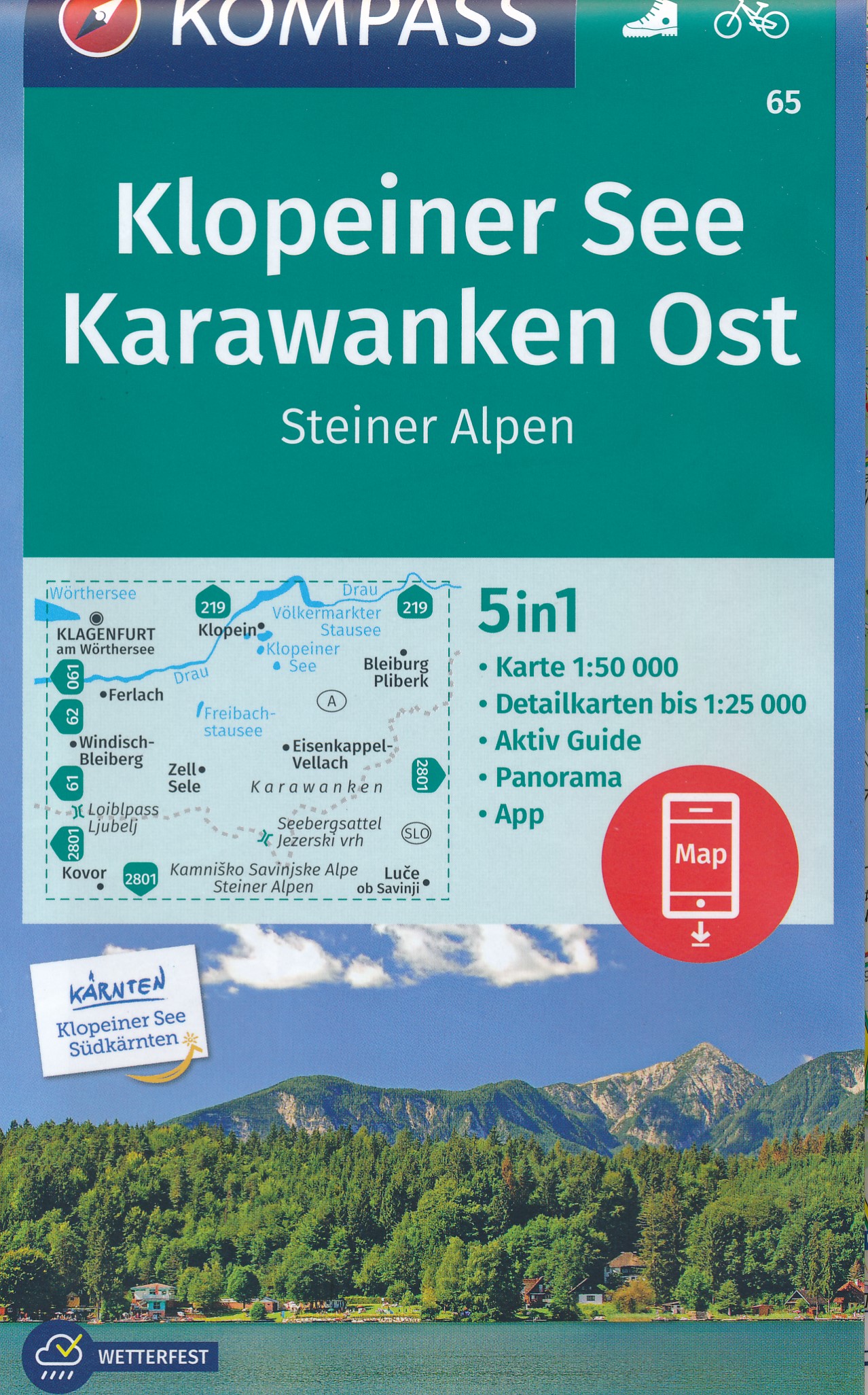
- Carinthia South - Klopeiner See - Karawanken
- Jauntal - Klopeiner See - Völkermarkt - Bleiburg - Steiner Alps area of Carinthia presented at 1:50,000 in a series of contoured and GPS compatible outdoor leisure map from Freytag & Berndt with hiking and cycling routes, mountain huts, campsites and youth hostels, local bus stops, plus other tourist information.To see the list of currently... Read more

- Also available from:
- De Zwerver, Netherlands
De Zwerver
Netherlands
2019
Netherlands
2019
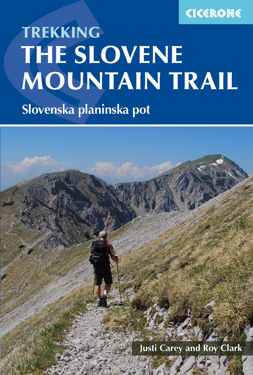
- Wandelgids The Slovene Mountain Trail | Cicerone
- Guidebook to trekking the Slovene Mountain Trail or Transverzala, 550km across Slovenia. Beginning at Maribor near the Austrian border to Ankaran on the Adriatic coast, the route is described as a series of 3 to 6-day treks through the region of Pohorje and the limestone mountains of the Karavanke and Kamnik-Savinja and Julian Alps. Read more

The Book Depository
United Kingdom
2018
United Kingdom
2018
- The Karnischer Hohenweg
- A 1-2 week trek on the Carnic Peace Trail: Austria and Italy Read more
- Also available from:
- De Zwerver, Netherlands

De Zwerver
Netherlands
2018
Netherlands
2018
- Wandelgids Trekking the Karnischer Höhenweg | Cicerone
- English-language guidebook to the Karnischer Höhenweg, a 206km waymarked hut-to-hut trek along the border between Italy and Austria. Also known as the Carnic Peace Trail, it runs west to east along the Ridge of the Carnic Alps, the site of the WW1 front line. With information on planning your trip, accommodation and the history of the area. Read more


De Zwerver
Netherlands
2020
Netherlands
2020
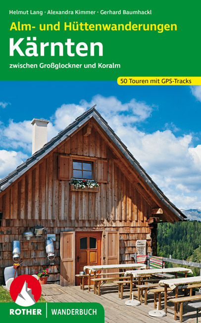
- Wandelgids Kärnten - Karinthië Alm- und Hüttenwanderungen | Rother Bergverlag
- 51 Touren zwischen Großglockner und Koralm. Mit GPS-Tracks. Read more

De Zwerver
Netherlands
2019
Netherlands
2019
- Wandelgids Kärnten - Karinthië | Rother Bergverlag
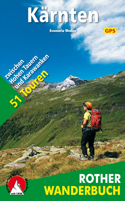
- Kärnten, am südöstlichen Rand des weiten Alpenbogens gelegen, wartet mit einer Vielzahl an spannenden Tourenmöglichkeiten auf. Von den Firngipfeln der Hohen Tauern über die runden, grasbewachsenen Nockberge bis zu den schroffen Kalkfelsen der Karnischen Alpen und der Karawanken warten vielfältige landschaftliche Höhepunkte darauf entdeckt zu... Read more
De Zwerver
Netherlands
2014
Netherlands
2014
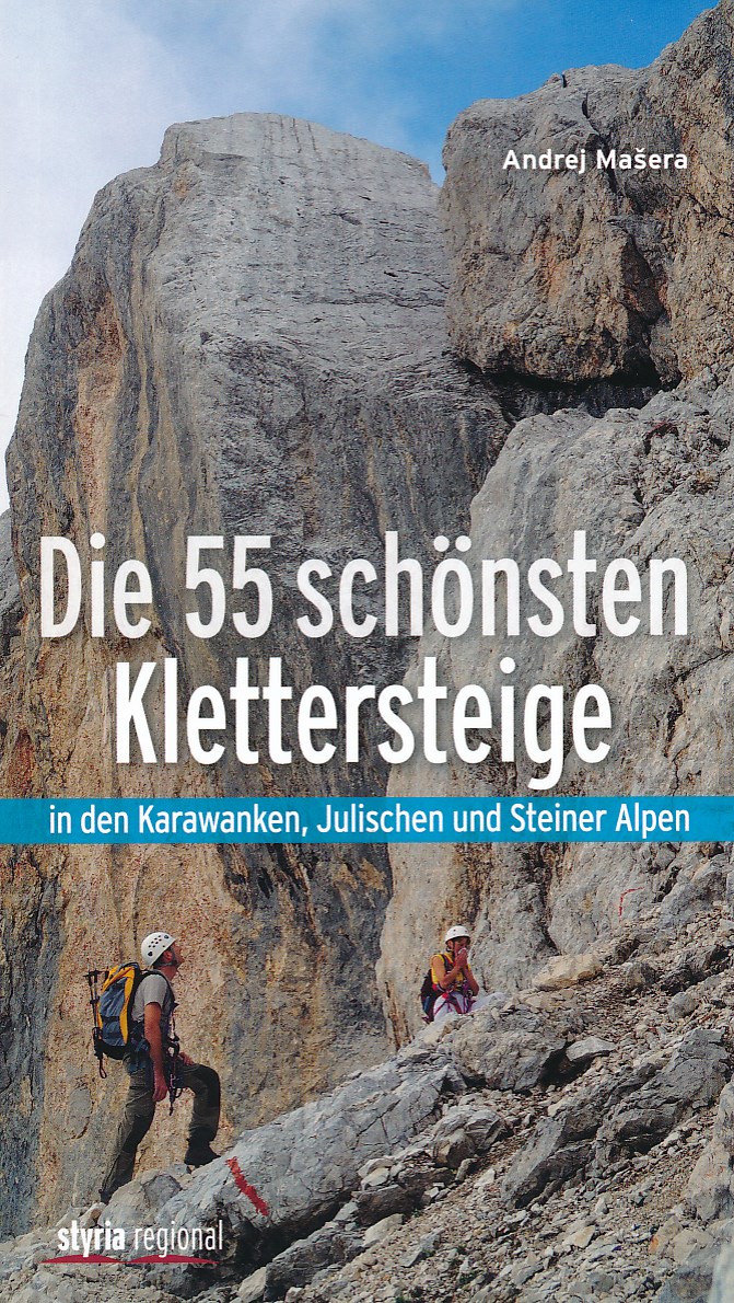
- Klimgids - Klettersteiggids Die 55 schönsten Klettersteige | Styria Verlag
- Die Julischen Alpen sind für viele Bergsteiger ein unbekanntes Gebiet. Dabei zählt dieses Gebirge neben den Dolomiten zu den faszinierendsten Klettersteigrevieren der Welt. Spektakuläre Anstiege durch mächtige Felswände; scharfe Grate und grandiose Gipfelerlebnisse bietet Andrej Ma eras kompakter Führer zu den schönsten Klettersteig- Routen... Read more

Stanfords
United Kingdom
United Kingdom
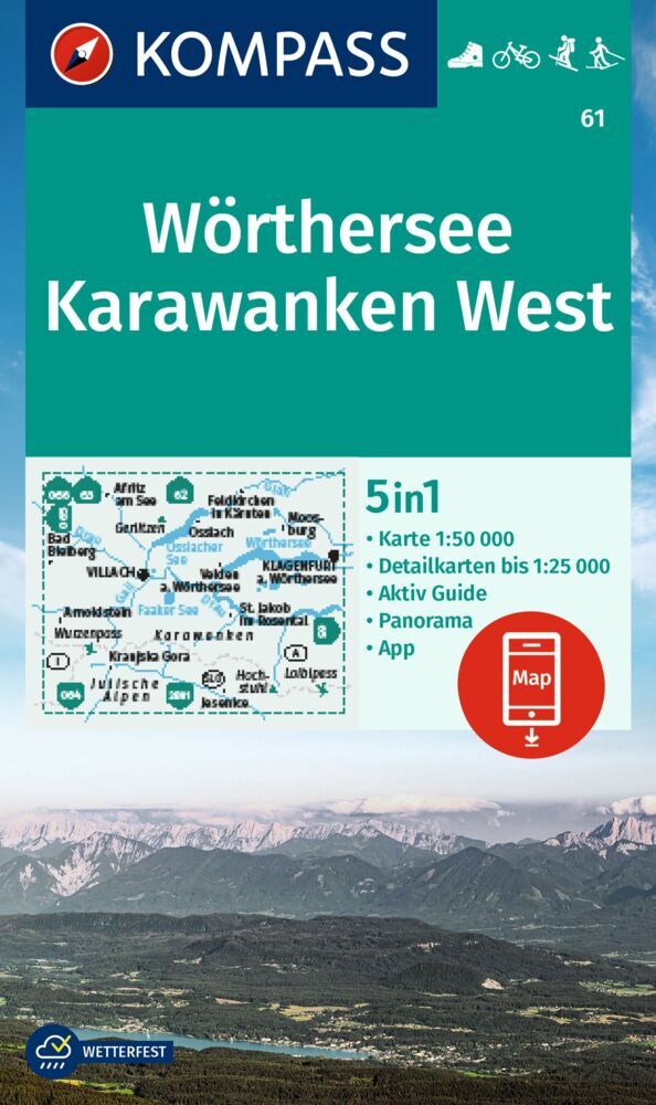
- Worthersee - Karawanken West Kompass 61
- Wörther See - Karawanken West (No. 61), a detailed, GPS compatible map at 1:50,000 from Kompass with local and long-distance footpaths, cycling routes, accommodation, etc, printed on durable, waterproof and tear-resistant synthetic paper. This title has on the reverse an additional panorama map of the region.KOMPASS HIKING & RECREATIONAL... Read more
Stanfords
United Kingdom
2021
United Kingdom
2021
- Austria F&B Alp and Hut-to-Hut Hiking Guide
- A comprehensive guidebook detailing walking routes in Austria. The 101 walks reflect the diversity of this popular region and cover Austria`s magnificent Alps - including the Ratikon, Silvretta, Stubai and Zillertal - as well as the Dachsteingebirge, Hohe Tauern and the Karawanken. Graded according to difficulty and ranging from short walks of... Read more
Bol.com
Netherlands
2009
Netherlands
2009
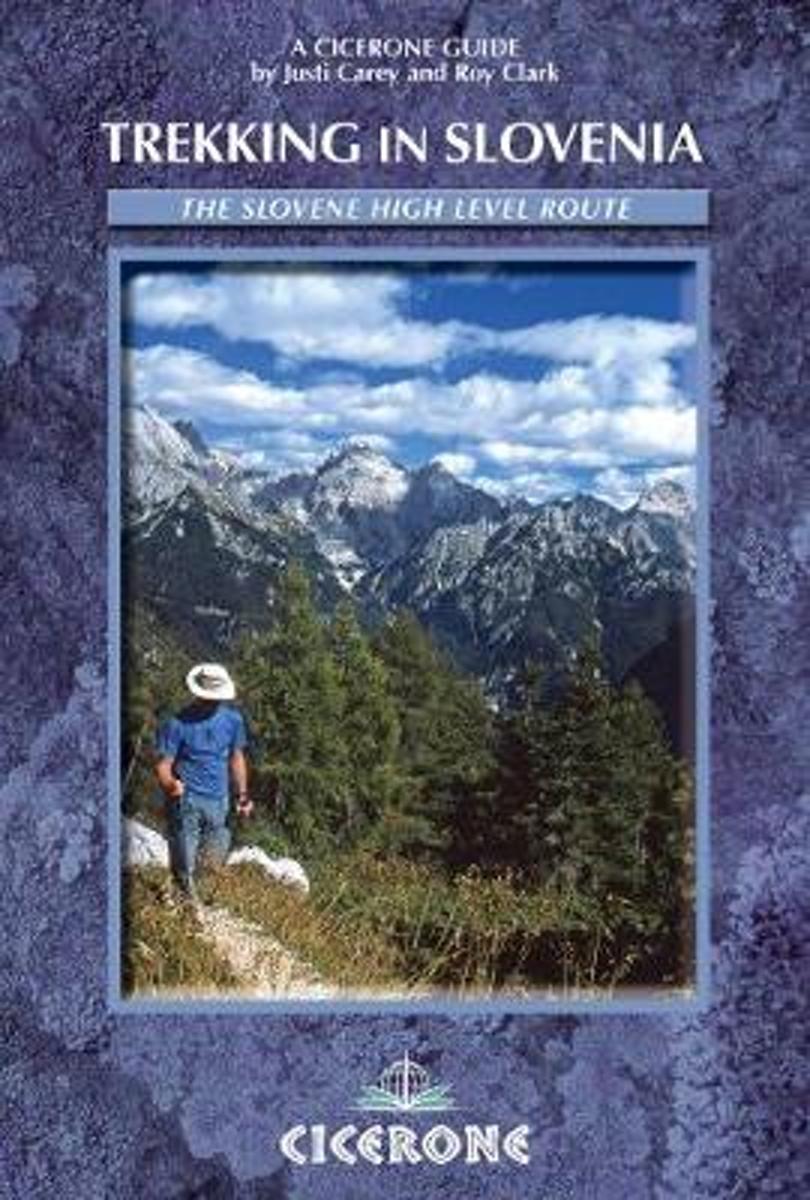
- Trekking in Slovenia
- A guidebook to trekking the Slovene High Level Route, crossing Slovenia from Austria to the Adriatic. The 500km route is described in a series of 3-6 day treks of all levels of difficulty, which can be completed as single sections or linked in a number of ways for longer holidays. From Maribor, close by the Austrian border in the north-east, to... Read more
- Also available from:
- Bol.com, Belgium
Bol.com
Belgium
2009
Belgium
2009
- Trekking in Slovenia
- A guidebook to trekking the Slovene High Level Route, crossing Slovenia from Austria to the Adriatic. The 500km route is described in a series of 3-6 day treks of all levels of difficulty, which can be completed as single sections or linked in a number of ways for longer holidays. From Maribor, close by the Austrian border in the north-east, to... Read more

Bol.com
Netherlands
Netherlands
- Un Jubilado En Los Alpes
- Se aproximaba el verano y era necesario decidirse. Entre unos pocos proyectos previstos hasta esos dias, que habian ido surgiendo en mi imaginacion durante el invierno, se fueron concretando a mitad de la primavera la posibilidad de caminar por el Himalaya, en Cachemira, recorrer algunos valles del Caucaso al norte de Georgia o atravesar los... Read more
- Also available from:
- Bol.com, Belgium
Bol.com
Belgium
Belgium
- Un Jubilado En Los Alpes
- Se aproximaba el verano y era necesario decidirse. Entre unos pocos proyectos previstos hasta esos dias, que habian ido surgiendo en mi imaginacion durante el invierno, se fueron concretando a mitad de la primavera la posibilidad de caminar por el Himalaya, en Cachemira, recorrer algunos valles del Caucaso al norte de Georgia o atravesar los... Read more

Bol.com
Netherlands
Netherlands
- Hiking in Switzerland
- This is the official guidebook to the Swiss section of the Via Alpina (National Route 1), published by the Swiss Hiking Federation. The Via Alpina is a network of five long-distance hiking routes which cross eight Alpine countries from Trieste to Monaco - over 5,000 kilometres of hiking trails in total. On Swiss soil, National Route 1 Via... Read more
- Also available from:
- Bol.com, Belgium
Bol.com
Belgium
Belgium
- Hiking in Switzerland
- This is the official guidebook to the Swiss section of the Via Alpina (National Route 1), published by the Swiss Hiking Federation. The Via Alpina is a network of five long-distance hiking routes which cross eight Alpine countries from Trieste to Monaco - over 5,000 kilometres of hiking trails in total. On Swiss soil, National Route 1 Via... Read more
Karten

The Book Depository
United Kingdom
United Kingdom
- Dachstein - Ausseerland - Filzmoos - Ramsau Hiking + Leisure Map 1:50 000
- Dachstein - Ausseer Land - Filzmoos - Ramsau - Bad Ischl - Schladming area of the Austrian Alps presented at 1:50,000 in a series of contoured and GPS compatible outdoor leisure map from Freytag & Berndt with hiking and cycling routes, mountain huts, campsites and youth hostels, local bus stops, plus other tourist information. To see the list... Read more
- Also available from:
- Stanfords, United Kingdom

Stanfords
United Kingdom
United Kingdom
- Dachstein - Ausseerland - Filzmoos - Ramsau F&B WK281
- Dachstein - Ausseer Land - Filzmoos - Ramsau - Bad Ischl - Schladming area of the Austrian Alps presented at 1:50,000 in a series of contoured and GPS compatible outdoor leisure map from Freytag & Berndt with hiking and cycling routes, mountain huts, campsites and youth hostels, local bus stops, plus other tourist information. To see the list... Read more

The Book Depository
United Kingdom
United Kingdom
- Also available from:
- Stanfords, United Kingdom

Stanfords
United Kingdom
United Kingdom
- Carinthian Alps - Gailtal - Gitschtal - Nassfeld - Lesachtal - Weissensee - Upper Drautal F&B WK223
- Naturarena Kärnten - Gailtal - Gitschtal -Lesachtal - Weissensee - Oberes Drautal area of Carinthia presented at 1:50,000 in a series of contoured and GPS compatible outdoor leisure map from Freytag & Berndt with hiking and cycling routes, mountain huts, campsites and youth hostels, local bus stops, plus other tourist information.To see the... Read more

The Book Depository
United Kingdom
United Kingdom
- Also available from:
- Stanfords, United Kingdom

Stanfords
United Kingdom
United Kingdom
- Wörthersee - Ossiacher See - Faaker See - Karawanken - Villach - Jesenice F&B WK233
- Wörther See - Ossiacher See - Gerlitzen - Faaker See - Karawanken - Villach - Klagenfurt area of Carinthia presented at 1:50,000 in a series of contoured and GPS compatible outdoor leisure map from Freytag & Berndt with hiking and cycling routes, mountain huts, campsites and youth hostels, local bus stops, plus other tourist information.To see... Read more

De Zwerver
Netherlands
Netherlands
- Wandelkaart 14 San Remo, imperia Monte Carlo | IGC - Istituto Geografico Centrale
- The westernmost part of the Italian Riviera with coverage extending from Monte Carlo to Imperia and northwards to Tende, in a series contoured hiking maps at 1:50,000 with local trails, long-distance footpaths, mountain accommodation, etc. from the Turin based Istituto Geografico Centrale.Maps in this series have contours at 50m intervals,... Read more
- Also available from:
- Stanfords, United Kingdom

Stanfords
United Kingdom
United Kingdom
- San Remo - Imperia - Monte Carlo IGC 14
- The westernmost part of the Italian Riviera with coverage extending from Monte Carlo to Imperia and northwards to Tende, in a series contoured hiking maps at 1:50,000 with local trails, long-distance footpaths, mountain accommodation, etc. from the Turin based Istituto Geografico Centrale.Maps in this series have contours at 50m intervals,... Read more

- Also available from:
- Stanfords, United Kingdom

Stanfords
United Kingdom
United Kingdom
- Langhe Meridionali IGC 18
- The southern part of the Langhe region of Piedmont, famous for its wines, cheeses, and truffles, in a series contoured hiking maps at 1:50,000 with local trails, long-distance footpaths, mountain accommodation, etc. from the Turin based Istituto Geografico Centrale.Maps in this series have contours at 50m intervals, enhanced by shading and... Read more

De Zwerver
Netherlands
Netherlands
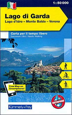
- Wandelkaart - Fietskaart 07 Outdoorkarte IT Gardasee - Gardameer | Kümmerly & Frey
- Lake Garda - Lake d'Idro - Monte Baldo - Verona area at 1:50,000 in a series of waterproof and tear-resistant, GPS compatible and contoured recreational maps from K Read more
- Also available from:
- Stanfords, United Kingdom
Stanfords
United Kingdom
United Kingdom
- Lake Garda - Lake Idro - Monte Baldo - Verona K+F Outdoor Map 7
- Lake Garda - Lake d`Idro - Monte Baldo - Verona area at 1:50,000 in a series of waterproof and tear-resistant, GPS compatible and contoured recreational maps from Kümmerly + Frey with both local and long-distance hiking and cycling trails, ski routes, sites for other outdoor pursuits, accommodation, bus stops, etc. An inset provides a small... Read more

De Zwerver
Netherlands
Netherlands
- Wandelkaart 03 Il parco nazionale del Gran Paradiso | IGC - Istituto Geografico Centrale
- Gran Paradiso National Park in a series contoured hiking maps at 1:50,000 with local trails, long-distance footpaths, mountain accommodation, etc, from the Turin based Istituto Geografico Centrale. This new edition published in late 2013 highlights, among other routes, the GTA (Grande Traversata delle Alpi), Via Alpina and Alta Via 2. Coverage... Read more
- Also available from:
- Stanfords, United Kingdom

Stanfords
United Kingdom
United Kingdom
- Gran Paradiso National Park IGC 3
- Gran Paradiso National Park in a series contoured hiking maps at 1:50,000 with local trails, long-distance footpaths, mountain accommodation, etc, from the Turin based Istituto Geografico Centrale. The map highlights, among other routes, the GTA (Grande Traversata delle Alpi), Via Alpina and Alta Via 2. Coverage extends from Aosta at the top of... Read more

De Zwerver
Netherlands
Netherlands
- Wandelkaart 17 Torino, Pinerolo e Bassa val di Susa | IGC - Istituto Geografico Centrale
- Turin - Pinerolo - Lower Susa Valley, map no. 17, in a series contoured hiking maps at 1:50,000 with local trails, long-distance footpaths, mountain accommodation, etc. from the Turin based Istituto Geografico Centrale covering the Italian Alps and Piedmont, the lakes and northern Lombardy, and the Italian Riviera.The maps have contours at 50m... Read more
- Also available from:
- Stanfords, United Kingdom

Stanfords
United Kingdom
United Kingdom
- Turin - Pinerolo - Lower Susa Valley 50K IGC Map No. 17
- Turin - Pinerolo - Lower Susa Valley area of Piedmont in a series contoured hiking maps at 1:50,000 with local trails, long-distance footpaths, mountain accommodation, etc. from the Turin based Istituto Geografico Centrale.Maps in this series have contours at 50m intervals, enhanced by shading and graphic relief. An overprint highlights local... Read more

De Zwerver
Netherlands
Netherlands
- Wandelkaart 04 Massiccio del Monte Bianco | IGC - Istituto Geografico Centrale
- The Mont Blanc Massif in a series contoured hiking maps at 1:50,000 with local trails, long-distance footpaths, mountain accommodation, etc, from the Turin based Istituto Geografico Centrale. This new edition published in late 2013 highlights, among other routes, the Alta Via 1 and the northern section of the Alta Via 2, both of which join up... Read more
- Also available from:
- Stanfords, United Kingdom

Stanfords
United Kingdom
United Kingdom
- Mont Blanc Massif IGC 4
- The Mont Blanc Massif in a series contoured hiking maps at 1:50,000 with local trails, long-distance footpaths, mountain accommodation, etc, from the Turin based Istituto Geografico Centrale. The map highlights, among other routes, the Alta Via 1 and the northern section of the Alta Via 2, both of which join up with TMB, as well as the local... Read more

De Zwerver
Netherlands
Netherlands
- Wandelkaart 20 Il Monferrato da Asti a Casale Monferrato | IGC - Istituto Geografico Centrale
- Il Monferrato, map no. 20, in a series contoured hiking maps at 1:50,000 with local trails, long-distance footpaths, mountain accommodation, etc. from the Turin based Istituto Geografico Centrale covering the Italian Alps and Piedmont, the lakes and northern Lombardy, and the Italian Riviera.The maps have contours at 50m intervals, enhanced by... Read more
- Also available from:
- Stanfords, United Kingdom

Stanfords
United Kingdom
United Kingdom
- Il Monferrato: Asti - Casale Monferrato 50K IGC Map No. 20
- The Monferrato region of Piedmont east of Turin, between Asti and Casale Monferrato, in a series contoured hiking maps at 1:50,000 with local trails, long-distance footpaths, mountain accommodation, etc. from the Turin based Istituto Geografico Centrale. This title also shows local cycle routes.Maps in this series have contours at 50m... Read more

De Zwerver
Netherlands
Netherlands
- Wandelkaart 05 Cervino Matterhorn e Monte Rosa | IGC - Istituto Geografico Centrale
- Matterhorn/M.Cervino and Monte Rosa, map no. 5, in a series contoured hiking maps at 1:50,000 with local trails, long-distance footpaths, mountain accommodation, etc. from the Turin based Istituto Geografico Centrale covering the Italian Alps and Piedmont, the lakes and northern Lombardy, and the Italian Riviera.The maps have contours at 50m... Read more
- Also available from:
- Stanfords, United Kingdom

Stanfords
United Kingdom
United Kingdom
- Matterhorn / M. Cervino - Monte Rosa IGC 5
- The Italian side of the Matterhorn and Monte Rosa, with coverage extending from Zermatt to Aosta, in a series contoured hiking maps at 1:50,000 with local trails, long-distance footpaths, mountain accommodation, etc. from the Turin based Istituto Geografico Centrale. Maps in this series have contours at 50m intervals, enhanced by shading and... Read more

De Zwerver
Netherlands
Netherlands
- Wandelkaart 21 Il Canavese da Ivrea a Chivasso | IGC - Istituto Geografico Centrale
- Il Canavese: Ivrea to Chiavasso, map no. 21, in a series contoured hiking maps at 1:50,000 with local trails, long-distance footpaths, mountain accommodation, etc. from the Turin based Istituto Geografico Centrale covering the Italian Alps and Piedmont, the lakes and northern Lombardy, and the Italian Riviera.The maps have contours at 50m... Read more
- Also available from:
- Stanfords, United Kingdom

Stanfords
United Kingdom
United Kingdom
- Il Canavese: Ivrea to Chiavasso 50K IGC Map No. 21
- Il Canavesea area including Ivrea and Chiavasso in a series contoured hiking maps at 1:50,000 with local trails, long-distance footpaths, mountain accommodation, etc. from the Turin based Istituto Geografico Centrale. This title also shows cycle routes.Maps in this series have contours at 50m intervals, enhanced by shading and graphic relief.... Read more

De Zwerver
Netherlands
Netherlands
- Wandelkaart 07 Valli Maira, grana e stura | IGC - Istituto Geografico Centrale
- Maira, Grana and Stura Valleys, map no. 7, in a series contoured hiking maps at 1:50,000 with local trails, long-distance footpaths, mountain accommodation, etc. from the Turin based Istituto Geografico Centrale covering the Italian Alps and Piedmont, the lakes and northern Lombardy, and the Italian Riviera.The maps have contours at 50m... Read more
- Also available from:
- Stanfords, United Kingdom

Stanfords
United Kingdom
United Kingdom
- Maira, Grana and Stura Valleys IGC 7
- Maira, Grana and Stura Valleys in a series contoured hiking maps at 1:50,000 with local trails, long-distance footpaths, mountain accommodation, etc. from the Turin based Istituto Geografico Centrale.Maps in this series have contours at 50m intervals, enhanced by shading and graphic relief. An overprint highlights local footpaths and... Read more