
Kaisergebirge
Beschreibung

The Kaisergebirge is one of the highlights of the Northern Limestone Alps. The area lies in the north of Austria near the German border, near Kufstein, the best place to start.
It is a beautiful and popular mountain area, not that large, but exceptionally beautiful. On the north side is a mountain range called the Kaiser Zahmer. To the south lies the Wilder Kaiser, with the Ellmauer Halt (2344 m) as its highest summit. In between the charming Kaisertal is situated, with the spectacular limestone mountains towering above.
The dramatic walls and sharp peaks are a paradise for climbers. For the experienced walker, there are good hiking possibilities too, but the traverse of the limestone ranges themselves is not simple. The highest peaks can be reached by the average hiker. And those who like to climb along the Klettersteige (Via Ferrata) will find many routes.
A good and safe walk is a four day trip around the Wilder Kaiser massif. Alternatively, one can climb the Pyramidenspitze (1997 m), the highest point of the Zahmer Kaiser, or the Ellmauer Halt itself. Of course, you can expect a good selection of huts in the Kaisergebirge.
Karte

Wanderwege Region
Links
Fakten
Berichte
Führer und Karten
Übernachtung
Organisationen
Reisebüros
GPS
Sonstiges
Bücher

Netherlands
2015
- Wandelgids Österreich: Adlerweg - Oostenrijk | Conrad Stein Verlag
- Handzaam boekje met de routebeschrijving inclusief een heleboel praktische informatie. De beschrijving is uitstekend, maar kaarten zijn beperkt en schetsmatig aanwezig. Duits. Dieses OutdoorHandbuch beschreibt Tirols bekanntesten Fernwanderweg, den 320 km langen Adlerweg zwischen St. Johann i. T. im Osten und der Passhöhe des Arlbergpasses im... Read more

Netherlands
2023

Netherlands
2012
- Wandelgids Hikeline Wilder Kaiser | Esterbauer
- Handzame gids met een goede beschrijving van een groot aantal dagtochten in dit gebied. De gids is in spiraalbinding en elke pagina is op scheur- en watervast papier gedrukt. Daar is echt over nagedacht! Wilder Kaiser Das Kaisergebirge im österreichischen Bundesland Tirol liegt mit seinen beiden markanten Gebirgsstöcken, dem Zahmen und dem... Read more
Netherlands
2022
- Wandelgids Wilder Kaiser | Rother Bergverlag
- Zahmer Kaiser - Kufstein - St. Johann - Kössen. 56 ausgewählte Bergwanderungen in und um das Kaisergebirge Read more

Netherlands
2021
- Wandelgids Adlerweg - Adelaarsweg | Rother Bergverlag
- De Rother wandelgidsen beschrijven zeer goed de wandelingen in specifieke gebieden. In de gids vindt men kaarten, routebeschrijvingen en de nodige praktische informatie om van de wandelingen/trekkings een geslaagde onderneming te maken. 31 Höhenprofile; 32 Wanderkärtchen im Maßstab 1:75.000, zwei Übersichtskarten; GPS-Tracks zum Download »Auf... Read more
Netherlands
2023
- Wandelgids 22 Chiemgau | Rother Bergverlag
- Uitstekende wandelgids met een groot aantal dagtochten in dal en hooggebergte. Met praktische informatie en beperkt kaartmateriaal! Wandelingen in verschillende zwaarte weergegeven in rood/blauw/zwart. Die Landschaft des Chiemgaus, mit ihren anheimelnden, schmucken Dörfern, ihren weiten, sanften Wiesenflächen, die von mehr oder weniger steil... Read more

Netherlands
2022

Netherlands
2018
- Wandelgids Tourist route E4 in Bulgaria | Oilaripi
- Verrassend goede wandelgids van een deel van de E4 in Bulgarije. Goede kaarten, hoogteprofielen, prima beschrijvingen en praktische informatie maken het een volwaardige wandelgids die je in eerste instantie van dit gebied niet zou verwachten. Guidebook along the main ridge of the great alpine route E4 in Bulgaria, also known as �the fiv... Read more

United Kingdom
2015
- The High Mountains of Crete
- The White Mountains, Psiloritis and Lassithi Mountains Read more
- Also available from:
- De Zwerver, Netherlands
- Stanfords, United Kingdom
- Bol.com, Netherlands
- Bol.com, Belgium

Netherlands
2015
- Wandelgids The high mountains of Crete - Kreta | Cicerone
- Guidebook of walking routes in Crete's mountains, covering the Lefka Ori (White Mountains), Mount Ida (the Psiloritis range), the Lassithi mountains and E4 trail. Each of the 87 walks is graded, in a range between 2 and 28km with various longer options, covering a multitude of terrains from rugged mountain ridges to forested crags and beaches. Read more

United Kingdom
2015
- Crete High Mountain Walks, the White Mountains, Mt Ida and Lassithi - 3rd ed.
- The High Mountains of Crete is Loraine Wilson’s authoritative Cicerone guide to the best walking routes in Crete’s mountainous regions. The guide covers walks in the well-known Samaria Gorge and the other dramatic gorges and numerous peaks rising to over 2100m, alongside high mountain plains, forested crags, massive cliffs and remote beaches.... Read more

Netherlands
2015
- The high mountains of Crete
- Guidebook to walking and trekking the high mountains of Crete. The largest of the Greek Islands, Crete's mountains provide breathtaking walking and wilderness on this popular island. The routes in this guidebook are graded for difficulty and range from short, easy strolls to challenging, multi-day treks, providing options for all walkers. In... Read more
Belgium
2015
- The high mountains of Crete
- Guidebook to walking and trekking the high mountains of Crete. The largest of the Greek Islands, Crete's mountains provide breathtaking walking and wilderness on this popular island. The routes in this guidebook are graded for difficulty and range from short, easy strolls to challenging, multi-day treks, providing options for all walkers. In... Read more

Netherlands
- WF5421 Allgäu, Allgäuer Alpen Kompass
- De Kompass wandelgids + kaart geeft een overzicht van alle wandelroutes in het gebied met nauwkeurige routeaanwijzingen en hoogteaanduidingen, De extra grote kaart, schaal 1:35 000, is ideaal om van te voren uw route uit te stippelen en om onderweg te gebruiken • naast de bekende bestemmingen, worden ook de minder bekende vermeld • openbaar... Read more
- Also available from:
- Bol.com, Belgium
Belgium
- WF5421 Allgäu, Allgäuer Alpen Kompass
- De Kompass wandelgids + kaart geeft een overzicht van alle wandelroutes in het gebied met nauwkeurige routeaanwijzingen en hoogteaanduidingen, De extra grote kaart, schaal 1:35 000, is ideaal om van te voren uw route uit te stippelen en om onderweg te gebruiken • naast de bekende bestemmingen, worden ook de minder bekende vermeld • openbaar... Read more

Netherlands
- Japan Im Zeitlichen Wandel Politik Und Geschichte Der Meiji Restauration
- "Die Meiji-Zeit (1868-1912) ist eine der bemerkenswertesten Epochen in der Geschichte der Nationen. Unter Kaiser Meiji macht sich Japan daran, in nur wenigen Jahrzehnten das zu erreichen, f r dessen Entwicklung der Westen Jahrhunderte gebraucht hat - die Schaffung eines modernen Staates mit modernen Industrien, modernen politischen... Read more
- Also available from:
- Bol.com, Belgium
Belgium
- Japan Im Zeitlichen Wandel Politik Und Geschichte Der Meiji Restauration
- "Die Meiji-Zeit (1868-1912) ist eine der bemerkenswertesten Epochen in der Geschichte der Nationen. Unter Kaiser Meiji macht sich Japan daran, in nur wenigen Jahrzehnten das zu erreichen, f r dessen Entwicklung der Westen Jahrhunderte gebraucht hat - die Schaffung eines modernen Staates mit modernen Industrien, modernen politischen... Read more

United Kingdom
2016
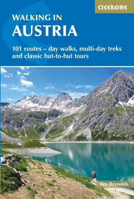
- Walking in Austria
- 101 routes - day walks, multi-day treks and classic hut-to-hut tours Read more
- Also available from:
- De Zwerver, Netherlands
- Stanfords, United Kingdom
- Bol.com, Netherlands
- Bol.com, Belgium
Netherlands
2016
- Wandelgids Oostenrijk - Walking in Austria | Cicerone
- A comprehensive guidebook to walking routes in Austria. 101 routes, day walks, multi-day treks and classic hut-to-hut tours in the Ratikon, Silvretta, Stubai, and Zillertal Alps, the Hohe Tauern, and the Karawanken. With information on transport, accommodation, gear and safety, plus full details of over a hundred Austrian mountain huts. Read more

United Kingdom
2016
- Walking in Austria: 101 Routes - Day Walks, Multi-Day Treks and Classic Hut-to-Hut Tours
- A comprehensive guidebook detailing walking routes in Austria. The 101 walks reflect the diversity of this popular region and cover Austria`s magnificent Alps - including the Ratikon, Silvretta, Stubai and Zillertal - as well as the Dachsteingebirge, Hohe Tauern and the Karawanken. Graded according to difficulty and ranging from short walks of... Read more
Netherlands
2016
- Walking in Austria
- A comprehensive guidebook detailing walking routes in Austria. The 101 walks reflect the diversity of this popular region and cover Austria's magnificent Alps - including the Ratikon, Silvretta, Stubai and Zillertal - as well as the Dachsteingebirge, Hohe Tauern and the Karawanken. Graded according to difficulty and ranging from short walks of... Read more
Belgium
2016
- Walking in Austria
- A comprehensive guidebook detailing walking routes in Austria. The 101 walks reflect the diversity of this popular region and cover Austria's magnificent Alps - including the Ratikon, Silvretta, Stubai and Zillertal - as well as the Dachsteingebirge, Hohe Tauern and the Karawanken. Graded according to difficulty and ranging from short walks of... Read more
Netherlands
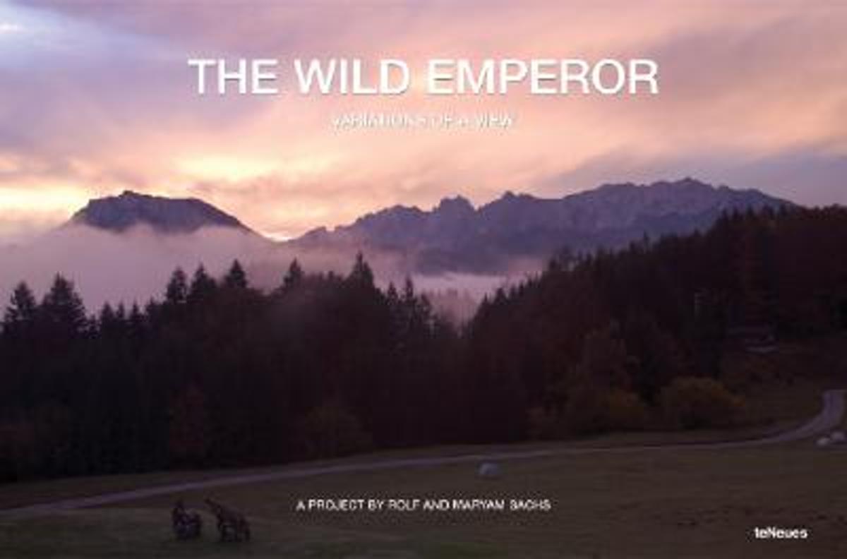
- Wild Emperor, Variations of a View
- A series of panoramic photographs were taken of an alpine view from the balcony of a mountain lodge called the Rechenau, near Kiefersfelden in Bavaria. Maryam and Rolf Sachs focused their camera on two majestic mountain peaks, ?Der Zahme Kaiser? (the Tame Emperor) on the left and ?Der wilde Kaiser?(the Wild Emperor) on the right, that lie over... Read more
- Also available from:
- Bol.com, Belgium
Belgium
- Wild Emperor, Variations of a View
- A series of panoramic photographs were taken of an alpine view from the balcony of a mountain lodge called the Rechenau, near Kiefersfelden in Bavaria. Maryam and Rolf Sachs focused their camera on two majestic mountain peaks, ?Der Zahme Kaiser? (the Tame Emperor) on the left and ?Der wilde Kaiser?(the Wild Emperor) on the right, that lie over... Read more
Karten

United Kingdom
- Fragokastelo - Plakias 2016
- Uitstekende topografische kaarten van een deel van Griekenland: zonder meer hele goede kaarten voor wandeltochten in een onbekend stuk Griekenland! Ze zijn gedrukt op scheurvast en watervast papier op een schaal van 1:25.000 met een UTM grid voor GPS gebruikers. Op de meeste kaarten is geven de hoogtelijnen een interval van 20m. aan. Met... Read more
- Also available from:
- De Zwerver, Netherlands
- Stanfords, United Kingdom

Netherlands
- Wandelkaart 11.17 Frangokastelo - Plakias - Kreta | Anavasi
- Uitstekende topografische kaarten van een deel van Griekenland: zonder meer hele goede kaarten voor wandeltochten in een onbekend stuk Griekenland! Ze zijn gedrukt op scheurvast en watervast papier op een schaal van 1:25.000 met een UTM grid voor GPS gebruikers. Op de meeste kaarten is geven de hoogtelijnen een interval van 20m. aan. Met... Read more

United Kingdom
- Frangokastelo - Plakias Anavasi 11.17
- The Frangokastelo – Plakias area on the southern coast of Crete at 1:25,000 in a series of contoured, GPS compatible hiking maps of Crete from Anavasi, printed waterproof and tear-resistant paper. Annotations provide useful hints for walkers. Coverage extends from Imbros Gorge in the west to Plakias in the east.Topography is shown by contour... Read more

United Kingdom
- Exo Mani 2018
- Uitstekende wandelkaart op scheur- en watervast papier van het wandelgebied rond Kardamyli maar ook nog met Agios Nikolaos. De wandelpaden staan er op ingetekend, zo ook alle bezienswaardigheden als klooster, kastelen en meerdere opgravingen. Mani is the middle and southernmost peninsula of the Peloponnese and is split between Laconia and... Read more
- Also available from:
- De Zwerver, Netherlands
- Stanfords, United Kingdom

Netherlands
- Wandelkaart 8.10 Exo Mani | Anavasi
- Uitstekende wandelkaart op scheur- en watervast papier van het wandelgebied rond Kardamyli maar ook nog met Agios Nikolaos. De wandelpaden staan er op ingetekend, zo ook alle bezienswaardigheden als klooster, kastelen en meerdere opgravingen. Mani is the middle and southernmost peninsula of the Peloponnese and is split between Laconia and... Read more

United Kingdom
- Exo Mani - Verga - Kardamyli - Trachila Anavasi 8.10
- The northern part of the western coast of the Mani Peninsula, the “middle finger” of the Peloponnese, on a light, waterproof and tear-resistant, double-sided, contoured and GPS-compatible map at 1:20,000 from Anavasi highlighting 24 hiking trails and various facilities and places of interest. Coverage, with a good overlap between the sides,... Read more

United Kingdom
- Prespa - Vitsi - Voras
- Uitstekende topografische kaarten van een deel van Griekenland: zonder meer hele goede kaarten voor wandeltochten in een onbekend stuk Griekenland! Ze zijn gedrukt op scheurvast en watervast papier op een schaal van 1:50.000 met een UTM grid voor GPS gebruikers. Op de meeste kaarten is geven de hoogtelijnen een interval van 20m. aan. Met... Read more
- Also available from:
- De Zwerver, Netherlands
- Stanfords, United Kingdom

Netherlands
- Wandelkaart 6.2 Prespa - Vitsi - Voras | Anavasi
- Uitstekende topografische kaarten van een deel van Griekenland: zonder meer hele goede kaarten voor wandeltochten in een onbekend stuk Griekenland! Ze zijn gedrukt op scheurvast en watervast papier op een schaal van 1:50.000 met een UTM grid voor GPS gebruikers. Op de meeste kaarten is geven de hoogtelijnen een interval van 20m. aan. Met... Read more

United Kingdom
- Prespa - Vitsi - Voras Anavasi 6.2
- Prespa - Vitsi – Voras area of northern Greece at 1:50,000 on a light, waterproof and tear-resistant, GPS compatible, contoured map from Anavasi, with recommendations for three hiking trails and notes on the E4 and E6 cross-European trails. The map is double-sided; coverage in the west starts from the Prespa Lake on the border with Albania and... Read more

United Kingdom
- Also available from:
- Stanfords, United Kingdom

United Kingdom
- Kufstein - Kaisergebirge - Kitzbühel F&B WK301
- Kufstein - Kaisergebirge - Kitzbühel - Wörgl - St Johann in Tirol area of the Austrian Alps presented at 1:50,000 in a series of contoured and GPS compatible outdoor leisure map from Freytag & Berndt with hiking and cycling routes, mountain huts, campsites and youth hostels, local bus stops, plus other tourist information. To see the list of... Read more

United Kingdom
- Samaria - Sougia
- Uitstekende topografische kaarten van een deel van Griekenland: zonder meer hele goede kaarten voor wandeltochten in een onbekend stuk Griekenland! Ze zijn gedrukt op scheurvast en watervast papier op een schaal van 1:25.000 met een UTM grid voor GPS gebruikers. Op de meeste kaarten is geven de hoogtelijnen een interval van 20m. aan. Met... Read more
- Also available from:
- De Zwerver, Netherlands
- Stanfords, United Kingdom

Netherlands
- Wandelkaart 11.13 Samaria - Soughia - Kreta | Anavasi
- Uitstekende topografische kaarten van een deel van Griekenland: zonder meer hele goede kaarten voor wandeltochten in een onbekend stuk Griekenland! Ze zijn gedrukt op scheurvast en watervast papier op een schaal van 1:25.000 met een UTM grid voor GPS gebruikers. Op de meeste kaarten is geven de hoogtelijnen een interval van 20m. aan. Met... Read more

United Kingdom
- Samaria - Sougia - Paliochora Anavasi 11.13
- Samaria – Sougia area of the White Mountains on Crete on a waterproof and tear-resistant, GPS compatible and contoured hiking map at 1:25,000 from Anavasi, extending from the famous Gorge of Samaria westwards to Azogyres and Plemeniana, and north past Omalos and the peaks of Troili and Kaimeni Kafala.Topography is shown by contour lines at 20m... Read more

United Kingdom
- Crete West
- Western Crete on a double-sided, contoured and GPS compatible map at 1:100,000 from Harms Verlag, with highlighting for numerous places of interest and 20 recommended hiking trails, plus street plans of central Heraklion, Rethymnon and Chania and a plan of the archaeological site at Knossos. All place names are in both Greek and Latin alphabet.... Read more
- Also available from:
- De Zwerver, Netherlands

Netherlands
- Wandelkaart Kreta west | Harms IC Verlag
- Western Crete on a double-sided, contoured and GPS compatible map at 1:100,000 from Harms Verlag, with highlighting for numerous places of interest and 20 recommended hiking trails, plus street plans of central Heraklion, Rethymnon and Chania and a plan of the archaeological site at Knossos. All place names are in both Greek and Latin alphabet.... Read more

Netherlands
2016
- Wandelgids The Cretan Way E4 | Anavasi
- The Cretan Way is a 500km walking route which takes you from east to west across the varied and spectacular landscapes of Crete. It is the ideal way to discover the rural, mountainous and costal regions of this incredible island. This guide is based on a 28-day walk.This guide includes practical information, maps at a scale of 1:25.000 of... Read more
- Also available from:
- Stanfords, United Kingdom

United Kingdom
2016
- The Cretan Way - A 28 Day Walk
- The Cretan Way is a 500km walking route which takes you from east to west across the varied and spectacular landscapes of Crete. It is the ideal way to discover the rural, mountainous and costal regions of this incredible island. This guide is based on a 28-day walk.This guide includes practical information, maps at a scale of 1:25.000 of... Read more

Netherlands
- Wandelkaart 5 Rila gebergte | Domino
- Rila Mountains at 1:50,000 on a large, double-sided, contoured map with GPS waypoints for shelters and chalets, peaks, etc. and highlighting hiking routes. Topography is shown by contours at 50m intervals with additional relief shading and graphics and colouring for scree, single rocks over 5m high, marshlands and pine scrub and forests. An... Read more
- Also available from:
- Stanfords, United Kingdom

United Kingdom
- Rila Mountains Domino
- Rila Mountains at 1:50,000 on a large, double-sided, contoured map with GPS waypoints for shelters and chalets, peaks, etc. and highlighting hiking routes. Topography is shown by contours at 50m intervals with additional relief shading and graphics and colouring for scree, single rocks over 5m high, marshlands and pine scrub and forests. An... Read more

Netherlands
- Wandelkaart 6 Pirin gebergte | Domino
- Pirin Mountains at 1:50,000 on a large, double-sided, contoured map with GPS waypoints for shelters and chalets, peaks, etc. and highlighting hiking routes. Topography is shown by contours at 40m intervals with additional relief shading and graphics and colouring for sandstone stacks, single rocks over 5m high, marshlands and different types of... Read more
- Also available from:
- Stanfords, United Kingdom

United Kingdom
- Pirin Mountains Domino
- Pirin Mountains at 1:50,000 on a large, double-sided, contoured map with GPS waypoints for shelters and chalets, peaks, etc. and highlighting hiking routes. Topography is shown by contours at 40m intervals with additional relief shading and graphics and colouring for sandstone stacks, single rocks over 5m high, marshlands and different types of... Read more

Netherlands
- Wandelkaart Strandzha - Bulgarije | Domino
- Strandzha Mountains in the south-eastern corner of Bulgaria between Burgas to the Turkish border on a contoured and GPS compatible map from Domino showing local hiking trails and highlighting various interesting sites, with three more detailed enlargements at 1:25,000. Most place names are in both Latin and Cyrillic alphabet; map legend... Read more
- Also available from:
- Stanfords, United Kingdom

United Kingdom
- Strandzha Mountains: Burgas to the Turkish Border Domino Map
- Strandzha Mountains in the south-eastern corner of Bulgaria between Burgas to the Turkish border on a contoured and GPS compatible map from Domino showing local hiking trails and highlighting various interesting sites, with three more detailed enlargements at 1:25,000. Most place names are in both Latin and Cyrillic alphabet; map legend... Read more
Netherlands
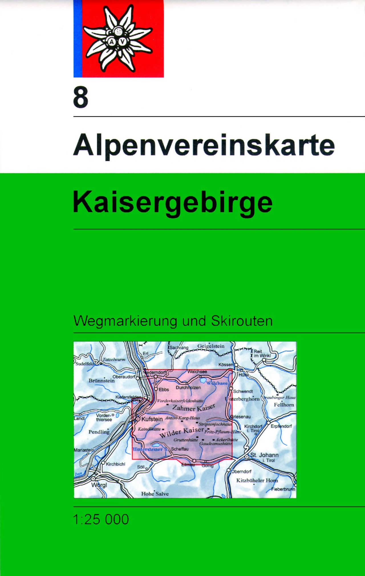
- Wandelkaart 08 Alpenvereinskarte Kaisergebirge | Alpenverein
- Kaisegebirge area of the Alps in a combined hiking and ski edition at 1:25,000 from a series of detailed, GPS compatible maps published by the DAV - Deutscher Alpenverein and produced by the German and Austrian Alpine Clubs using cartography from their respective survey organizations. Maps in this series have topography vividly presented by... Read more
- Also available from:
- Stanfords, United Kingdom

United Kingdom
- Kaisergebirge Alpenverein KOMBI Map 8
- Kaisegebirge area of the Alps in a combined hiking and ski edition at 1:25,000 from a series of detailed, GPS compatible maps published by the DAV - Deutscher Alpenverein and produced by the German and Austrian Alpine Clubs using cartography from their respective survey organizations. Maps in this series have topography vividly presented by... Read more

Netherlands
- Wandelkaart - Wegenkaart - landkaart 7 Westelijke Rhodopen - Western Rhodopes | Domino
- Western Rhodope Mountains at 1:100,000 on a contoured GPS compatible map from Domino extending from just west of the Pirin National Park to Asenovgrad in the north-east. The map is double-sided with a good overlap between the sides. Topography is shown by contours at 50m intervals with relief shading and spot heights, plus colouring for... Read more
- Also available from:
- Stanfords, United Kingdom

United Kingdom
- Western Rhodope Mountains Domino Map
- Western Rhodope Mountains at 1:100,000 on a contoured GPS compatible map from Domino extending from just west of the Pirin National Park to Asenovgrad in the north-east. The map is double-sided with a good overlap between the sides. Topography is shown by contours at 50m intervals with relief shading and spot heights, plus colouring for... Read more

Netherlands
- Wandelkaart 1 Stara Planina gebergte | Domino
- Stara Planina Central: Zlatitsa to Kalofer map at 1:50,000 from Bulgarian publishers Domino, contoured and GPS compatible, with hiking trails, accommodation options including a list of local mountain refuges, etc. The map is double-sided and covers the mountains from just west of Ribaritsa and Zlatitsa eastwards beyond Kalofer to the peak of... Read more
- Also available from:
- Stanfords, United Kingdom

United Kingdom
- Stara Planina Central: Zlatitsa to Kalofer Domino Map
- Stara Planina Central: Zlatitsa to Kalofer map at 1:50,000 from Bulgarian publishers Domino, contoured and GPS compatible, with hiking trails, accommodation options including a list of local mountain refuges, etc. The map is double-sided and covers the mountains from just west of Ribaritsa and Zlatitsa eastwards beyond Kalofer to the peak of... Read more

Netherlands
- Wandelkaart 2.4 Nafpaktos - Panaitoliko - Karpenisi | Anavasi
- Prespa - Vitsi – Voras area of northern Greece at 1:50,000 on a light, waterproof and tear-resistant, GPS compatible, contoured map from Anavasi, with recommendations for three hiking trails and notes on the E4 and E6 cross-European trails. The map is double-sided; coverage in the west starts from the Prespa Lake on the border with Albania and... Read more

Netherlands
- Wandelkaart Sredna Gora - Bulgarije | Domino
- Pirin Mountains at 1:50,000 on a large, double-sided, contoured map with GPS waypoints for shelters and chalets, peaks, etc. and highlighting hiking routes. Topography is shown by contours at 40m intervals with additional relief shading and graphics and colouring for sandstone stacks, single rocks over 5m high, marshlands and different types of... Read more